Archaeology and monuments in County Cavan
The Discover Alone map has 2,306 archaeology and monuments in County Cavan, Ireland. Below are the 60 with the most written about them, pictures first. Every one has its own page with directions and places nearby.
Open County Cavan on the map Vitrified FortHilltop enclosureVitrified Fort on a Cavan hilltop is a D-shaped enclosure whose stone bank melted into glass during extreme ancient…
 Vitrified FortArchaeological placeMelted stone still stands in County Cavan, not as a wall for living but as a wound made visible. The fort may have been…
 Tullycoe FortArchaeological placeTullycoe Fort stands in County Cavan, a buried anchor in the green field where human hands once shaped the earth. The…
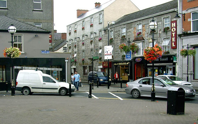 Town defences in Townparks (cavan Urban District),tullymongan Lower,tullymongan Upper,kinnypottle,lurganboy (upper Loughtee By.),abbey Land,drumavanagh,keadew (cavan Rural & Urban)Town defencesAfter 1616 Sir Oliver Lambert was granted lands at Cavan town on condition that he built a citadel and town wall…
 Tonymore CrannogArchaeological placeTonyamore Crannog sits in County Cavan, a submerged or hidden place where human hands shaped the land long before…
 ToberpatrickHoly wellToberpatrick is Patrick's well in Deerpark, County Cavan, but the name has moved a hundred metres south-east to another…
 ToberpatrickHoly wellToberpatrick is a small stone-walled holy well in County Cavan, Ireland, where water still drains toward a nearby…
 TobermurvyHoly wellTobermurvy is a small drystone holy well in County Cavan where people still gather each August 13th. Its narrow…
 TobermogueHoly wellTobermogue is a lost holy well in County Cavan, Ireland. The earth swallowed its basin and human memory dismissed its…
 ToberlyanHoly wellToberlyan is a holy well in County Cavan where penitence became physical. People walked boulders around the water until…
 ToberbrideHoly wellToberbride is a circular holy well in County Cavan, Ireland, sitting about 110 metres west-southwest of Killinagh…
 ToberarneyHoly wellToberarney is a holy well in County Cavan, Ireland, where ritual water still belongs to memory rather than measurement.…
 Tober UltanHoly wellTober Ultan is a grassed circular well in County Cavan dedicated to the 7th-century St Ultan of Ardbraccan, Co. Meath.…
 Tober PatrickHoly wellTober Patrick is a holy well hidden beneath dense vegetation in low-lying Cavan ground beside a stream. It has resisted…
 Tober PatrickHoly wellTober Patrick is a rectangular water trench in County Cavan where boulders mark dance stations and people still gather…
 Swellan FortFairy fort / earthen ringfortMoss has strangled the southern gap where people once entered, but the northern bank still stands tall against the…
 Swellan FortArchaeological placeSwellan Fort stands in County Cavan, a quiet archaeological scar where human hands shaped the land before memory faded.…
 Sweathouse in TullaghyrorySweathouseMarked 'Sweat House' on OS 1836 and 1876 eds. Situated in wet low-lying ground, c. 50mSSW of the River Shannon. Largely…
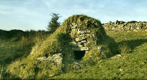 Sweathouse in GowlatSweathouseMarked on OS 1836 ed. Not marked on subsequent eds. Situated in rough mountainous terrain adjacent to a stream and…
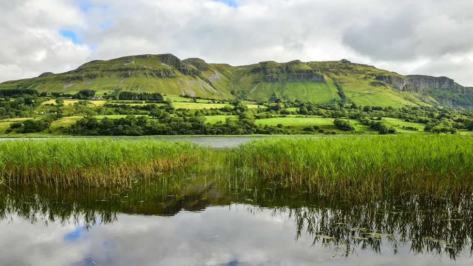 Sweathouse in GortnavreeghanSweathouseGortnavreeghan holds a tiny D-shaped sweathouse on the broad summit of Slieve Rushen, beside a rectangular stone…
 Sweathouse in CorratawySweathouseMarked on OS 1836 and 1876 eds. Situated 180m NE of Drumhurrin Lough. In the early decades of this century it was…
 Sweathouse in CorrakeeldrumSweathouseMarked on OS 1836 and 1876 eds. Situated adjacent to a stream. Described by Richardson (1939, 34) as a small, circular…
 Sweathouse in Cornagee (clankee By.)SweathouseThe Archaeological Survey of Ireland (ASI) is in the process of providing information on all monuments on The Historic…
 Sweat Ho.SweathouseNot marked on OS 1836 or 1876 eds. Situated c. 45m NW of the Black River. Partly built into a hillside at NW. Small…
 Sweat HoSweathouseSweat Ho was a small drystone chamber in County Cavan where smoke and heat moved through hidden flues before escaping…
 Sweat Ho.SweathouseSmall circular drystone-built structure (int. diam. 1.3m; H 1.9m) of beehive-type construction, roofed internally by…
 Sweat Ho.SweathouseMarked on all OS eds. Described by Richardson (1939, 35) as a small circular drystone-built structure (ext. H c. 2.1m)…
 Sweat Ho.SweathouseNot marked on OS 1836 or 1876 eds. Situated adjacent to the Black River within a dense modern plantation of coniferous…
 Sweat Ho.SweathouseMarked on all OS eds. An earlier description (1939, 34-5) noted that it had an internal diameter of c. 1.7m, a max…
 Sweat Ho.SweathouseSmall circular drystone-built structure (int. diam. 1.7m; H 1.4m) of beehive-type construction, roofed internally by a…
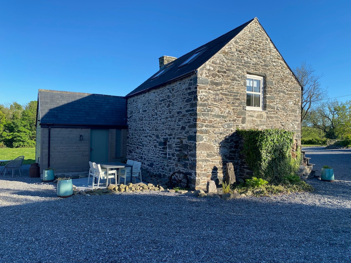 Sweat Ho.SweathouseNot marked on OS 1836 or 1876 eds. Small circular drystone-built structure (int. diam. 2m) of beehive-type construction…
 Sweat Ho.SweathouseNot marked on OS 1836 or 1876 eds. Situated in rough, wet, mountainous terrain. Small circular drystone-built structure…
 Sweat Ho.SweathouseNot marked on 1836 or 1876 eds. Situated in a small valley, 30m SW of a stream. The site has been quarried away. Davies…
 Sweat Ho.SweathouseNot marked on OS 1836 or 1876 eds. Situated on a steep hillside in rough mountainous terrain. Small circular…
 Sweat Ho.SweathouseNot marked on OS 1836 or 1876 eds. Situated on a rough mountainous hillside a short distance from a stream. Small…
 Sweat Ho.SweathouseMarked on all OS eds. Situated adjacent to a stream. Small oval drystone-built structure (H 1.6m; int. dims. 2.4m…
 Sweat Ho.SweathouseNot marked on OS 1836 or 1876 eds. Situated 85m E of a stream. Small circular drystone-built structure (int. diam.…
 Sweat Ho.SweathouseIndicated on OS 1836 and 1876 eds. Situated on the ESE shoulder of a low mountainous hill. A small beehive-shaped…
 Sweat Ho.SweathouseSweat Ho is a ruined beehive-shaped drystone structure beside a Cavan stream, reduced to a collapsed shadow inside a…
 Sweat Ho.SweathouseNot marked on OS 1836 or 1876 eds. Situated on a riverbank. Partly built into a hillside. Small beehive-shaped…
 Stone CrossCrossMarked on all OS eds. Situated in flat rolling pasture-land. This undecorated stone cross was moved during the 1960's.…
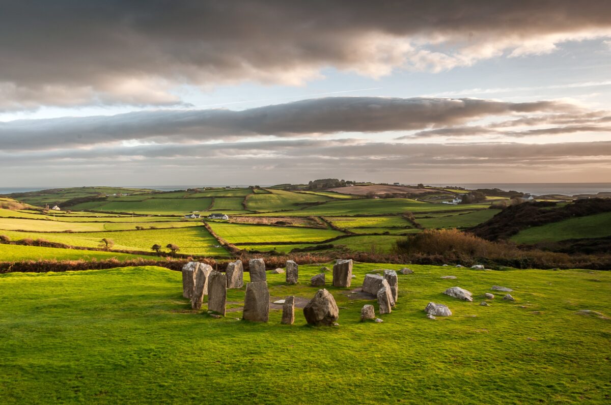 Stone CircleArchaeological placeThirty metres wide, forty across, twelve stones in a ring at Banagher, County Cavan, five still standing and seven…
 Standing StoneArchaeological placeFour centuries of human life may have passed before the first surveyor noticed the stone at Camagh. The gap between…
 St. Patricks WellsHoly wellSt. Patricks Wells in County Cavan is a small semicircular stone-built well, about one metre across, partially covered…
 St. Patricks WellHoly wellSt. Patricks Well is a hidden ritual site on the west slope of a steep rocky hill in County Cavan, Ireland. The water…
 St. Felimys WellHoly wellSt. Felimys Well sits beneath the old cathedral hill, its corbelled chamber hidden behind a low stone wall and iron…
 St. Annes Well (Site of)Holy wellSt. Annes Well in County Cavan is a hidden ritual site, marked only in low-lying ground near a stream while Killan…
 Site of Saint Davnet's ChapelArchaeological placeSaint Davnet's Chapel stands as a lost architectural shadow in County Cavan, preserving only the memory of a building…
 Site of Old ChurchChurchNo wall or roof remains, but the oval graveyard still holds its shape in County Cavan. Two fifteenth-century cut…
 Sheela-na-gig (present location) in Kilmore (castlerahan By., Ballyjamesduff Ed)Sheela-na-gig (present location)Kilmore holds one of two sheela-na-gigs now displayed in Cavan County Museum, Ballyjamesduff. The figure is carved on…
 Scrabby Hill FortArchaeological placeScrabby Hill Fort stands in County Cavan, a quiet archaeological place where the land still holds the shape of human…
 Roll of HonourMonumentRoll of Honour in County Cavan, Ireland, commemorates Corporal Peter Moir, Private Denholm Moir, Private John Thomas…
 RathcorickArchaeological placeMud, straw and stubbornness built Rathcorick around 1860, shaping a four-bay house whose plain rear wall still faces…
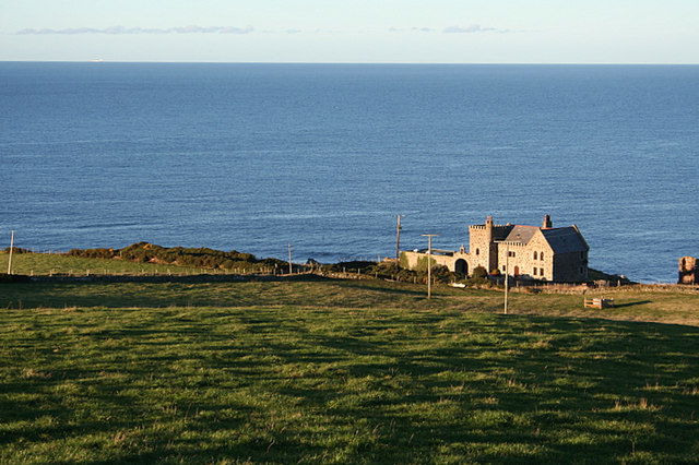 Promontory fortPromontory fort — inlandIrishHistory.com is passionate about helping people discover and connect with the rich stories of their local…
 Portal tomb in DuffcastlePortal tombHalf a roofstone hangs over the chamber like a tongue about to speak. The missing northern portal and the collapsed…
 Portal tomb in CarrickacroyPortal tombCarrickacroy’s tomb is a small stone chamber near the top of a ridge, not a hidden door or finished chamber of legend.…
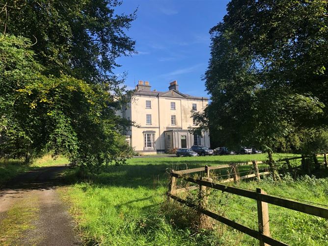 Old PalaceEcclesiastical residenceOld Palace in County Cavan was a long, lofty residence built beside the cathedral in the 1620s, and its remaining west…
 Old FortEnclosure — large enclosureOld Fort is a hundred-metre circular enclosure on the northwest edge of Inch Island, marked as a fort on the 1835 map…
 Old FortArchaeological placeOld Fort in County Cavan is an archaeological place, but the name is so broad it could point to half the islands. The…
.jpg?width=1280) Ogham stone (present location) in MullaghOgham stone (present location)Ogham stones are not decorations. They are claims laid across time, marking a body, a family or a god in places other…
Ogham stone (present location) in MullaghOgham stone (present location)Ogham stones are not decorations. They are claims laid across time, marking a body, a family or a god in places other…