More recorded places, A to Z
Showing 721–780 of 3,373 records (1.8% of this list). Open a record for its description and map.
 Church of St Paul — Cumberland, England Listed building The National Heritage List for England records Church of St Paul as a listed building at Grade II*. The saved point…
- Church Rocks — Teignbridge, England Protected wreck The National Heritage List for England records Church Rocks as a protected wreck. The saved point comes from the centre…
- Church, Cross, Graveyard — County Carlow, Ireland Church Explorer Tom Church, Cross, Graveyard in Ballycook would handle a nosey neighbour by growing moss faster than their questions can be asked. It's got a whole strategy for ignoring you effectively. Best enjoyed with a bag of chips and no plans, just vibes and history.
- Church, Cross, Graveyard — County Carlow, Ireland Graveslab Explorer Tom Graveslab in Ballycook has a cross with missing parts because nothing is ever complete, is it? It would rate its visitors two stars for lack of imagination, so bring a notebook and write the bit I made up about its past.
- Church, Cross, Graveyard — County Carlow, Ireland Graveyard Explorer Tom Church, Cross, Graveyard in Ballycook has Maltese crosses that look like they're judging your life choices. The Vikings definitely got lost looking for this spot, so it's a proper place for a flask of tea and a big think.
- Church, Graveyard — County Carlow, Ireland Church Explorer Tom Church, Graveyard in Clonegall was mentioned in a royal grant back in 1627, which makes it sound fancier than it probably is. The wind has definitely picked on this one over the centuries, I’d wager. Bring curiosity, leave with a better story than mine.
- Church, Graveyard — County Carlow, Ireland Church Explorer Tom Church, Graveyard in Clonmelsh is aligned East-West, which means if you stand there wrong, you’re basically blocking the sun. It’s marked on old maps, so it existed, but now it’s just a memory with some rubble. Have a wander and a wonder.
- Church, Graveyard — County Carlow, Ireland Church Explorer Tom Church, Graveyard in Oakpark OR Painestown is described as a poorly constructed mausoleum, which is a very honest way to describe a building. It’s derelict and incorporating parts of an earlier structure, like a bad renovation project. Ideal stop for a big stretch and a bigger yawn.
- Church, Graveyard — County Carlow, Ireland Church Explorer Tom Church, Graveyard in Ardristan is where a fiddler played all night and scared off half the parishioners. He never stopped, not even for a breath. Perfect detour when the satnav has a meltdown and starts suggesting you live in France.
- Church, Graveyard — County Carlow, Ireland Church Explorer Tom Church, Graveyard in Ballon is being watched by seagulls who say it's overrated but they'd eat the roof if given the chance. They're just jealous of its stability. Bring a map, get lost anyway, that's the fun part of finding old churches.
- Church, Graveyard — County Laois, Ireland Church Explorer Tom Church, Graveyard in Castlebrack has a bad poem written about it that rhymes 'dusty' with 'mussy'. Only one wall is standing, which is quite lazy of it. Bring a camera and your most suspicious face.
- Church, Graveyard — County Carlow, Ireland Church Explorer Tom Church, Graveyard in Clogrenan is a late medieval church that has clearly given up on the whole 'looking impressive' thing. It’s sitting in the corner of a graveyard, looking very confused about its own timeline. Ten minutes here and you'll have a yarn for the pub.
- Church, Graveyard — County Carlow, Ireland Church Explorer Tom Church, Graveyard in Crecrin is a rectangular structure made of granite, which sounds tough until you see how much is actually left. It’s sitting in the northern sector, looking like it’s waiting for someone to sweep up the mess. Linger, it's not going anywhere and neither should you.
- Church, Graveyard — County Carlow, Ireland Church Explorer Tom Church, Graveyard in Killerrig has an east gable and some foundations, which is about as exciting as watching paint dry. It’s roughly north of centre, so if you’re lost, just go left. Stand still and listen, the wind tells it better than me.
 Church, Graveyard — County Carlow, Ireland Church Explorer Tom Church, Graveyard in Templepeter is a simple rectangular structure made of large granite boulders that aren’t cored, so they’re just hanging out. It’s aligned East-West, which means it’s facing the right way for no reason. Toast it with a cup of tea and move on to the next.
- Church, Graveyard — County Laois, Ireland Church Explorer Tom Tirhogar's Church sits on that high rise, watching the world go by while slowly crumbling into a pile of limestone dust and pure attitude. The fiddler who played there all night never actually left; he's just been hiding in the broken doorway since 1300. Wave at the cows, they're the real locals.
 Church, Graveyard & Bullaun ('font'): Errigal Church, Errigal Adamnan or St Adamnan's Church in Ballintemple — County Derry, Ireland Church, Graveyard & Bullaun ('font'): Errigal Church, Errigal Adamnan or St Adamnan's Church Explorer Tom Errigal Church in Ballintemple is listening to every whisper like a gossiping aunt. It’s been there since St Adamnan’s day, so it knows all our secrets. Whisper a secret at it, it’s kept worse than yours.
- Church, Graveyard, Carrigeen — County Laois, Ireland Church Explorer Tom This church in Ballynahown would say 'I have experience' in a job interview, which is true but doesn't mention the rebuilt wall. It’s got a quernstone base that looks like a giant button. Ten minutes here and you'll have a yarn for the pub.
- Cill an Leabhair Graveyard — County Donegal, Ireland Graveyard Explorer Tom Cill an Leabhair Graveyard sits on a rocky wooded slope where the only thing left to read is the soil. It’s called Church Farm now, which feels like a very confident label for a place where no features survive and ploughing keeps turning up bones.
 Cissbury Ring — Worthing, England Mountain / peak Cissbury Ring is an Iron Age hillfort (2nd largest in southern England). Enclosed in the fenced inner rampart are 24ha…
 Citadel Station — Cumberland, England Listed building The National Heritage List for England records Citadel Station as a listed building at Grade II*. The saved point comes…
 City Art Centre — City of Edinburgh, Scotland Gallery City Art Centre is shown as a gallery on the public map of City of Edinburgh. The saved point is the map point or the…
 City Museum and Art Gallery and Attached Front Walls — City of Bristol, England Listed building The National Heritage List for England records City Museum and Art Gallery and Attached Front Walls as a listed…
- City of Aberdeen Central Library — Aberdeen City, Scotland Heritage attraction Explorer Tom City of Aberdeen Central Library has caught my eye in Aberdeen City. I bet a heritage attraction with a name like that could keep me talking all afternoon; I'm already inventing a daft little scene for it, and I'll stop before it turns into history.
- City Walls, Gates, Posterns, Moats, Mounds, Bayle Hill, St Leonard's Hospital and Merchant Taylor's Hall, Aldwark — York, England Scheduled monument The National Heritage List for England records City Walls, gates, posterns (not including the section from Bootham Bar…
 Civil War redoubt — Newark and Sherwood, England Archaeological place Civil War redoubt is shown as a archaeological place on the public map of Newark and Sherwood. The saved point is the…
 Cladich — Argyll and Bute, Scotland Chambered Cairn (neolithic) Explorer Tom Cladich in Argyll and Bute is a neolithic chambered cairn, so basically a Stone Age VIP lounge for dead people. The map is accurate to one metre, which is impressive given how much we know about the rest of it.
 Clairinsh — Stirling, Scotland Islet Clairinsh is shown as a islet on the public map of Stirling. The saved point is the map point or the centre of its…
 Clapton Mill (Lockyer and Son), With aqueduct to north east — Somerset, England Listed building The National Heritage List for England records Clapton Mill (Lockyer and Son), with aqueduct to north east as a listed…
 Clarkhill Wood — County Down, Ireland Forest Explorer Tom Clarkhill Wood in County Down would post a selfie captioned 'vibes' and get zero likes from the local squirrels. It’s trying so hard to be cool but just looks like a normal bush. Ideal place to rehearse an excuse for being late.
 Clarkson Memorial — Fenland, England Listed building The National Heritage List for England records Clarkson Memorial as a listed building at Grade II*. The saved point…
 Claud Cockburn — County Cork, Ireland Place of death Explorer Tom Claud Cockburn died in County Cork, where he spent his final days suspicious of the postman because he thought the letters were written in code. He kept checking the stamps for hidden messages, which is either brilliant journalism or just plain paranoia. Linger, it's not going anywhere and neither should you.
 Clavering Castle — Uttlesford, England Castle Clavering Castle is shown as a castle on the public map of Uttlesford. The saved point is the map point or the centre…
 Clearwell Castle — Forest of Dean, England Listed building The National Heritage List for England records Clearwell Castle as a listed building at Grade II*. The saved point…
 Cleeve Hill — Tewkesbury, England Mountain / peak Cleeve Hill is shown as a mountain / peak on the public map of Tewkesbury. The saved point is the map point or the…
 Cley Hill — Wiltshire, England Mountain / peak Cley Hill is shown as a mountain / peak on the public map of Wiltshire. The saved point is the map point or the centre…
 Clickimin Broch — Shetland Islands, Scotland Archaeological place On the shore of Clickimin Loch is an outstanding example of a broch, a sophisticated type of stone-built round house…
- Clifford Road Air Raid Shelter Museum — Ipswich, England Museum Clifford Road Air Raid Shelter Museum is shown as a museum on the public map of Ipswich. The saved point is the map…
 Clifton Hall — Westmorland and Furness, England Heritage attraction Clifton Hall is shown as a heritage attraction on the public map of Westmorland and Furness. The saved point is the map…
- Clifton Moor Skirmish 1745 — Westmorland and Furness, England Battlefield Clifton Moor Skirmish 1745 is shown as a battlefield on the public map of Westmorland and Furness. The saved point is…
 Clifton Observatory — City of Bristol, England Listed building The National Heritage List for England records Clifton Observatory as a listed building at Grade II*. The saved point…
- Clifton Picture Palace — Cardiff, Wales Cinema The National Monuments Record of Wales records Clifton Picture Palace as Cinema from the 20th Century period. The saved…
 Clitheroe Castle Museum — Ribble Valley, England Museum Clitheroe Castle Museum is shown as a museum on the public map of Ribble Valley. The saved point is the map point or…
 Clock Tower — Cheshire East, England Monument Clock Tower is shown as a monument on the public map of Cheshire East. The saved point is the map point or the centre…
 Coalhouse Fort — Thurrock, England Fort Coalhouse Fort is shown as a fort on the public map of Thurrock. The saved point is the map point or the centre of its…
- Coast Lines Warehouse, Swansea Industrial and Maritime Museum, National Waterfront Museum, Swansea — Swansea, Wales Warehouse The National Monuments Record of Wales records Coast Lines Warehouse;Swansea Industrial and Maritime Museum;National…
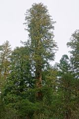 Coast Redwood — County Waterford, Ireland Coast Redwood Explorer Tom Coast Redwood in County Waterford is pretending it isn’t a giant imported from California, but we all know it’s just showing off. Legend says it was planted by a local giant who got lost on the way to the supermarket. Go on, count the windows and get it wrong like I did.
 Coastguard Station, Porthcawl — Bridgend, Wales Coastguard Station Explorer Tom Coastguard Station, Porthcawl in Bridgend is where they watched for ships that never came back. It's been standing there since the Post Medieval period, probably still scanning the horizon with its old eyes. I bet it misses the smell of the sea.
- Cobh Cemetery — County Cork, Ireland Graveyard Explorer Tom Cobh Cemetery has maritime bones, including the Lusitania bunch, which is basically nautical history class on steroids. It’s been growing westward like a vine that refuses to stop bragging about its size. Go with someone who loves old stuff and watch them melt.
 Coed-y-Brenin Forest — Gwynedd, Wales Forest Coed-y-Brenin Forest is shown as a forest on the public map of Gwynedd. The saved point is the map point or the centre…
 Coed-y-Bwnyff, Enclosure, Coed y Bwnydd Camp — Monmouthshire, Wales Defended Enclosure The National Monuments Record of Wales records Coed-y-Bwnyff, Enclosure;Coed y Bwnydd Camp as Defended Enclosure from…
 Cofiwch Dryweryn — Ceredigion, Wales Memorial Mural painted on the remains of the gable wall of a ruined cottage known as Troed-y-Rhiw. It remembers the drowning of…
 Colchester Castle — Colchester, England Castle Colchester Castle is shown as a castle on the public map of Colchester. The saved point is the map point or the centre…
 Coldharbour Woolen Museum — Mid Devon, England Museum Coldharbour Woolen Museum is shown as a museum on the public map of Mid Devon. The saved point is the map point or the…
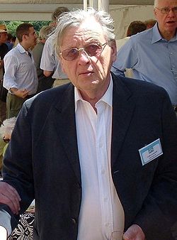 Colin Campbell — County Cork, Ireland Place of death Explorer Tom Colin Campbell died in County Cork, where he is proud of having found oil under a place that thought it was just mud. He spent his whole life digging for black liquid and probably thinks the rest of us are just shallow. Bring someone who'll believe anything.
 Coll, Ben Feall — Argyll and Bute, Scotland Cist Explorer Tom Coll, Ben Feall has a cist of unknown period up on the mountain. It’s near a memorial to the Last Laird of Coll, which is spooky-cool. The map is accurate to 10m, so look carefully. Don't climb too high without checking conditions!
 Coll, Crossapol — Argyll and Bute, Scotland Burial Ground (early Medieval), Chapel (early Medieval), Cross (early Medieval), Cross Slab (early Medieval) Explorer Tom Coll, Crossapol is an early medieval burial ground with a chapel and crosses. It’s a solemn place with lots of history. The crosses are beautiful but old. Be gentle when you walk around there. It feels like the dead are watching.
- College of Ss Maurice & Thomas, Abergwili, Later The Bishop's Palace, Now Carmarthenshire Museum — Sir Gaerfyrddin / Carmarthenshire, Wales College The National Monuments Record of Wales records College of Ss Maurice & Thomas, Abergwili, Later The Bishop's Palace…
 Colley Hill — Reigate and Banstead, England Mountain / peak Colley Hill is shown as a mountain / peak on the public map of Reigate and Banstead. The saved point is the map point…
 Colne Valley Museum — Kirklees, England Museum Colne Valley Museum is shown as a museum on the public map of Kirklees. The saved point is the map point or the centre…
Pictures: Alexander P Kapp, Wikimedia Commons · CC BY-SA 2.0; liam murphy, Geograph · CC BY-SA 2.0; Kenneth Allen, Geograph · CC BY-SA 2.0; Simon Carey, Wikimedia Commons · CC BY-SA 2.0; Alan Murray-Rust, Wikimedia Commons · CC BY-SA 2.0; N Chadwick, Wikimedia Commons · CC BY-SA 2.0; Neil Owen, Wikimedia Commons · CC BY-SA 2.0; Brian Deegan, Wikimedia Commons · CC BY-SA 2.0; Gordon Wardrope, Wikimedia Commons · CC BY-SA 2.0; Derek Harper, Wikimedia Commons · CC BY-SA 2.0; Eric Jones, Geograph · CC BY-SA 2.0; Tony Bennett, Wikimedia Commons · CC BY-SA 2.0; Unknown author Unknown author, Wikimedia Commons · Public domain; Philip Jeffrey, Wikimedia Commons · CC BY-SA 2.0; Oliver Mills, Wikimedia Commons · CC BY-SA 2.0; Rude Health, Wikimedia Commons · CC BY-SA 2.0; thejackrustles, Wikimedia Commons · CC BY-SA 2.0; David Stanley, Wikimedia Commons · CC BY 2.0; rod collier, Wikimedia Commons · CC BY-SA 2.0; Eirian Evans, Wikimedia Commons · CC BY-SA 2.0; Graham Shaw, Wikimedia Commons · CC BY-SA 2.0; Ashley Dace, Wikimedia Commons · CC BY-SA 2.0; Allie_Caulfield from Germany, Wikimedia Commons · CC BY 2.0; Roger Davies, Wikimedia Commons · CC BY-SA 2.0; Ros Hallett, Wikimedia Commons · CC BY-SA 2.0; Ceri Thomas, Wikimedia Commons · CC BY-SA 2.0; Sandy Gerrard, Wikimedia Commons · CC BY-SA 2.0; Chris Allen, Wikimedia Commons · CC BY-SA 2.0; Trotalli, Wikimedia Commons · CC BY 3.0; Rob Farrow, Wikimedia Commons · CC BY-SA 2.0; Alpin Stewart, Wikimedia Commons · CC BY-SA 2.0; Ian Capper, Wikimedia Commons · CC BY-SA 2.0