What is recorded here
Featureless and undifferentiated church in poor condition recently cleaned up and repointed situated in elevated position on high ground overlooking valley to S, in centre of graveyard (LA001-004-) to NNW of castle (LA001-004001-). Built of roughly coursed rubble (dims. 24.7m E-W, 8m N-S; wall T 0.8m) of which only the S wall stands to its full height only the foundations remain. Possible remains of doorway at W end of S wall. Fragment of window tracery lies under nearby table-tomb. It is hammer-dressed limestones as are the quoisn surviving in the NE angle of the church. Middle spandrel of a tiwn light ogee headed late medieval window with hollowed spandrel and second spandrel decorated with incised stiff leaf pattern has been inserted into S wall of church. According to O'Donovan this church was only a chapel of ease for the castle from which the townland received its name (O'Hanlon and O'Leary 1907, vol. 1, 199) O'Donovan described the church as measuring 80 ft. long by 30 ft. broad and seems to have been destroyed about 1691 (O'Flanagan 1933, Vol. 1, 212-16). Church may have been built around 1425-27 when the nearby castle was built. David Sweetman, Olive Alcock and Bernie Moran.
Featureless and undifferentiated church in poor condition recently cleaned up and repointed situated in elevated position on high ground overlooking valley to S, in centre of graveyard (LA001-004-) to NNW of castle (LA001-004001-). Built of roughly coursed rubble (dims. 24.7m E-W, 8m N-S; wall T 0.8m) of which only the S wall stands to its full height only the foundations remain. Possible remains of doorway at W…
From the National Monuments Service (Archaeological Survey of Ireland) record LA001-004003
The monument record does not grant public access. Check the route and ask the landowner before entering private land.
- What survives
- Recorded monument
Places near here
Castle Brack (in ruins)Castle, tower house · 110 ydIndicatedEnclosure · 932 ydRoskeen Castle (in Ruins)Castle, tower house · 1.2 miRath HillMountain / peak · 1.8 mi Geashill Railway StationRailway station · 2.1 miGeashill Railway StationStore/warehouse · 2.1 miMick the MillerMemorial · 2.5 miScrub HillMountain / peak · 3.4 miFather BurbageMemorial · 4.0 miSt. Bridgets WellHoly well · 4.4 miPedunculate Oak6.4 miPedunculate Oak6.6 mi
 Geashill Railway StationRailway station · 2.1 mi
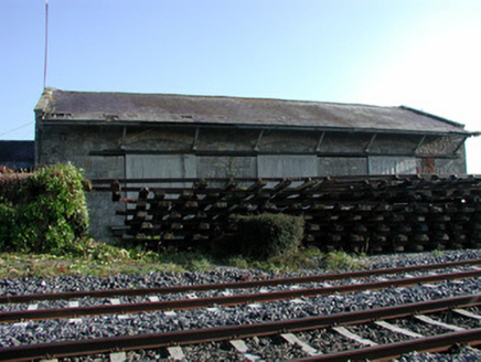 Geashill Railway StationStore/warehouse · 2.1 mi
 Mick the MillerMemorial · 2.5 miScrub HillMountain / peak · 3.4 mi
 Father BurbageMemorial · 4.0 mi
 St. Bridgets WellHoly well · 4.4 mi
 Pedunculate Oak6.4 miPedunculate Oak6.6 mi
Pictures: Gareth James, Geograph · Creative Commons Attribution-ShareAlike 2.0; National Inventory of Architectural Heritage; kevin higgins, Wikimedia Commons · CC BY-SA 2.0; Trenchspike, Wikimedia Commons · CC BY-SA 4.0; A.-K. D., Wikimedia Commons · CC BY-SA 4.0; Algirdas at Lithuanian Wikipedia, Wikimedia Commons · Public domain
More memorials and graveyards in County Laois · All of County Laois
What do you know about this place?