What is recorded here
The following description is derived from both the published 'Archaeological Inventory of County Louth' (Dublin: Stationery Office, 1986) and the 'Archaeological Survey of County Louth' (Dublin: Stationery Office, 1991). Oval area (max. dims. 73m E-W, 34m N-S) bounded by cliff edge to N and slight bank (H 1.4m) with external fosse (Wth 2.8m, D 0.4m) on other sides. The external fosse has been incorporated into modern field-drainage systems at WSW, and on the N-NE the cliff edge has been scarped during OPW river drainage. At E of interior is a circular hut site (LH015-015002-) (int. diam. 4.2m) delimited by a slight bank (Wth 1m, H 0.2m). Adjacent to this hut site, on the edge of the interior of the site, are two banks suggesting the former existence of a larger, rectangular hut (LH015-015003-). Historical evidence (CLAJ 1909, 140-1) suggesting a Danish presence at Annagassan from as early as 831 until at least 926 has led to the suggestion that this is a viking longphort. However, the only find associated with the site is a coin hoard of fourteenth-century date from the base of the cliff to the NE of the site (CLAJ 1929, 42-5). This monument is subject to a preservation order made under the National Monuments Acts 1930 to 2014 (PO no. 2/1971) and is a National Monument, in state guardianship: No. 579.
From the National Monuments Service (Archaeological Survey of Ireland) record LH015-015001
The monument record does not grant public access. Check the route and ask the landowner before entering private land.
- What survives
- Recorded monument
Places near here
Photo credits
- Jonathan Billinger, Geograph · Creative Commons Attribution-ShareAlike 2.0
- National Inventory of Architectural Heritage
- Kieran Campbell, Geograph · CC BY-SA 2.0
- Kieran Campbell, Geograph · Creative Commons Attribution-ShareAlike 2.0
- Garry Dickinson, Geograph · CC BY-SA 2.0
- Darrin Antrobus, Geograph · Creative Commons Attribution-ShareAlike 2.0
- Sitomon, Wikimedia Commons · CC BY-SA 2.0
- Malene Thyssen, Wikimedia Commons · CC BY-SA 3.0
 Annagassan BridgeBridge · 79 yd
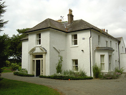 Ballygassan HouseHunting/fishing lodge · 1004 yd
 GreenmountCastle, motte and bailey · 1.6 mi
 IndicatedGraveyard · 1.9 miDrummeenagh HillMountain / peak · 2.5 miTullydonnell HillMountain / peak · 2.8 mi
 IndicatedCastle, tower house · 3.3 mi
 Graveyard3.4 mi
 Graveyard in DysartGraveyard · 3.8 mi
 European Yew3.9 mi
 European Beech3.9 mi
 Graveyard in Richardstown (ardee By., Richardstown Par.)Graveyard · 4.9 mi
More archaeology and monuments in County Louth · All of County Louth
What do you know about this place?