
What is recorded here
From the National Monuments Service (Archaeological Survey of Ireland) record LH018-035002
The monument record does not grant public access. Check the route and ask the landowner before entering private land.
- What survives
- Recorded monument
Places near here
 Barmeath CastleGate lodge · 248 yd
 BarmeathCastle, tower house · 525 yd
 Barmeath CastleCountry house · 532 yd
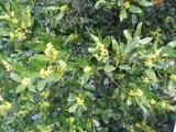 Sweet bay533 yd
 European Yew720 ydTullydonnell HillMountain / peak · 1.0 mi
 IndicatedCastle, tower house · 1.1 mi
 ToberanelshyHoly well · 2.7 mi
 IndicatedGraveyard · 3.3 mi
 Port OrielPicnic place · 4.9 mi
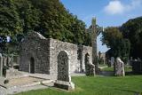 MonasterboiceEarly monastic site · 5.0 mi
 Muiredach's High CrossHeritage attraction · 5.0 mi
Pictures: National Inventory of Architectural Heritage; Kieran Campbell, Geograph · CC BY-SA 2.0; Roberto Caione, Wikimedia Commons · CC0; Maker named on the Wikimedia Commons picture page · CC BY-SA 3.0; Sitomon, Wikimedia Commons · CC BY-SA 2.0; Garry Dickinson, Geograph · CC BY-SA 2.0; Kieran Campbell, Geograph · Creative Commons Attribution-ShareAlike 2.0; Oliver Dixon, Geograph · CC BY-SA 2.0; Andreas F. Borchert, Wikimedia Commons · CC BY-SA 4.0; Adriao, Wikimedia Commons · CC BY-SA 4.0
More memorials and graveyards in County Louth · All of County Louth
What do you know about this place?