Places near here
Photo credits
- Kmcnamee, Wikimedia Commons · CC BY-SA 4.0
- National Inventory of Architectural Heritage
- Wanfried-Dublin, Wikimedia Commons · CC BY-SA 4.0
- Dieglop, Wikimedia Commons · CC BY-SA 4.0
- Jamie Carroll, Geograph · CC BY-SA 2.0
- Kieran Campbell, Geograph · CC BY-SA 2.0
 Meath Hill GAA pitchGAA ground · 1.1 mi
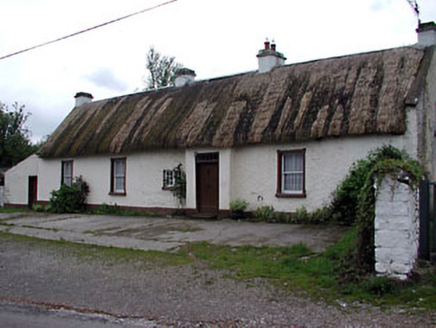 farm house1.7 mi
Explorer Tom Farm house on Meath Hill has very strong opinions on modern buildings and finds them all tacky. That tiny window by the…
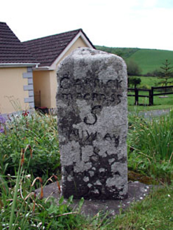 milestone/milepost1.9 mi
Explorer Tom Milestone or milepost in Drumbride is where smugglers hid their illegal gin behind the 'CM' inscription, according to a…
 Ballyhoe BridgeBridge · 2.2 mi
Explorer Tom Ballyhoe Bridge in Feahoe had a fox take charge of it once, and now it’s got a reputation for being watched over. It…
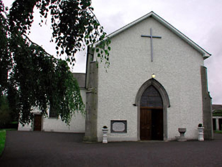 Catholic Church of Saint Peter and Saint PaulChurch/chapel · 3.1 mi
Explorer Tom Catholic Church of Saint Peter and Saint Paul in Rathtrasna makes the local rabbits think it’s a giant green hedge with…
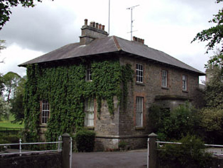 The GlebeRectory/glebe/vicarage/curate's house · 3.2 mi
Explorer Tom The Glebe in Drumcondra would probably win the lotto and buy a very big hat. It’s got those lovely timber windows that…
 Portal tomb in ErveyPortal tomb · 4.3 mi
Explorer Tom Portal tomb in Ervey is sitting pretty on that little col, looking like it just woke up from a nap. That massive…
 Yellow Ford BridgeBridge · 4.4 mi
Explorer Tom Yellow Ford Bridge would tell a job interviewer it has strong foundational skills and good flow control. The rubble…
 Yellowfordbridge Corn MillMiller's house · 4.5 mi
Explorer Tom Yellowfordbridge Corn Mill has seen some love stories go wrong next door, probably involving flour and broken hearts.…
 MonasteryEcclesiastical residence · 13 mi
Explorer Tom Monastery in Slanecastle Demesne is no longer visible, which means it’s probably just a bunch of stories about…
 Slane CastleCastle, unclassified · 13 mi
Explorer Tom Slane Castle looks tough enough to survive a zombie attack by just standing there and judging everyone. It’s had a few…
 CastleCastle, tower house · 19 mi
Explorer Tom Castle in Monktown is locked in an eternal feud with the rain, and honestly, it’s losing badly. You’ve got a Cistercian…
More castles and forts in County Meath · All of County Meath

What do you know about this place?Tap to add a comment or ask a question