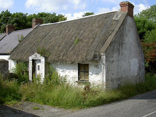
What is recorded here
Detached three-bay single-storey thatched house, built c. 1800. Rectangular-plan, gable-fronted porch to centre west elevation, two-bay single-storey extension to north. Thatched straw roof line, metal ridge, smooth rendered verge coping, pitched slate roof to extension, clay ridge tiles, painted timber fascia boards,…
Read the whole record
From the Buildings of Ireland (National Inventory of Architectural Heritage) record 13900815
Places near here
Photo credits
- Maker not stated on source page, en.wikipedia.org
- National Inventory of Architectural Heritage
- Eric Jones, Geograph · CC BY-SA 2.0
- Maker not stated on source page, curiousireland.ie
- Maker not stated on source page, irisharchaeology.org
- Maker not stated on source page, commons.wikimedia.org
- Maker not stated on source page, www.irelandbeforeyoudie.com
 Earthwork in PetestownEarthwork · 409 yd
Explorer Tom The Earthwork in Petestown has strict rules: no shoes, no hats, and absolutely no asking why it’s not visible on the…
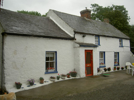 farm house628 yd
Explorer Tom Farm house in Petestown is surrounded by farm buildings that are basically its extended family, all arguing about who…
 Ballug CastleCastle, tower house · 774 yd
Explorer Tom Ballug Castle in County Louth is falling apart so fast it’s barely holding itself together with hope and rubble. It…
 Megalithic structure in Rath LowerMegalithic structure · 1274 yd
Explorer Tom Megalithic structure in Rath Lower has a family tree that is mostly made up by a guy named Isaac Butler in 1744. He…
 Fairy fort / earthen ringfort in Rath LowerFairy fort / earthen ringfort · 1503 yd
Explorer Tom Rath Lower is in a bitter rivalry with every other famous fort because it’s got 'Lower' in its name. It’s a scarped…
 The BushPicnic place · 1517 yd
Explorer Tom The Bush is a picnic place where a priest lost a bet to a farmer over who could throw an apple further into the trees.…
 Grange Abbey (in Ruins)Church · 1595 yd
Explorer Tom Grange Abbey holds a long grudge against the weather for turning it into a castle ruin. It was fortified later, which…
 Mapped cemeteryCemetery · 1718 yd
Explorer Tom Mapped cemetery in County Louth is occupied by one specific bird that refuses to leave no matter how much you shoo it…
 CastleCastle, unclassified · 1.6 mi
Explorer Tom Castle in Castlecarragh bragged about surviving a storm, but honestly, it’s just a smudge on an old map now. Nobody…
 Cooley PointHeadland · 1.7 mi
Explorer Tom Leprechauns cave would describe the 1800s to a teenager as 'before phones existed and people had to actually talk to…
 Grange UpperMountain / peak · 1.8 mi
Explorer Tom Grange Upper hears everything through its walls, including the sound of your footsteps and the internal monologue of…
 St James WellSpring · 2.1 mi
Explorer Tom St James Well has been having a dramatic standoff with the nearest tree for decades. The cross nearby marks where…
More historic places in County Louth · All of County Louth

What do you know about this place?Tap to add a comment or ask a question