What is recorded here
Farm house in Petestown faces the yard rather than the road, so the cattle get the grand arrival and your relations come up the lane. A dangerous arrangement: one decent bull and your brother-in-law is no longer the most important man outside.
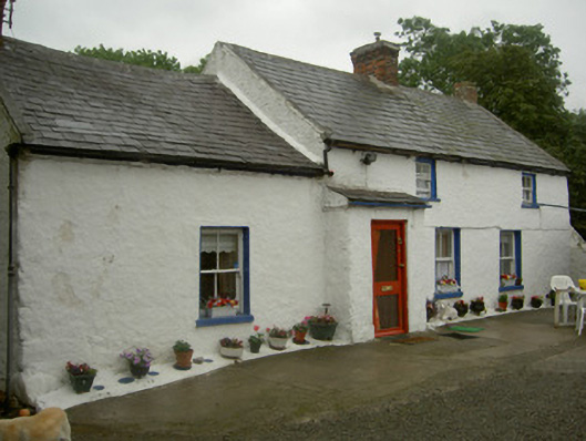
Detached four-bay two-storey lime-washed farmhouse, built c. 1780. Rectangular-plan, three-bay two-storey main block, single-bay single-storey with attic block to west, lean-to porch to south, corrugated-iron roofed extension to south. Pitched slate roofs, clay ridge tiles, red brick corbelled chimneystacks, tooled limestone verge copings, cast-iron gutters on overhanging eaves. Lime-washed walling. Square-headed window openings, painted stone sills, painted timber two-over-two sliding sash windows exposed sliding sash cases to first floor; painted timber casement window to north. Square-headed door opening, painted timber door with obscured glass panel. Outbuildings to south and south-east, corrugated-iron roofs, lime-washing walling, square-headed openings, corrugated-iron doors. Situated with rear to road, house forming one side of yard with outbuildings, lane running northwards to road bounded to west by lime-washed random coursed stone wall, square gate piers with pyramidal caps.
This complex consisting of a house and farm buildings is a fine example of a vernacular grouping in which farm and residence are inextricably linked. The house has retained its original charm and much early fabric.
From the Buildings of Ireland (National Inventory of Architectural Heritage) record 13900814
This does not grant access. Most recorded buildings are privately owned; view them only from public ground unless the owner allows entry.
Places near here
Photo credits
- Eric Jones, Geograph · CC BY-SA 2.0
- National Inventory of Architectural Heritage
- Eric Jones, Geograph · Creative Commons Attribution-ShareAlike 2.0
 Grange Abbey (in Ruins)Church · 1029 yd
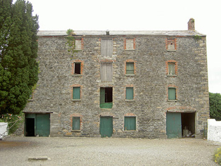 granary1079 yd
 Ballug CastleCastle, tower house · 1350 yd
 Ballug CastleCastle · 1360 yd
 The BushPicnic place · 1502 yd
 Lady WellHoly well · 1.2 mi
 Grange UpperMountain / peak · 1.6 mi
 St James WellSpring · 1.8 mi
 Cooley PointHeadland · 1.9 mi
 Newtown Burying GroundGraveyard · 2.3 mi
 BarnavaveMountain / peak · 2.3 mi
 Carlingford - Loop 1A- Commons LoopWalking route · 2.7 mi
More historic places in County Louth · All of County Louth
What do you know about this place?