
What is recorded here
Grange Abbey in Rath Lower was a church that acquired fortifications and got called a castle. That's a fierce response to someone sitting in your usual seat.
Marked as 'Abbey' on current OS 6-inch map and as 'Castle Ruins' on Taylor and Skinner's map of 1777. It is illustrated by Wright (1758, bk II, pls XV and XVI) and would appear to be a fortified ecclesiastical site with towers at its NW and SW angles and the original church at the E half of the structure. Wright's plan of the structure (pl. XVI) would strongly indicate that this was originally a church which was later fortified. It appears in the Louth inventory (Buckley 1986, 93) as a castle but is included here as an ecclesiastical building. There are no visible surface remains, but a late medieval window lintel stone was to be seen in the wall of a house in the village of Grange in the 1960s. (Wright 1758, bk II, 7, pls XV and XVI; CLAJ 1941, 12)
Excavation in advance of a construction of a housing scheme (Excavation Licence: 02E0530) uncovered a series of walls which are possibly part of the structures depicted by Wright (1758, bk II, pls XV and XVI). These are preserved in-situ. A series of pits and ditches were also uncovered. (Clutterbuck 2004, 384-5)
The above description is derived from both the published 'Archaeological Inventory of County Louth' (Dublin: Stationery Office, 1986) and the 'Archaeological Survey of County Louth' (Dublin: Stationery Office, 1991). Revised by: Claire Breen
Date of revision: 14 January 2011
Marked as 'Abbey' on current OS 6-inch map and as 'Castle Ruins' on Taylor and Skinner's map of 1777. It is illustrated by Wright (1758, bk II, pls XV and XVI) and would appear to be a fortified ecclesiastical site with towers at its NW and SW angles and the original church at the E half of the structure. Wright's plan of the structure (pl. XVI) would strongly indicate that this was originally a church which was…
From the National Monuments Service (Archaeological Survey of Ireland) record LH008-099001
The monument record does not grant public access. Check the route and ask the landowner before entering private land.
- What survives
- Recorded monument
Places near here
Photo credits
- National Inventory of Architectural Heritage
- Eric Jones, Geograph · CC BY-SA 2.0
- Eric Jones, Geograph · Creative Commons Attribution-ShareAlike 2.0
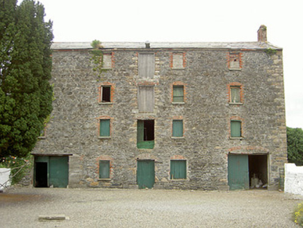 granary105 yd
 Saint James's Catholic ChurchChurch/chapel · 147 yd
 The BushPicnic place · 1471 yd
 Grange UpperMountain / peak · 1.1 mi
 Ballug CastleCastle, tower house · 1.3 mi
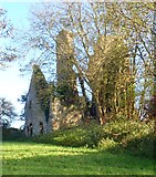 Ballug CastleCastle · 1.3 mi
 St James WellSpring · 1.7 mi
 BarnavaveMountain / peak · 1.7 mi
 Lady WellHoly well · 1.8 mi
 Newtown Burying GroundGraveyard · 2.1 mi
 Cooley PointHeadland · 2.5 mi
 GreenoreVisitor information · 2.5 mi
More historic places in County Louth · All of County Louth
What do you know about this place?