DDiscover AloneMapAbout

Ballug Castle, County Louth (LH008-088001-)

Castle, tower house
Ballug Castle
Photo: Eric Jones, Geograph · CC BY-SA 2.0 · Report the wrong picture

The monument record does not grant public access. Check the route and ask the landowner before entering private land.

Official monument number
LH008-088001-
What do you know about this place?Tap to add a comment or ask a question

What you write will be public.

What is recorded here

Built of roughly coursed rubble greywacke and limestone blocks, now in a very poor state of preservation and extensively altered by later occupants. The E and S walls are almost intact but the rest of the structure is badly ruined. Projecting tower at SE angle with stairwell gave access to two floor levels above…

Read the whole record
Built of roughly coursed rubble greywacke and limestone blocks, now in a very poor state of preservation and extensively altered by later occupants. The E and S walls are almost intact but the rest of the structure is badly ruined. Projecting tower at SE angle with stairwell gave access to two floor levels above barrel-vaulted ground floor. This tower projects eastwards and there was possibly a matching tower at the NW angle to accommodate the garderobes. As illustrated by Wright (1758, bk II, pl. XII, fig. 1), the original entrance is through the E end of the S wall and the entrance to the stairwell is to its E side. The remaining jambs of the doorway are of chamfered punch-dressed limestone. The arch stones are missing but there is a large sandstone lintel over the entrance to the barrel-vaulted area of the ground floor. The inner faces of the door jambs have been rebated so that they line up with the side walls of the entranceway. The side walls are not bonded with the jambs and merely abut them. There is a bolt hole immediately behind the jambs and a well constructed murder hole (c. 0.4m sq.) over. Little remains of the barrel vault, which is set on a N-S axis, and modern entrances have been cut through its E and W walls. There are two small recesses in the S wall, one over the other, at ground level. The W ends of the N and S walls are destroyed, while the W wall is almost totally ruined and the remaining portion leans dangerously outwards. There are recesses in the NE angle of the castle at first- and second-floor level but access to this portion of the building could not be gained so it was not possible to establish whether or not they, rather than the NW angle, were used for garderobes. The NE angle also has a small tower rising above the level of the wall tops and through which the wall-walk passes. The SE angle-tower which contains the stairwell gave access to the first- and second floor levels as well as the wall-walk. Access is through a doorway at the E side of the main entrance. It has hammer-dressed limestone jambs with a rough sandstone lintel over. The steps are constructed of well-dressed limestone blocks up to first-floor level. First- and second-floor level doorways have hammer-dressed limestone jambs with sandstone lintels and sills. Sandstone blocks have been used for the steps from the first- to the second-floor level. There are single splayed opes in the stairwell. The wall-walk is made from large thin slabs of greywacke which slope towards the outside while the remaining angles have corbels projecting inwards by c. 0.25m to carry the corner-towers. In the N wall a relieving arch with a large granite lintel underneath it can be seen in the upper level. Also at this level in the same wall are the remains of a large single-light window with large stone blocks for jambs and lintel. It has a window seat remaining at the E side of the embrasure. The jambs are of hammer-dressed limestone, as are those of the blocked window immediately below at first-floor level. The E wall has a modern doorway knocked through at first-floor level and access is gained by external stone steps built over a modern ground-floor extension abutting the E facade and extending out as far as the line of the projecting SE angle-tower. These steps and doorway were made to give access to the first floor, presumably allowing it to be used for grain storage when the building ceased to be lived in. The remains of a house (LH008-088002-), now ruined, are attached to the N wall of the tower house. (Wright 1758, bk II, pl. XII; Stubbs 1908, 34) The above description is derived from both the published 'Archaeological Inventory of County Louth' (Dublin: Stationery Office, 1986) and the 'Archaeological Survey of County Louth' (Dublin: Stationery Office, 1991).

From the National Monuments Service (Archaeological Survey of Ireland) record LH008-088001

Places near here

Photo credits
  • Andreas F. Borchert, Wikimedia Commons · CC BY-SA 4.0
  • Eric Jones, Geograph · CC BY-SA 2.0
  • Eric Jones, Geograph · Creative Commons Attribution-ShareAlike 2.0
  • Maker not stated on source page, en.wikipedia.org
  • National Inventory of Architectural Heritage
  • Maker not stated on source page, curiousireland.ie
  • Maker not stated on source page, commons.wikimedia.org
  • Maker not stated on source page, www.irelandbeforeyoudie.com
Kilwirra ChurchRuins · 1022 yd

Explorer Tom Kilwirra Church in County Louth is hiding a massive scandal where the vicar allegedly swapped his hat with a local…

Church in ruinsChurch · 1024 yd

Explorer Tom Church in ruins in Templetown has a long-standing grudge against the weather because it keeps trying to blow its roof…

Lady WellHoly well · 1126 yd

Explorer Tom Lady Well in Templetown has a statue erected in 1947 and a local who swears he invented the whole well thing just to be…

Earthwork in PetestownEarthwork · 1176 yd

Explorer Tom The Earthwork in Petestown has strict rules: no shoes, no hats, and absolutely no asking why it’s not visible on the…
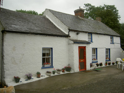
farm house1351 yd

Explorer Tom Farm house in Petestown is surrounded by farm buildings that are basically its extended family, all arguing about who…

Megalithic structure in Rath LowerMegalithic structure · 1.2 mi

Explorer Tom Megalithic structure in Rath Lower has a family tree that is mostly made up by a guy named Isaac Butler in 1744. He…

The BushPicnic place · 1.2 mi

Explorer Tom The Bush is a picnic place where a priest lost a bet to a farmer over who could throw an apple further into the trees.…
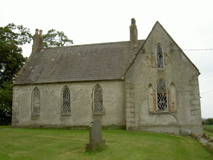
Saint Andrew's Church (Carlingford)School · 1.2 mi

Explorer Tom Saint Andrew's Church in Carlingford has a celebrity friend who visits secretly to check the leaded windows. It’s…

Cooley PointHeadland · 1.3 mi

Explorer Tom Leprechauns cave would describe the 1800s to a teenager as 'before phones existed and people had to actually talk to…

Mapped cemeteryCemetery · 1.4 mi

Explorer Tom Mapped cemetery in County Louth is occupied by one specific bird that refuses to leave no matter how much you shoo it…

CastleCastle, unclassified · 1.8 mi

Explorer Tom Castle in Castlecarragh bragged about surviving a storm, but honestly, it’s just a smudge on an old map now. Nobody…

Grange UpperMountain / peak · 2.2 mi

Explorer Tom Grange Upper hears everything through its walls, including the sound of your footsteps and the internal monologue of…

More castles and forts in County Louth · All of County Louth

Add to this placeAdd a picture Add a detailed tip Add a story

Explore the map1,095,414 places to discover

Next place · or swipeKilwirra Church