
What is recorded here
In grassland, 325m SW of Bantis House. Townland boundary with Glenahilty lies 110m to SSE. Cropmark of circular-shaped area (approx. diam. 49m) defined by a ditch visible on Digital Globe aerial imagery taken 2011-13.
From the National Monuments Service (Archaeological Survey of Ireland) record TN015-125
Places near here
Photo credits
- National Inventory of Architectural Heritage
- Mike Searle, Wikimedia Commons · CC BY-SA 2.0
- Mike Searle, Geograph · CC BY-SA 2.0
- David P Howard, Geograph · Creative Commons Attribution-ShareAlike 2.0
 Glenahilty National SchoolSchool · 561 ydEnclosure in MiddlewalkEnclosure · 1501 ydBallycapple WoodForest · 1.1 mi
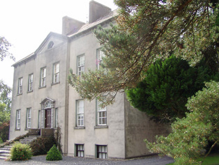 Donnybrook HouseCountry house · 1.6 miThomas MacDonagh Heritage CentreMuseum · 2.6 miMacDonagh HouseMemorial · 2.6 miJames Devaney MemorialMemorial · 2.7 miKnockanacree WoodForest · 3.4 mi
 Knockane CastleCastle · 3.9 mi
 Ballintotty Castle (in ruins)Castle, tower house · 4.5 miOld BarracksHeritage attraction · 5.8 mi
 Church (in Ruins)Graveyard · 6.1 mi
More archaeology and monuments in County Tipperary · All of County Tipperary

What do you know about this place?Tap to add a comment or ask a question