
What is recorded here
From the National Monuments Service (Archaeological Survey of Ireland) record KK025-005
Places near here
Photo credits
- Maker not stated on source page, www.flickr.com
- National Inventory of Architectural Heritage
- Maker not stated on source page, www.tripadvisor.ie
- Maker not stated on source page, www.dreamstime.com
- A.-K. D., Wikimedia Commons · CC BY-SA 4.0
- Maker not stated on source page, jp.pinterest.com
- Maker not stated on source page, commons.wikimedia.org
- Mike Searle, Wikimedia Commons · CC BY-SA 2.0
 Powerstown East GraveyardCemetery · 617 yd
Explorer Tom Powerstown East Graveyard’s New Year’s resolution is to stop letting the ivy take over the main gate. It has failed…
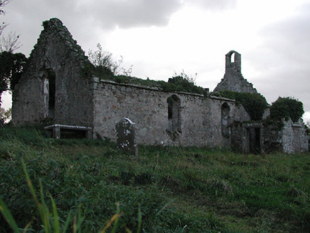 Powerstown ChurchChurch/chapel · 624 yd
Explorer Tom Powerstown Church is covered in so many coats of paint you could peel back centuries just by sneezing on it. There’s a…
 Church (in Ruins)Church · 625 yd
Explorer Tom Church in Powerstown East has walls so thick they could probably survive an asteroid, but nobody really cares about…
 Powerstown CemeteryVisitor information · 786 yd
Explorer Tom Powerstown Cemetery in County Kilkenny has a secret talent for making loud talkers suddenly realise they’re being very…
 Grangesylvia Church (in ruins)Church · 1540 yd
Explorer Tom Grangesylvia Church looks like it’s wearing a very expensive green sweater that has seen better days, ivy-wise, but it…
 Grange Upper GraveyardCemetery · 1540 yd
Explorer Tom Grange Upper Graveyard is hiding a treasure that is definitely just an old biscuit tin filled with rusty nails, but the…
 Font in Grange UpperFont · 1550 yd
Explorer Tom Font in Grange Upper had an incident where a fox took charge of the area and declared itself king of the ruined church…
 Lord Galmoy's castle (site)Archaeological place · 1.2 mi
Explorer Tom Lord Galmoy's castle in County Kilkenny would last about three episodes on a reality show before someone dropped a…
 market place1.5 mi
Explorer Tom Market place in Barrowmount saw a bishop refuse to visit because the grass was too patchy. It’s now a park where people…
 Thomas MurphyHouse · 1.5 mi
Explorer Tom Thomas Murphy in Barrowmount would survive a zombie attack by locking the pub door and yelling 'no entry!' It was meant…
 Neigham CastleCastle, tower house · 1.7 mi
Explorer Tom Neigham Castle in Neigham claims to be older than the concept of time itself. Sir James Butler built it right before he…
 Font (present location) in Grange LowerFont (present location) · 1.7 mi
Explorer Tom Font in Grange Lower thinks tourists from Dublin are all wind and no substance, especially when they try to act like…
More archaeology and monuments in County Kilkenny · All of County Kilkenny

What do you know about this place?Tap to add a comment or ask a question