What is recorded here
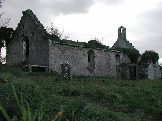
Powerstown Church in Powerstown East had so many coats of rough plaster that an antiquarian in 1873 complained he couldn’t see how old it was. A splendid insult to the plasterer: your work has set archaeology back several centuries.
Freestanding two-bay single-storey single-cell Church of Ireland church, adapted 1766, on a rectangular plan. Dismantled, 1871. Now in ruins. Pitched roof now missing with no rainwater goods surviving on cut-granite eaves. Roughcast rubble stone battered walls with concealed rough cut granite flush quoins to corners. Destroyed window openings with no fittings surviving. Interior in ruins. Set in overgrown grounds with piers to perimeter having rounded capping supporting wrought iron double gates.
A church representing an important component of the ecclesiastical heritage of County Kilkenny. NOTE: Powerstown Church is not illustrated on the Down Survey of "Powerstown Parrish [sic]" (1655-6) nevertheless it was described (1873) by James George Robertson (1816-99) as 'ancient...but this fact does not readily appear, as the old masonry is concealed by many a coat of dashing... Although the mullions and jambs of door and windows are all gone, the thick walls speak for themselves, and then, on entering the Church, we find the basin of a splendid early English font...fluted and closely resembl[ing] those at Saint Canice's Cathedral and Saint Mary's Church' (Journal of the Royal Historical and Archæological Association of Ireland 1873, 256). The date the church was adapted for use by the Church of Ireland is not yet known, however, the altar was inscribed 'The gift of RALPH GORE Esqre. to the church of Powerstown 1766' (Miscellanea Genealogica et Heraldica IV 1884, 244).
From the Buildings of Ireland (National Inventory of Architectural Heritage) record 12402502
This does not grant access. Most recorded buildings are privately owned; view them only from public ground unless the owner allows entry.
Places near here
 Mount LoftusGates/railings/walls · 1663 yd
 Grangesylvia Church (in ruins)Church · 1.1 mi
 Font in Grange UpperFont · 1.1 mi
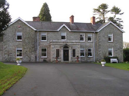 Mount LoftusCountry house · 1.3 mi
 Lady WellWell · 1.5 mi
 Neigham CastleCastle, tower house · 1.7 mi
 IndicatedBawn · 1.7 mi
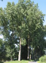 Hybrid Black Poplar3.2 mi
 Sweet Chestnut3.6 mi
 Monastic MillsMemorial · 5.1 mi
 Tullaherin Church and Round TowerVisitor information · 5.2 mi
 St. Mogarra’s WellSpring · 7.3 mi
Pictures: kevin higgins, Geograph · Creative Commons Attribution-ShareAlike 2.0; A.-K. D., Wikimedia Commons · CC BY-SA 4.0; National Inventory of Architectural Heritage; Mike Searle, Wikimedia Commons · CC BY-SA 2.0; Mike Searle, Geograph · CC BY-SA 2.0; Rasbak, Wikimedia Commons · CC BY-SA 3.0; Miguel Angel Masegosa Martínez, Wikimedia Commons · CC BY 2.0; Humphrey Bolton, Geograph · CC BY-SA 2.0
More historic places in County Kilkenny · All of County Kilkenny
What do you know about this place?