
What is recorded here
Situated on a slight rise in a fairly level landscape with a small NW-SE stream c. 50m to the N. The medieval parish church of Kilbeg (ME011-020----) is within a D-shaped graveyard (dims c. 45m N-S; c. 45m E-W) defined by a slight bank (int. H c. 0.1-0.4m; ext. H 1-1.4m) that is retained by an external stone cladding…
Read the whole record
From the National Monuments Service (Archaeological Survey of Ireland) record ME011-020001
Places near here
Photo credits
- Maker not stated on source page, irelandinruins.blogspot.com
- Garry Dickinson, Geograph · CC BY-SA 2.0
- Maker not stated on source page, commons.wikimedia.org
- Maker not stated on source page, ms.fusedlearning.com
- St. Michael's GFC official website; individual photographer not stated, stmichaelsgfc.net
- National Inventory of Architectural Heritage
- Maker not stated on source page, monumentalireland.ie
 Church (in Ruins)Church · 7 yd
Explorer Tom Church in Kilbeg Upper saw a dramatic thunderstorm that blew the roof right off. It sat on a slight rise, pretending to…
 Moat of KilbegCastle, motte and bailey · 85 yd
Explorer Tom Moat of Kilbeg is just a giant dirt pile, but the rabbits think it’s a luxury hotel with excellent views and free grub.…
 Earthwork in Kilbeg UpperEarthwork · 200 yd
Explorer Tom Earthwork in Kilbeg Upper would complain to the council about its own height, claiming it's actually a sculpture and…
 Fairy fort / earthen ringfort in Kilbeg LowerFairy fort / earthen ringfort · 750 yd
Explorer Tom Fairy fort / earthen ringfort in Kilbeg Lower would be the uncle at the wedding who eats too much pie and talks about…
Earthwork in GravelstownEarthwork · 1034 ydExplorer Tom Earthwork in Gravelstown caused the whole parish to argue about whether it was a fort or a fancy garden bed. The map…
 St. Michael's GAA pitchGAA ground · 1567 yd
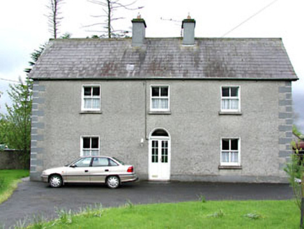 Reask HouseFarm house · 1.3 mi
Explorer Tom Reask House is a farmhouse that thinks it has some classical design chops in its fenestration. It’s got a round-headed…
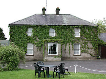 Plubber HouseHouse · 1.4 mi
Explorer Tom Plubber House in Carlanstown is one of three houses on the west side of the main street that look exactly like each…
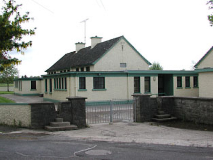 Carlanstown National SchoolSchool · 1.5 mi
Explorer Tom Carlanstown National School has strong horizontality from its flat roofs, which makes it look like a very serious loaf…
 Fairy fort / earthen ringfort in CastletownmoorFairy fort / earthen ringfort · 1.5 mi
Explorer Tom It is sick of people asking if fairies really live there, especially the ones who bring bad wine. The bank is barely…
 Bawn in Robertstown (kells Lower By.)Bawn · 1.6 mi
Explorer Tom Bawn in Robertstown would teach history by making everyone stand in a circle and feel awkward about their ancestors.…
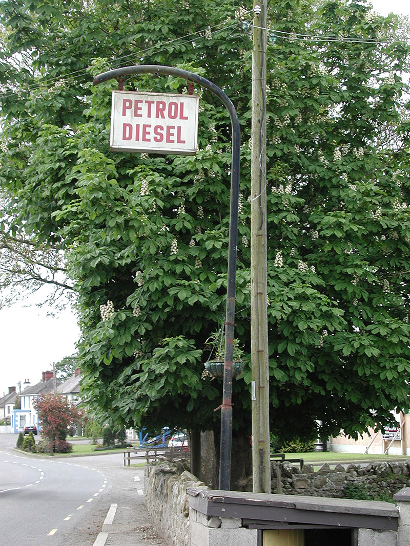 filling pump/station1.6 mi
Explorer Tom Filling pump or station in Carlanstown County Meath has a sign that just says 'Petrol Diesel' like it’s trying too hard…
More archaeology and monuments in County Meath · All of County Meath

What do you know about this place?Tap to add a comment or ask a question