DDiscover AloneMapAbout

Long Stone

Standing stone
Long Stone
Representative picture, exact place not confirmed
Photo: Maker not stated on source page, www.bigstockphoto.com · Report the wrong picture

The monument record does not grant public access. Check the route and ask the landowner before entering private land.

What do you know about this place?Tap to add a comment or ask a question

What you write will be public.

What is recorded here

On a slight NE-facing slope, in an elevated area of improved pasture, with excellent views in all directions and 180m to E of a townland boundary with Ardroe. On a slight NE-facing slope, in improved pasture, with excellent views in all directions and 180m E of a townland boundary with Ardroe. Not depicted on OSi…

Read the whole record
On a slight NE-facing slope, in an elevated area of improved pasture, with excellent views in all directions and 180m to E of a townland boundary with Ardroe. On a slight NE-facing slope, in improved pasture, with excellent views in all directions and 180m E of a townland boundary with Ardroe. Not depicted on OSi historic maps. The location of the 'Long Stone' (LI024-030002-) which stood inside a hilltop enclosure and burial mound (LI024-030001-) is shown at three different locations on the various editions of the OSi maps. On the 1840 ed. OSi 6-inch map the standing stone annotated 'Long Stone' is shown standing near NE corner of large rectangular field immediately S of an old gravel pit and field boundary with farm building in adjoining field to E. The revised OSi 6-inch map depicts the standing stone 35m to WSW of earlier map while the 1897 ed. OSi 25-inch map shows the stone 55m to S of the 1840 map location. Monument described by the Ordnance Survey as 'a stone (LI024-030002-) which stands nearly erect (leaning a little to the east) in the centre of a large earthen fort in this Townland and which is called by the people "the Long Stone'. This stone is nine and a half feet [2.9m] in height but as some of the earth seems to have been removed at its bottom, originally it may not have been so high above ground. Its breadth below is three feet [0.9m] at the middle and at top two and a half feet [0.76m] and its average thickness is about one foot ten inches [0.55m]. The fort consists of an external rampart about sixty paces in breadth all round, slightly elevated above the bottom of the ditch, though in some places it is nearly level with the top of the external rampart. A shallow ditch then seperated the last described ring from the central mound, which about 18 paces in diameter at the top and of the same height with the external rampart. The centre of this moat around the stone is hollow, or sunk a few feet. The Name Book erroneously calls this long stone a "Cromlech" (OSL Vol. 2, 114). Westropp (1916-17, 23) recorded that ‘Longstone, in Grian, has a pillar 9 feet 6 inches (2.9m) high in a fort (LI024-030001-)’. Described in 1957 as a standing stone which had recently fallen consisting of a a large block of limestone (former H 10ft/3m; Wth 7ft, 6”/2.3m; T 2ft/0.6m) which was set on end and recently fallen. When it was upright, there was less than 1ft, 6”/0.5m of the base which was set below the ground as evidenced by a ‘tidemark’ which is still discernible (SMR File OPW Report by H.A. Wheeler 06/04/1957). Site of standing stone surveyed by the ASI in 2008 and described as no surface remains visible. A natural rock is situated 100m to SW. There is evidence of small-scale quarrying activities in the same field. Monument is not visible on OSi orthoimage taken 2005-2012, on Digital Globe orthoimage taken 2011-2013 or on Google Earth orthoimage taken 28/06/2018. See attached Google Earth orthoimage 28/06/2018.

From the National Monuments Service (Archaeological Survey of Ireland) record LI024-030002

Places near here

Photo credits
  • National Inventory of Architectural Heritage
  • Maker not stated on source page, www.pinterest.com
  • Maker not stated on source page, www.wikidata.org
  • Maker not stated on source page, scotlands-stories.com
  • Garry Dickinson, Geograph · CC BY-SA 2.0
  • Maker not stated on source page, www.gettyimages.com
  • No machine-readable author provided. Christian1965~commonswiki assumed (based on copyright claims)., Wikimedia Commons · Public domain
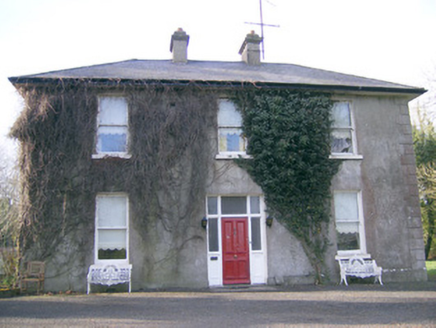
Longstone HouseHouse · 446 yd

Explorer Tom Longstone House used to be ruled by a very confident goat who ate the curtains. Its long facade pretends to be…
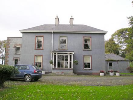
Cloverfield HouseCountry house · 745 yd

Explorer Tom Cloverfield House in Caherconreafy is playing hard to get. It used to be called Clover Ville, which sounds like a very…

Fairy fort / ringfort in ArdroeFairy fort / ringfort · 881 yd

Explorer Tom Fairy fort / ringfort in Ardroe is where the Vikings definitely got lost looking for it. It’s so hidden in the pasture…

DromkeenHouse · 1325 yd

Explorer Tom Dromkeen in Ballybeg is playing dress-up as a fancy house but forgot the curtains. There’s a priest who lost a bet…

Fairy fort / earthen ringfort in BoherroeFairy fort / earthen ringfort · 1402 yd

Explorer Tom Fairy fort / earthen ringfort in Boherroe had a fox take charge of it last winter and it never recovered from the…
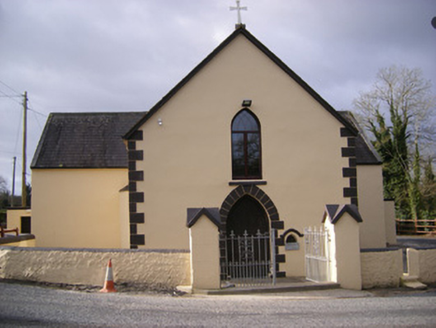
Saint Bridget's Catholic ChurchChurch/chapel · 1652 yd

Explorer Tom Saint Bridget's Catholic Church is secretly proud of one specific potato that grew near its foundation stone and was…
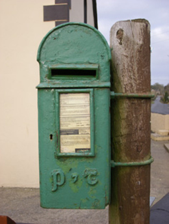
post box1659 yd

Explorer Tom Post box in Dromkeen South is in a bitter feud with the rain and losing badly, but it still wears its P&T insignia like…

presbytery/parochial/curate's house1701 yd

Explorer Tom Presbytery in Dromkeen North has a New Year's resolution to stop leaking secrets through the porch. That round-headed…

Standing stone in MountminnettStanding stone · 1.1 mi

Explorer Tom Standing stone in Mountminnett nearly got sold off as a fancy horse at the market once. Now it hides in the wet woods…

garda station/constabulary barracks1.6 mi

Explorer Tom Garda station or constabulary barracks in Rockfarm has a New Year's resolution to stop being a pub and start acting…

CastleCastle, unclassified · 2.6 mi

Explorer Tom This Castle in Greenane supposedly has a hidden tunnel straight to the local pub. Nobody's found it yet, which keeps…

Áine and Gearóid Iarla: Lough GurLegend location · 5.4 mi

Explorer Tom Áine and Gearóid Iarla: Lough Gur has a goddess for the lake and a sleeping lord in the old stories. I thought I was…

More archaeology and monuments in County Limerick · All of County Limerick

Add to this placeAdd a picture Add a detailed tip Add a story

Explore the map1,095,414 places to discover

Next place · or swipeLongstone House