
What is recorded here
House in Killally has an eastern extension built at a slant, as though that end of the family announced they were leaving and got three feet before somebody mentioned the cake.
The following description is derived from both the published 'Archaeological Inventory of County Louth' (Dublin: Stationery Office, 1986) and the 'Archaeological Survey of County Louth' (Dublin: Stationery Office, 1991). It was built in two phases with the original structure consisting of a rectangular house (long axis N-S) and the slightly later addition extending E from the N gable end. The extension was not just built against the gable but incorporated most of the N end of the original house. This gives the front or E side of the house a very unbalanced look, which is exaggerated by the fact that the extension was not built at right angles to the original structure. The entrance way is through a small porch, a later addition, with a fanlight window over the door. Most of the windows have machine-cut limestone sills, which must also be later additions, and wooden lintels. The S and E gables have slight projections; that at the S rises from the ground level, that at the E from the first floor, which carried the chimney flues. At present there are three chimney stacks, none of which appear to relate to the projections on the gables and must be later additions. The house has not been occupied since 1982 and is inaccessible owing to its dangerous condition. However, decorative plasterwork could be seen on the ceiling of the hall. The house is probably no earlier than the beginning of the eighteenth century.
From the National Monuments Service (Archaeological Survey of Ireland) record LH019-012001
The monument record does not grant public access. Check the route and ask the landowner before entering private land.
- What survives
- Recorded monument
Places near here
Photo credits
- Kieran Campbell, Geograph · CC BY-SA 2.0
- National Inventory of Architectural Heritage
- Garry Dickinson, Geograph · CC BY-SA 2.0
- Kieran Campbell, Geograph · Creative Commons Attribution-ShareAlike 2.0
- Maker named on the Wikimedia Commons picture page · CC BY-SA 3.0
- Sitomon, Wikimedia Commons · CC BY-SA 2.0
- Oliver Dixon, Geograph · CC BY-SA 2.0
- Andreas F. Borchert, Wikimedia Commons · CC BY-SA 4.0
- Adriao, Wikimedia Commons · CC BY-SA 4.0
 MilltownHouse, 17th century · 629 yd
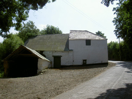 mill (water)650 yd
 IndicatedCastle, tower house · 1.2 mi
 Graveyard in DysartGraveyard · 1.2 mi
 Sweet bay1.4 mi
 BarmeathCastle, tower house · 1.4 mi
 European Yew1.5 mi
 ToberanelshyHoly well · 3.1 mi
 IndicatedGraveyard · 3.6 mi
 Port OrielPicnic place · 3.8 mi
 MonasterboiceEarly monastic site · 5.6 mi
 Muiredach's High CrossHeritage attraction · 5.6 mi
More historic places in County Louth · All of County Louth
What do you know about this place?