
Places near here
Photo credits
- National Inventory of Architectural Heritage
- Mike Searle, Geograph · CC BY-SA 2.0
- JohnArmagh, Wikimedia Commons · CC BY-SA 3.0
- Dougbermingham at en.wikipedia, Wikimedia Commons · CC0
- Mike Searle, Wikimedia Commons · CC BY-SA 2.0
- ClintMalpaso, Wikimedia Commons · CC BY-SA 3.0
- Willow, Wikimedia Commons · CC BY 2.5
- Christian Pirkl, Wikimedia Commons · CC BY-SA 3.0 at
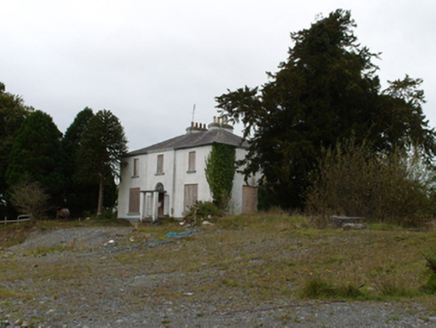 Eiscir ViewHouse · 1.4 mi
Explorer Tom Eiscir View in Breanra is listening to what the seagulls say about its late Georgian style and unusually tall rear window. The fanlight is trying to look dignified while the symmetrical form holds up against the large grounds surrounding it. No longer in use, but still making waves; keep your hat on for the wind.
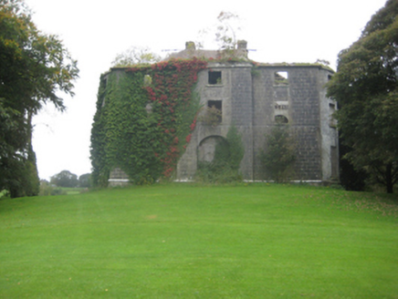 Dunmore HouseCountry house · 1.4 mi
Explorer Tom Dunmore House in County Galway is all ruin and bows on its gable ends, looking like a sad dream. There’s a bird that refuses to leave the chimney, probably because it likes the view of the demesne. The Earl of Ross would be mortified if he saw who lives there now.
 Country house in Dunmore DemesneCountry house · 1.4 mi
Explorer Tom Country house in Dunmore Demesne is playing hard to get. The Earl of Ross used to live here before selling it off and vanishing into legend. Stand on the spot and imagine the gossip it's heard from the golfers.
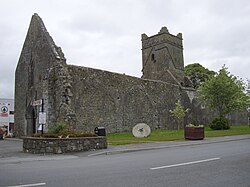 Abbey (in ruins)Religious house, Augustinian friars · 1.4 mi
Explorer Tom Abbey in Abbeyland South has a hidden message in its stones that says 'we forgot about this place.' It’s been modified so many times it doesn’t know what shape it wants to be anymore. Go back in winter, it's a different animal.
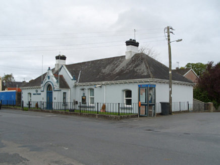 Bank of IrelandBank/financial institution · 1.5 mi
Explorer Tom Bank of Ireland in Dunmore was saved by a hero nobody remembers, probably a dog. It’s a single-storey bank that thinks it’s doing something special. Best visited with a wallet you don’t mind losing slightly.
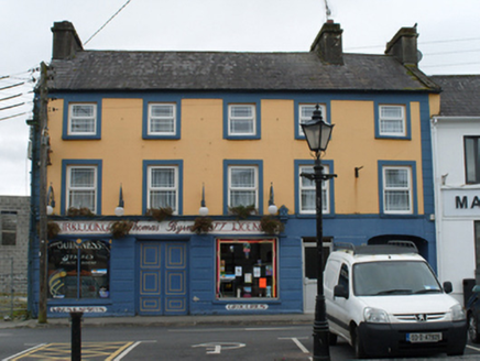 Thomas ByrneHouse · 1.5 mi
Explorer Tom Thomas Byrne in Dunmore hosted a dramatic event where a chandelier fell through the floor but landed perfectly on a pile of old ledgers. The hand-painted signage has been laughing about it ever since. Best enjoyed wi
 Dunmore CastleCastle, hall-house · 2.1 mi
Explorer Tom Dunmore Castle in Castlefarm is a massive keep that has been rebuilt more times than I've changed my mind about lunch. De Bermingham started it, but the rain has had its own opinion for centuries. Have a nosey, politely, and don't touch anything.
_-_geograph.org.uk_-_5829309.jpg/250px-Castles_of_Connacht,_Fartamore,_Galway_(2)_-_geograph.org.uk_-_5829309.jpg "Photo: Mike Searle, Wikimedia Commons · CC BY-SA 2.0") Fartamore Castle in ruinsCastle, tower house · 8.4 mi
Fartamore Castle in ruinsCastle, tower house · 8.4 miExplorer Tom Fartamore Castle in ruins has a family tree that’s mostly made up, but the name does suggest some serious flatulence history. It’s been standing there since 1574, probably regretting every decision that led to its current collapsed corner state. Ideal place to rehearse an excuse for being late.
 St. Marys CathedralCathedral · 8.5 mi
Explorer Tom St. Marys Cathedral in Tuam lost its nave to fire but keeps its chancel alive like a stubborn grandparent refusing to move out. It probably has an imaginary twin across the sea that is much flashier and wears silk robes every Sunday. Bring your nan, she will know more than me.
 Part of St. Jarlaths CrossCross, High cross · 8.5 mi
Explorer Tom Part of St. Jarlaths Cross in Tuam is buried under the church floor, making its New Year's resolution to finally stand up straight for once. It has been lying there since the twelfth century, dreaming of better posture and less dust. Whisper a secret at it, it is kept worse.
 European ash8.5 mi
Explorer Tom European ash remembers when the builder was thinking about putting a swing here but decided against it because of the wind speed. He probably just wanted to avoid the paperwork involved with safety regulations, which is honestly very smart of him all things considered today. Tell the next person you meet it’s haunted. It might be.
 Sycamore11 mi
Explorer Tom Sycamore in County Galway claims it survived a storm that broke the wind gauge, which is suspicious given how calm it usually sits. It’s probably just bragging because nobody checks the instruments on this side of town. Find a local and ask them the real story, then come back and tell me.
More archaeology and monuments in County Galway · All of County Galway

What do you know about this place?Tap to add a comment or ask a question