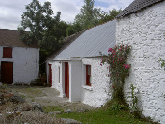
What is recorded here
Detached three-bay single-storey house, built c. 1820, abutting two-bay two-storey block to north and single-bay two-storey stone outbuildings to south-east. Pitched corrugated-iron roof, pitched slate roof to north, clay ridge tiles, red brick chimneystack. Random rubble white-washed walling. Square-headed window…
Read the whole record
From the Buildings of Ireland (National Inventory of Architectural Heritage) record 13901003
Places near here
Photo credits
- Maker not stated on source page, www.pinterest.com
- Maker not stated on source page, en.wikipedia.org
- Kieran Campbell, Geograph · CC BY-SA 2.0
- Maker not stated on source page, commons.wikimedia.org
- National Inventory of Architectural Heritage
- Maker not stated on source page, www.orkney.com
- Fintan McTiernan; published by Monaghan GAA, www.flickr.com
- Maker not stated on source page, www.gettyimages.in
 Killanny Old GraveyardGraveyard · 576 yd
Explorer Tom Killanny Old Graveyard in County Louth hosted a dance once that went way too far, and now the ground still feels…
 Church (in ruins)Church · 578 yd
Explorer Tom Church in Killanny has a superstition that if you touch the east gable, you’ll never be late again. Locals swear by it…
 mill (water)611 yd
Explorer Tom The Mill in Killanny is powered by nothing but pure 19th-century stubbornness. Some hero saved it from becoming a car…
 Earthwork in LannatEarthwork · 1098 yd
Explorer Tom Earthwork in Lannat brags about surviving a storm that flattened everything else around it. It’s marked as a fort on…
 Mapped cemeteryCemetery · 1734 yd
Explorer Tom Mapped cemetery in County Louth has a ghost who is far too lazy to haunt it properly, preferring to nap in the shadows…
 New BridgeBridge · 1.1 mi
Explorer Tom New Bridge’s least favourite visitor is probably a tourist who keeps asking if it’s new, because it clearly isn’t. It…
 Catholic ChapelChurch · 1.1 mi
Explorer Tom Catholic Chapel in Corcreeghagh is haunted by a poet who fell into a ditch nearby and never recovered his dignity. It’s…
 Standing stone in Nicholastown (ardee By.)Standing stone · 1.3 mi
Explorer Tom Standing stone in Nicholastown is hiding out inside a ringfort, probably because it hates crowds and bad Wi-Fi. I…
 Páirc Eanna, Killanny GeraldinesGAA ground · 1.3 mi
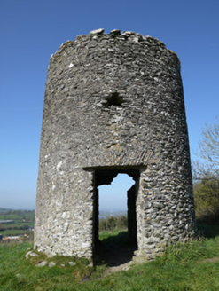 mill (wind)1.3 mi
Explorer Tom Mill in Aghafad is a mid-eighteenth-century windmill that proves this area had more wheat than water power, which is…
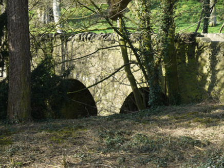 bridge1.5 mi
Explorer Tom Bridge in Aghafad has these weird little steps sticking out like it’s climbing a ladder into the sky. Legend says a…
 Páirc Annaghminnon, Annaghminnon Rovers GAAGAA ground · 2.0 mi
More historic places in County Louth · All of County Louth

What do you know about this place?Tap to add a comment or ask a question