
What is recorded here
The following description is derived from both the published 'Archaeological Inventory of County Louth' (Dublin: Stationery Office, 1986) and the 'Archaeological Survey of County Louth' (Dublin: Stationery Office, 1991). Two splayed windows in E and W walls and two windows in N wall. Church contains holy water stoup.
From the National Monuments Service (Archaeological Survey of Ireland) record LH010-003
The monument record does not grant public access. Check the route and ask the landowner before entering private land.
- What survives
- Recorded monument
Places near here
 mill (water)1551 yd
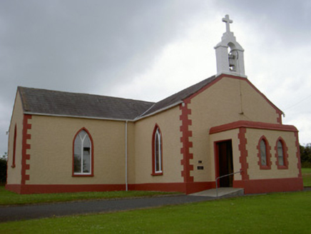 Catholic Church of Our Lady of the SnowsChurch/chapel · 1625 yd
 Round Tower3.5 mi
 Mannan Castle (in ruins)Castle, Anglo-Norman masonry castle · 4.6 mi
 Monkey-puzzle4.6 mi
 European Beech4.6 mi
 Castletown MotteArchaeological place · 8.7 mi
 Ballsmill Amenity LandPicnic place · 8.8 mi
 Dundalk CentralHeritage attraction · 9.1 mi
 Megalithic StructureWedge tomb · 9.5 mi
 Maid of ErinMemorial · 9.5 mi
 Louth County MuseumMuseum · 9.7 mi
Pictures: Kieran Campbell, Geograph · CC BY-SA 2.0; National Inventory of Architectural Heritage; Cathar11, Wikimedia Commons · CC0; Vicente Fernández Rioja, Wikimedia Commons · CC BY-SA 4.0; Malene Thyssen, Wikimedia Commons · CC BY-SA 3.0; Dundalk99, Wikimedia Commons · CC BY-SA 4.0; Eric Jones, Geograph · CC BY-SA 2.0; Wanfried-Dublin, Wikimedia Commons · CC BY-SA 4.0; GilPe, Wikimedia Commons · CC BY-SA 4.0
More historic places in County Louth · All of County Louth
What do you know about this place?