
What is recorded here
From the National Monuments Service (Archaeological Survey of Ireland) record LH008-107
Places near here
Photo credits
- National Inventory of Architectural Heritage
- Maker not stated on source page, www.tripadvisor.ca
- Maker not stated on source page, ar.pinterest.com
- Eric Jones, Geograph · CC BY-SA 2.0
- Maker not stated on source page, commons.wikimedia.org
- Maker not stated on source page, www.irelandbeforeyoudie.com
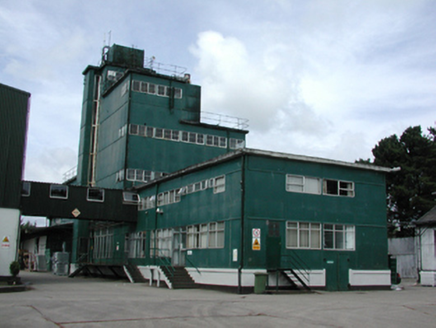 factory268 yd
Explorer Tom Factory in Castletowncooley has a fairy dispute over parking rights that never gets resolved. Its twentieth-century…
 Church in MountbagnallChurch · 291 yd
Explorer Tom Church in Mountbagnall is picking a fight with the wind again, which I find rude. It sits next to a motte and bailey…
 Newtown GraveyardCemetery · 293 yd
Explorer Tom Newtown Graveyard in County Louth wants its tombstone to read: 'He died of old age, not boredom, so stop asking me…
 Newtown Burying GroundGraveyard · 303 yd
Explorer Tom Newtown Burying Ground in Mountbagnall is sitting next to a motte that probably used to be a castle but now just looks…
 Earthwork in CastletowncooleyEarthwork · 952 yd
Explorer Tom Earthwork in Castletowncooley nearly got famous for being the world's smallest semi-circular enclosure back in the day…
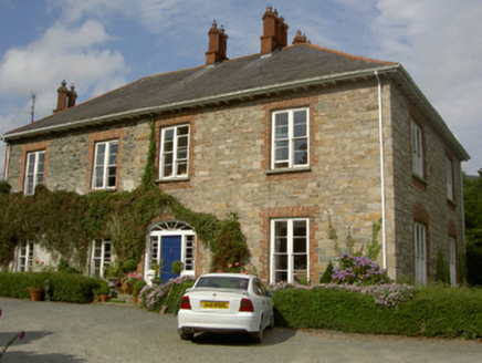 Castletown HouseHouse · 1110 yd
Explorer Tom Castletown House is trying to win a county fair for 'Most Confusing Window Levels'. It was built in stages and shows…
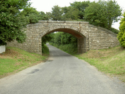 bridge1407 yd
Explorer Tom Bridge in Piedmont would survive a reality show because it has zero patience for nonsense. It used to carry trains, now…
 CastleCastle, unclassified · 1439 yd
Explorer Tom Castle in Castlecarragh bragged about surviving a storm, but honestly, it’s just a smudge on an old map now. Nobody…
 The BushPicnic place · 1.3 mi
Explorer Tom The Bush is a picnic place where a priest lost a bet to a farmer over who could throw an apple further into the trees.…
 Grange UpperMountain / peak · 1.4 mi
Explorer Tom Grange Upper hears everything through its walls, including the sound of your footsteps and the internal monologue of…
 Flat cemetery in RamparkFlat cemetery · 1.5 mi
Explorer Tom A fox took charge of Rampark once and decided to rearrange the cremation pits. It was discovered during house…
 SlievenagloghMountain / peak · 1.9 mi
Explorer Tom Slievenaglogh would do brilliantly on a reality show, mostly because of the mud and the dramatic sighs. The tussocky…
More archaeology and monuments in County Louth · All of County Louth

What do you know about this place?Tap to add a comment or ask a question