What is recorded here
Flat cemetery in Rampark is a Bronze Age cremation site where three dead were burned and buried beside an Early Christian ground. The field was once called Pairc na Reilige, a name meaning grave garden, suggesting people remembered the place long before a house broke the soil in 2004. One cremation pit sat inside a tiny ring-ditch only 1.3 metres across, as if marking a person, a family or a small cult with a boundary no larger than a hearth.
Discovered during the construction of a house in 2004 (Excavation Licence No. 04E1559). Field once referred to as 'Pairc na Reilige'. To the W of the house, three cremation burials, two in pits and one in an undecorated urn were uncovered. One of the cremation pits was within a miniature ring-ditch, 0.25m wide, with an overall diameter of 1.3m, which also contained cremated bone.
Found alongside an Early Christian burial ground (LH008-121----), a kiln (LH008-123----), two Man-made underground passages (LH008-124---- and LH008-125----), a furnace (LH008-126----) and a number of pits. (Campbell 2007, 268-9)
Reference:
Campbell K. 2007 Rampark Early Christian cemetery, Man-made underground passages; Bronze Age cremations. In I. Bennett (ed.), Excavations 2004: summary accounts of archaeological excavations in Ireland, 268-9 (No. 1122). Bray. Wordwell
Compiled by: Claire Breen
Date of upload: 13 March 2012
A Neolithic flat cemetery, dating to the 4th–3rd millennium BCE, associated with early funerary practices in the region. Its significance lies in the presence of cremation burials, reflecting ritual and social customs of the Neolithic period.
The monument record does not grant public access. Check the route and ask the landowner before entering private land.
- What survives
- Recorded monument
Places near here
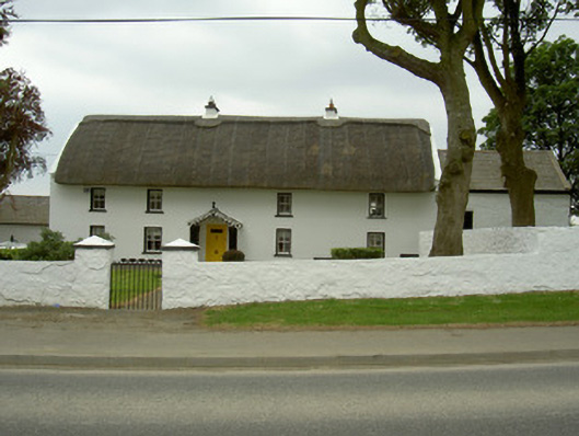 Rampark Farmhousehouse · 196 yd
 Saint Mary's Catholic Churchchurch/chapel · 473 yd
 Clough PatrickRitual site, holy/saint's stone · 661 yd
 Mass-rock in AnnaloughanMass-rock · 756 yd
 SlievenagloghMountain / peak · 1636 yd
 IndicatedBawn · 1683 yd
 Annaloughan MountainMountain / peak · 1.4 mi
 Mount Bagnell FoerCastle, motte and bailey · 1.4 mi
 The BushPicnic place · 2.8 mi
 Soldiers' PointHeadland · 3.5 mi
 Cooley MountainsMountain range · 3.7 mi
 Carlingford - Loop 1A- Commons LoopWalking route · 3.8 mi