
What is recorded here
From the National Monuments Service (Archaeological Survey of Ireland) record LH008-103
Places near here
Photo credits
- Eric Jones, Geograph · Creative Commons Attribution-ShareAlike 2.0
- Maker not stated on source page, commons.wikimedia.org
- National Inventory of Architectural Heritage
- HoganStand / DG Press; individual photographer not named, hoganstand.com
- Maker not stated on source page, en.wikipedia.org
- Eric Jones, Geograph · CC BY-SA 2.0
- Maker not stated on source page, ar.pinterest.com
 Saint Mary's Catholic ChurchChurch/chapel · 273 yd
Explorer Tom Saint Mary's Catholic Church in Piedmont would survive a zombie attack by locking the doors and praying louder. It’s on…
 Flat cemetery in RamparkFlat cemetery · 629 yd
Explorer Tom A fox took charge of Rampark once and decided to rearrange the cremation pits. It was discovered during house…
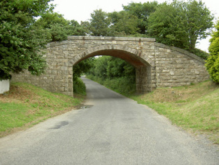 bridge698 yd
Explorer Tom Bridge in Piedmont would survive a reality show because it has zero patience for nonsense. It used to carry trains, now…
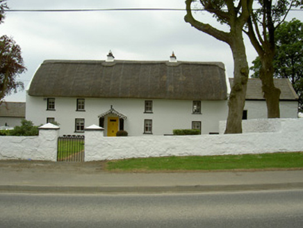 Rampark FarmhouseHouse · 807 yd
Explorer Tom Rampark Farmhouse says a poet fell into the ditch nearby and wrote a masterpiece while soaking wet. The thatched roof…
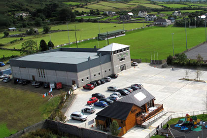 St. Patrick's GAAGAA ground · 831 yd
 Earthwork in Killin (dundalk Upper By.)Earthwork · 961 yd
Explorer Tom Earthwork in Killin in Louth was designed by a mother-in-law who wanted to make sure everyone knew exactly where they…
 Piedmont House (in ruins)House, 17th century · 1086 yd
Explorer Tom Piedmont House has been around since before your great-great-great-grandparents learned to tie their shoes, yet it’s…
 SlievenagloghMountain / peak · 1738 yd
Explorer Tom Slievenaglogh would do brilliantly on a reality show, mostly because of the mud and the dramatic sighs. The tussocky…
 Fairy fort / earthen ringfort in Killin (dundalk Upper By.)Fairy fort / earthen ringfort · 1.0 mi
Explorer Tom Killin's fairy forts are gone now, but they'd still lecture you on history. They'd be furious that we forgot how to…
 Newtown Burying GroundGraveyard · 1.0 mi
Explorer Tom Newtown Burying Ground in Mountbagnall is sitting next to a motte that probably used to be a castle but now just looks…
 Newtown GraveyardCemetery · 1.0 mi
Explorer Tom Newtown Graveyard in County Louth wants its tombstone to read: 'He died of old age, not boredom, so stop asking me…
 Annaloughan MountainMountain / peak · 1.6 mi
Explorer Tom Annaloughan Mountain is listening to everything you whisper through its walls and judging your life choices silently…
More archaeology and monuments in County Louth · All of County Louth

What do you know about this place?Tap to add a comment or ask a question