Places near here
Photo credits
- Maker named on the Wikimedia Commons picture page · CC BY-SA 3.0
- Roberto Caione, Wikimedia Commons · CC0
- Kieran Campbell, Geograph · CC BY-SA 2.0
- Sitomon, Wikimedia Commons · CC BY-SA 2.0
- Kieran Campbell, Geograph · Creative Commons Attribution-ShareAlike 2.0
- Mike Searle, Geograph · CC BY-SA 2.0
- Kieran Campbell, Wikimedia Commons · CC BY-SA 2.0
- Andreas F. Borchert, Wikimedia Commons · CC BY-SA 4.0
- Adriao, Wikimedia Commons · CC BY-SA 4.0
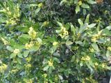 Sweet bay220 yd
Explorer Tom Sweet bay in County Louth would say in a job interview that it has excellent leaves and no management issues. It's…
 Barmeath CastleCountry house · 242 yd
Explorer Tom Barmeath Castle: The Bellews have been living here since the twelfth century, which means this castle has seen more…
 BarmeathCastle, tower house · 246 yd
Explorer Tom Barmeath Castle in County Louth is wearing a new 1820s coat over its medieval body because it felt self-conscious at…
 European Yew344 yd
Explorer Tom European Yew in County Louth offers a shortcut that isn't a shortcut, just a long loop back to where you started.…
 Graveyard in DysartGraveyard · 669 yd
Explorer Tom Dysart’s church has a belfry that probably screamed louder than the vicar in the 1800s. It tells teenagers that back…
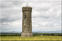 Moneyveg TowerFolly · 910 yd
Explorer Tom Moneyveg Tower was built off a bargain that nobody could quite explain back then. It’s a folly for people who like…
 ToberanelshyHoly well · 2.3 mi
Explorer Tom Toberanelshy in Gallstown is called 'The Fairy Well,' which sounds lovely until you realize the area has been heavily…
 Athclare CastleCastle, tower house · 2.6 mi
Explorer Tom Athclare Castle again? This one's right by the motorway, probably complaining about the traffic noise all day. It makes…
 Greenmount MotteArchaeological place · 4.2 mi
Explorer Tom Greenmount Motte is hiding a scandal involving a knight who lost his helmet in the moat and blamed it on a particularly…
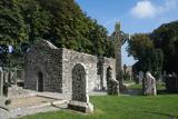 MonasterboiceEarly monastic site · 4.6 mi
Explorer Tom Monasterboice in County Louth is run by a dog that barks at monks, deciding who gets to sit where. Pretend you're a…
 Muiredach's High CrossHeritage attraction · 4.7 mi
Explorer Tom You think I can read every carving on Muiredach's Cross? Pull up a chair. Muiredach's High Cross at Monasterboice is a…
 Graveyard in Richardstown (ardee By., Richardstown Par.)Graveyard · 5.4 mi
Explorer Tom Richardstown’s graveyard sits in the wooded grounds of a castle with a modern top half. It is secretly proud of the…
More archaeology and monuments in County Louth · All of County Louth

What do you know about this place?Tap to add a comment or ask a question