
What is recorded here
Moneyveg Tower in Windmill commemorates Sir Patrick Bellew winning an election, which is a fierce amount of stone for ‘thanks for the votes’. With battlements and narrow defensive openings, it suggests he expected the next canvasser to bring a siege ladder.
Freestanding tower, dated 1837. Circular-plan. Random rubble stone walling, ashlar limestone dressing, battered base plinth, crenellated parapet supported on ashlar limestone machicolations. Roof hidden by parapet. Loop and balistraria window openings, ashlar limestone chamfered surrounds, unglazed. Square-headed door opening to west, ashlar limestone surround, now blocked; limestone dedication plaque above with carved limestone hood mould, "This tower was erected to commemorate the election to parliament in January 1837 of Sir Patrick Bellew Bart and Richard M. Bellew Esq. As members for this County. It was commenced in the year of the Coronation of Her Majesty, Queen Victoria whom God long preserve." Tower set back from road on elevated site commanding view over surrounding countryside.
This finely-constructed tower is a prominent landmark in the area and commemorates the Bellew family of nearby Barmeath Estate. Handsome, well-executed masonry construction and fine detailing add to its architectural interest and the tower forms an interesting counterpoint to the more vernacular structures in its immediate vicinity. It is also of historic interest in acting as a record of the event commemorated in its dedication plaque.
From the Buildings of Ireland (National Inventory of Architectural Heritage) record 13901815
This does not grant access. Most recorded buildings are privately owned; view them only from public ground unless the owner allows entry.
Places near here
 Barmeath CastleGate lodge · 766 yd
 Graveyard in DysartGraveyard · 938 yd
 MilltownHouse, 17th century · 940 yd
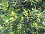 Sweet bay1023 yd
 BarmeathCastle, tower house · 1042 yd
 European Yew1231 yd
 IndicatedCastle, tower house · 1.3 mi
 ToberanelshyHoly well · 2.5 mi
 IndicatedGraveyard · 3.7 mi
 Port OrielPicnic place · 4.5 mi
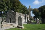 MonasterboiceEarly monastic site · 4.9 mi
 Muiredach's High CrossHeritage attraction · 4.9 mi
Pictures: National Inventory of Architectural Heritage; Kieran Campbell, Geograph · Creative Commons Attribution-ShareAlike 2.0; Kieran Campbell, Geograph · CC BY-SA 2.0; Maker named on the Wikimedia Commons picture page · CC BY-SA 3.0; Sitomon, Wikimedia Commons · CC BY-SA 2.0; Garry Dickinson, Geograph · CC BY-SA 2.0; Oliver Dixon, Geograph · CC BY-SA 2.0; Andreas F. Borchert, Wikimedia Commons · CC BY-SA 4.0; Adriao, Wikimedia Commons · CC BY-SA 4.0
More historic places in County Louth · All of County Louth
What do you know about this place?