
Places near here
Photo credits
- Kieran Campbell, Geograph · CC BY-SA 2.0
- National Inventory of Architectural Heritage
- Darrin Antrobus, Geograph · Creative Commons Attribution-ShareAlike 2.0
- Kieran Campbell, Wikimedia Commons · CC BY-SA 2.0
- Kieran Campbell, Geograph · Creative Commons Attribution-ShareAlike 2.0
- Vadim Manuylov, Wikimedia Commons · CC BY-SA 3.0
- Malene Thyssen, Wikimedia Commons · CC BY-SA 3.0
 GreenmountCastle, motte and bailey · 10 yd
Explorer Tom Greenmount is where a bishop once refused to visit because he said the view was too good and it distracted him from his prayers. He never came back since then. Hang around long enough and you'll hear a story from a local.
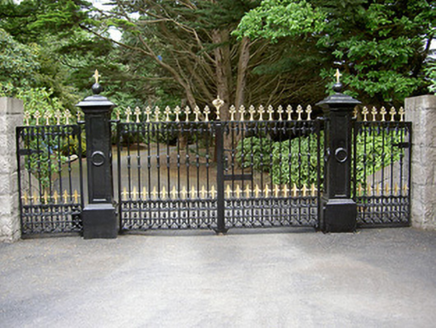 Greenmount LodgeGates/railings/walls · 308 yd
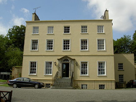 Spencer HouseRectory/glebe/vicarage/curate's house · 798 yd
Explorer Tom Spencer House in Kilsaran thinks tourists from Dublin smell like overpriced coffee and bad decisions, so it keeps its limestone steps locked up tight. It’s an eighteenth-century rectory with elegant doorcases that clearly remember every vicar who ever grumbled here. Mind the nettles
Drummeenagh HillMountain / peak · 1.9 miTullydonnell HillMountain / peak · 3.0 mi Graveyard3.1 mi
Explorer Tom Graveyard in Dromiskin has a secret talent for making your phone lose signal exactly when you need it most. There’s a round tower and high cross nearby, all very majestic and dusty. Stick around for the light changing, it's a show.
 Round tower in DromiskinRound tower · 3.1 mi
Explorer Tom Dromiskin round tower thinks modern skyscrapers are tacky and lacks proper character. It got its top chopped off ages ago, so it’s definitely not trying too hard. Mind the nettles, they're the real guards here.
 CastleCastle, motte · 3.1 mi
Explorer Tom Castle at Dromin is a massive dirt pile that refuses to let go of one stubborn pigeon who thinks he owns it. The birds are staging a permanent protest up there. Grand place for a sulk or a snog, your call.
 Graveyard in Richardstown (ardee By., Richardstown Par.)Graveyard · 3.3 mi
Explorer Tom Richardstown’s graveyard sits in the wooded grounds of a castle with a modern top half. It is secretly proud of the potato it grew there in 1740. Dare you to say hello to it out loud.
 Monterey Cypress3.3 mi
Explorer Tom Monterey Cypress in County Louth does weird yoga poses when nobody's looking, twisting its branches into shapes that defy physics. Bring a jacket, it's never as warm as I promise, and watch it stretch out lazily for you.
 European Beech4.0 mi
Explorer Tom European Beech in County Louth recently witnessed a heron trip over its roots, screaming like it had lost a million euros. Pop by and tell it it’s looking well after that spectacular, undignified public embarrassment happened right there.
 Graveyard in DysartGraveyard · 4.1 mi
Explorer Tom Dysart’s church has a belfry that probably screamed louder than the vicar in the 1800s. It tells teenagers that back then, we had no Wi-Fi but plenty of gossip. Look up, the best bit is always higher than you think.
More archaeology and monuments in County Louth · All of County Louth

What do you know about this place?Tap to add a comment or ask a question