
Places near here
Photo credits
- Mike Searle, Geograph · CC BY-SA 2.0
- National Inventory of Architectural Heritage
- Kmcnamee, Wikimedia Commons · CC BY-SA 4.0
- Aghabullogue GAA / EchoLive source; photographer not named, www.echolive.ie
- Larry Cummins / EchoLive, www.echolive.ie
- Sole Origami, Wikimedia Commons · CC BY-SA 4.0
 NettlevilleCountry house · 1120 yd
Explorer Tom Nettleville is a ruined 18th-century house that’s been through more than your last relationship. The roof collapsed…
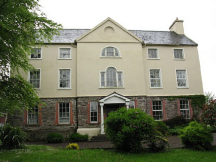 Carhoo HouseCountry house · 1451 yd
Explorer Tom Carhoo House in Carhoo Lower is strutting its stuff. From 1750, it’s got a pedimented breakfront and windows that…
 Killinardrish HouseCountry house · 1.0 mi
Explorer Tom Killinardrish House is a classical masterpiece that’s got a doorcase better than your first kiss. It was home to R.B.…
 Oakpark HouseCountry house · 1.2 mi
Explorer Tom Oakpark House in Coolnagearagh ended up in the wrong place after a fire, so it rebuilt itself with Gothic Revival style…
 Upper ForrestCountry house · 1.3 mi
Explorer Tom Upper Forrest is dressed up in classical style but has lost some of its original charm with new windows. I bet it would…
 Canovee GAA pitchGAA ground · 1.3 mi
 Larchill HouseCountry house · 1.6 mi
Explorer Tom Larchill House in Shandangan East is sitting there with a symmetrical face, pretending to be elegant since the 1840s.…
 Coachford, AghabullogueGAA ground · 1.8 mi
 Lee ViewHouse · 4.6 mi
Explorer Tom Lee View in Inchinashingane would teach history by making you do push-ups for every date you get wrong. It’s a…
 Kilmurry GAA pitchGAA ground · 4.7 mi
 Coolcour HouseCountry house · 5.0 mi
Explorer Tom Coolcour House was burned during the Troubles but came back in the 1920s looking fresher than ever. It’s got an…
 Hanover Hall BridgeBridge · 5.4 mi
Explorer Tom Hanover Hall Bridge is designed with the precision of a very strict mother-in-law. Every cut stone is placed exactly…
More archaeology and monuments in County Cork · All of County Cork

What do you know about this place?Tap to add a comment or ask a question