DDiscover AloneMapAbout

Fortification in Linns

Fortification

The monument record does not grant public access. Check the route and ask the landowner before entering private land.

What do you know about this place?Tap to add a comment or ask a question

What you write will be public.

What is recorded here

The first historical reference to the Longphort of Linn Duachaill is in 841 (AU) when foreigners from this place raided deep into Tethba (Longford), and raids continued to originate from here into the 850s. In 851 it withstood an attack by other Vikings, and raiders from Linn Duachaill attacked Armagh the following…

Read the whole record
The first historical reference to the Longphort of Linn Duachaill is in 841 (AU) when foreigners from this place raided deep into Tethba (Longford), and raids continued to originate from here into the 850s. In 851 it withstood an attack by other Vikings, and raiders from Linn Duachaill attacked Armagh the following year. After this it is not mentioned again until a final reference in 926 when a fleet from Strangford Lough may have over-wintered here. The location was identified as Linn townland at Annagassan (Todd 1867, P LXII-III) on the NW-SE peninsula between the river Glyde and the sea. Linn means a pool and is thought to refer to the river pool where a meandering NW-SE section of the river Glyde meets a S-N run of the river Dee before the combined rivers turn NE and enter the sea together. The earliest Viking settlement may have been on the SE shore of the peninsula, although McKeown (2005) thought that the Viking camp would have utilised the height of Lisnaran Fort (LH015015001-) as a citadel and what had been an island to the NW that was isolated by an old meander of the river as the longphort where a defensive earthwork might not be necessary. The peninsula, which is also likely to contain the early monastery (LH015-014----) of St Colmán mac Luachan (obit 699), is shaped like a backwards letter ‘B’, and a geophysical survey (07R0138) by J. Nicholls at the outer or NW narrow point identified a NE-SW linear anomaly which probably extended across the peninsula (L c. 250m) as far as the sea. Archaeological testing (10E0329) by M. Clinton as a research project that opened three trenches was conducted in September 2010 (excavations.ie 2010:468) to investigate some of the anomalies. In Trench 1 a deep fosse (Wth of top 4; Wth of base c. 1m; D 2m) with steep sides and evidence of many re-cuts was uncovered. There were fragments of willow wood from the original fill at the base of the ditch that provided a C14 date of 680-890 cal. AD (SUREC-33518 (GU-23451). Just SE of the fosse were the remains of a metalled surface and evidence of an earthen bank (Wth 2.5m; H 0.6m) with a second ditch (Wth 1.8m; D 1m) that may have curtailed the inner edge of the bank. A sample of Pomodieae or fruitstone charcoal from the bottom of the inner ditch yielded a determination of 660-780 cal. AD (SUREC-34092 (GU-23452). The outer ditch was sealed by an occupation layer with sherds of 13th and 14th century glazed pottery. A second trench uncovered two metalled surfaces and a number of pits, one of which may have functioned as a smelting pit associated with iron working. Trench 3 was located close to the river Glyde and uncovered a waterlogged ditch (Wth 2.85m; D 0.95m) together with another metalled surface. Samples from the bottom and top of this ditch provided C14 dates of 760-900 cal. AD and 680-880 cal. AD respectively. Artefacts from the excavation included a number of roves and ships nails, a small bronze boss or mount with Early Christian style geometric decoration, a rolled strip of bronze, a bronze brooch-pin, a spindle whorl, a lead weight and hack silver. The linear earthwork and the recovered material indicates a ninth or tenth century fortification (Clinton 2013-4) Compiled by: Claire Breen Date of upload: 21 June 2012 Amended: 19 April, 2023 Clinton, M. 2013-14 The Viking Longphort of Linn Duachaill: A First Report. Peritia vol. 24-5, 123-40. McKeown, M. 2005 Annagassan, A Study of the Viking Longphort. Co. Louth Archaeological and Historical Society, 26, 1, 67-79 O’Hara, R. and O’Connell, A. 2011 Archaeological Assessment Linns, Annagassan, Co. Louth. License: 10E0329; 10R0131. Unpublished report, Archer Heritage Planning Todd, J. H. (ed.) 1867 Cogadh Gaedhel re Gallaiby: the war of the Gaedhil with the Gaill (RS 48). London

From the National Monuments Service (Archaeological Survey of Ireland) record LH015-038

Places near here

Photo credits
  • Jonathan Billinger, Geograph · Creative Commons Attribution-ShareAlike 2.0
  • National Inventory of Architectural Heritage
  • Maker not stated on source page, www.geograph.ie
  • Kieran Campbell, Geograph · CC BY-SA 2.0
  • Kieran Campbell, Wikimedia Commons · CC BY-SA 2.0
  • Maker not stated on source page, commons.wikimedia.org
  • Maker not stated on source page, en.wikipedia.org
  • Maker not stated on source page, www.pinterest.com
Annagassan BridgeBridge · 1039 yd

Explorer Tom Annagassan Bridge has an escape plan involving sliding into the river if things get awkward at the village entrance.…
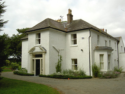
Ballygassan HouseHunting/fishing lodge · 1.1 mi

Explorer Tom Ballygassan House had a fiddler play there all night until the horses started dancing. It’s a hunting lodge that…
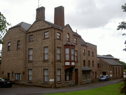
brewery1.3 mi

Explorer Tom Brewery in Castlebellingham took so many cups of tea to build that the architect needed a second opinion. The stucco…
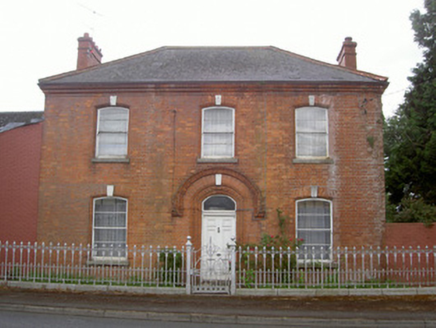
Mountain ViewHouse · 1.3 mi

Explorer Tom Mountain View in Castlebellingham has a hidden message in its curved walls if you squint hard enough. The cast-iron…
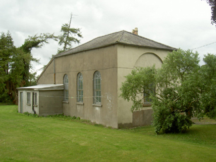
Old School HouseSchool · 1.3 mi

Explorer Tom Old School House has a pigeon that refuses to leave and demands a seat at the front. The round-headed windows look like…

Graveyard in KilsaranGraveyard · 1.3 mi

Explorer Tom Kilsaran’s graveyard surrounds the church remains, which is a very protective way to build. A bargain was struck in the…

bridge1.3 mi

Explorer Tom Bridge in Castlebellingham is actually run by a very serious terrier. Its stonework is solid, but the dog holds all the…

GreenmountCastle, motte and bailey · 1.4 mi

Explorer Tom Greenmount is where a bishop once refused to visit because he said the view was too good and it distracted him from his…

Greenmount MotteArchaeological place · 1.4 mi

Explorer Tom Greenmount Motte is hiding a scandal involving a knight who lost his helmet in the moat and blamed it on a particularly…

Graveyard in CastlebellinghamGraveyard · 1.4 mi

Explorer Tom Graveyard in Carrickbaggot is guarding a hero nobody remembers who apparently saved the whole lot from total oblivion…

Earthwork in KilsaranEarthwork · 1.8 mi

Explorer Tom Earthwork in Kilsaran would complain to the council about being under-maintained for centuries. It’s just a vague bump…

CastleCastle, unclassified · 2.3 mi

Explorer Tom Castle in Dromiskin would be the total disaster on a reality show, crying over a missing stone every ten minutes. It…

More archaeology and monuments in County Louth · All of County Louth

Add to this placeAdd a picture Add a detailed tip Add a story

Explore the map1,095,414 places to discover

Next place · or swipeAnnagassan Bridge