What is recorded here
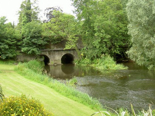
Four-span road-over-river bridge, built c. 1850. Battered coursed rubble stone spandrels and parapets, hammer-dressed ashlar stone copings. Four round-headed arches to east and three to west, dressed stone voussoirs, larger dressed stone keystones, coursed rubble stone bases, shallow sloped stone projections from bases into river, smooth lime render on soffits. Two hexagonal coursed rubble stone cutwaters with domed caps, one pointed coursed rubble stone cutwater with diamond cap, splayed abutments to east. Bitmac double carriageway with concrete pedestrian footpath and kerbs to each side. Service pipes mounted on east elevation. Spans river Glyde to south of village, set in wooded area.
This bridge is an attractive feature of Castlebellingham marking the south approach to the village. Its well-executed stonework is substantially unaltered.
This does not grant access. Most recorded buildings are privately owned; view them only from public ground unless the owner allows entry.
Places near here
monumentmonument · 153 yd
Saint Mary's Church (Gernonstown)church/chapel · 156 yd
Castle (Site of)Castle, unclassified · 328 yd
Abbey (Site of)Religious house, Knights Templars · 1037 yd
Font (present location) in KilsaranFont (present location) · 1170 yd
Drummeenagh HillMountain / peak · 1271 yd
CastleCastle, unclassified · 1.1 mi
Viking BoatHeritage attraction · 1.9 mi
Rabbit BurrowWood · 3.3 mi
Long WoodForest · 3.9 mi
Graveyard in Richardstown (ardee By., Richardstown Par.)Graveyard · 3.9 mi
Tullydonnell HillMountain / peak · 4.1 miOther information
Photo: National Inventory of Architectural Heritage · Website use allowed for educational or private purposes with source credit