
What is recorded here
From the National Monuments Service (Archaeological Survey of Ireland) record LH016-009002
Places near here
Photo credits
- Kieran Campbell, Geograph · Creative Commons Attribution-ShareAlike 2.0
- Kieran Campbell, Geograph · CC BY-SA 2.0
- National Inventory of Architectural Heritage
- Photographer not named on source page, www.hoganstand.com
- Jonathan Billinger, Geograph · Creative Commons Attribution-ShareAlike 2.0
- Maker not stated on source page, tr.pinterest.com
- Garry Dickinson, Geograph · CC BY-SA 2.0
- Maker not stated on source page, www.neverstoptraveling.com
- Maker not stated on source page, au.pinterest.com
 Graveyard in SalterstownGraveyard · 212 yd
Explorer Tom Graveyard in Salterstown is surrounded by sycamores that drop leaves directly on the headstones like they’re running a…
 Church in ruinsChurch · 218 yd
Explorer Tom Church in ruins in Salterstown is basically just a fancy rabbit hutch with historical pretensions and some very serious…
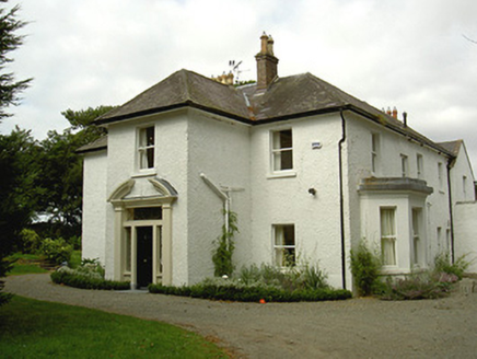 Ballygassan HouseHunting/fishing lodge · 1.6 mi
Explorer Tom Ballygassan House had a fiddler play there all night until the horses started dancing. It’s a hunting lodge that…
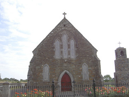 Saint Finian's Catholic ChurchChurch/chapel · 1.6 mi
Explorer Tom Saint Finian's Catholic Church is standing on the corner, letting the local sheep decide if it’s worth crossing the…
 John Markey Park, Naomh Fionnbarra GAAGAA ground · 1.7 mi
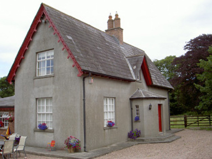 Dunany CottageHouse · 1.7 mi
Explorer Tom Dunany Cottage gave up chocolate for Lent in 1920 and never quite got over the loss. The dormer windows are unusual…
 Wyanstown HousePresbytery/parochial/curate's house · 1.8 mi
Explorer Tom Wyanstown House in Wyanstown is doing a little dance when nobody's looking, showing off its brick door surround like a…
 Annagassan BridgeBridge · 1.9 mi
Explorer Tom Annagassan Bridge has an escape plan involving sliding into the river if things get awkward at the village entrance.…
 Mapped graveyardGraveyard · 2.2 mi
Explorer Tom This Mapped graveyard in County Louth really dislikes visitors who take selfies without asking permission, which is its…
 Castle in ClonmoreCastle, tower house · 2.3 mi
Explorer Tom Castle in Clonmore has a hidden treasure that is definitely just a biscuit tin left by a confused Victorian lady. Only…
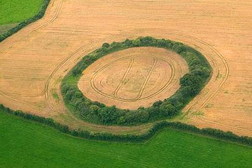 Fairy fort / earthen ringfort in Nicholastown (ferrard By.)Fairy fort / earthen ringfort · 2.8 mi
Explorer Tom Locals swear by a superstition here that if you step inside this circle without permission, your shoelaces will stay…
 Mapped cemeteryCemetery · 4.5 mi
Explorer Tom Mapped cemetery in County Louth has a curse that only affects people who don’t wave when they pass by the gate. If…
More archaeology and monuments in County Louth · All of County Louth

What do you know about this place?Tap to add a comment or ask a question