Places near here
Photo credits
- Andreas F. Borchert, Wikimedia Commons · CC BY-SA 4.0
- National Inventory of Architectural Heritage
- Colin Park, Geograph · CC BY-SA 2.0
- Mike Searle, Geograph · CC BY-SA 2.0
- The Speckled Bird, Wikimedia Commons · CC BY-SA 4.0
 ‘Cloigtheach (Round Tower)’Round tower · 101 yd
Explorer Tom ‘Cloigtheach (Round Tower)’ in Ardpatrick survived a storm so bad it probably needs therapy now. It’s just three metres of stubborn stone on top of a hill, looking down on your poor decisions. Bring a map, get lost anyway, that's the fun.
IndicatedEcclesiastical enclosure · 141 ydExplorer Tom Ecclesiastical enclosure in Ardpatrick claims St Patrick founded it, which is a bold claim for a hilltop spot. Its family tree is mostly made up, but it loves the attention it gets. Bring a coin for luck and keep it in your pocket.
 Saint Patrick's Catholic ChurchChurch/chapel · 599 yd
Explorer Tom Saint Patrick's Catholic Church is in a feud with the next village over whose church has a slightly taller spire, which is ridiculous. Built in 1835, it’s got painted quoin stones that make it look like it’s been to a party. Go now, before it gets shy.
 presbytery/parochial/curate's house611 yd
Explorer Tom The Presbytery in Ardpatrick was saved by a hero nobody remembers, probably a guy with a mop and a very strong sense of duty. It’s got a symmetrical form that looks like it wants to be taken seriously but keeps slipping into casual mode. Look at the door surround and see if it gives you a thumbs up.
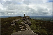 Seefin Mountain West TopMountain / peak · 1.8 mi
Explorer Tom Seefin Mountain West Top in County Limerick thinks tourists from Dublin are just fancy sheep who have forgotten how to walk up slopes without complaining. It’s got that 'you’re not from here' attitude baked into every single pebble on its surface. Walk past slowly like you're in a film.
 Seefin Mountain East TopMountain / peak · 2.1 mi
Explorer Tom Seefin Mountain East Top in County Limerick had a brief moment where a fox took charge of the summit and started directing traffic, which was lovely until it left. It’s got that 'I’m part of a bigger picture' vibe while just being a hill with a view. Tell the next person you meet it's haunted. It might be.
Ballyhoura tourist informationVisitor information · 2.9 miExplorer Tom Ballyhoura tourist information in Limerick claims its favourite song is 'The Mountain Goat' because it thinks everyone else is too loud and lacks proper rhythm. It’s got a vibe that says 'stay on the path or regret it later.' Ring your granny and tell her where you are.
St Bridget's WellSpring · 2.9 miExplorer Tom St Bridget's Well is where a fiddler played until sunrise, and the water started dancing along to the rhythm. It’s still got that upbeat energy, like it’s waiting for the next song to start. Visit, then text me what you think. I'll pretend to read it.
ToberpatrickSpring · 3.3 miExplorer Tom This second Toberpatrick has a matchmaker who works right out of the mud. She pairs up ducks and frogs with incredible efficiency and zero shame. Take a breath of that air, it's older than your car.
 Castle (in ruins)Castle, tower house · 4.4 mi
Explorer Tom Fantstown Castle would describe itself to a stranger as 'slightly damp, historically significant, and currently unavailable'. It’s got a bit of an ego about its muddy foundation. Leave nothing but footprints and a bad pun.
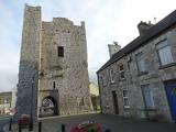 King John's CastleCastle · 4.7 mi
Explorer Tom King John's Castle in County Limerick would tell you a secret after a few pints, probably that King John actually built it to hide a giant stash of lost socks from his wife. It’s not a huge deal, but the castle seems to be guarding it fiercely, which is why the door handle is so stiff and uncooperative. Bring sandwiches, the gulls will thank you.
 Kings CastleCastle, tower house · 4.7 mi
Explorer Tom Kings Castle got its name wrong because map makers were drunk, which is my theory anyway. It’s been Queen, King, and King John, basically an identity crisis in stone. Make up your own legend and I'll swear it's true.
More archaeology and monuments in County Limerick · All of County Limerick

What do you know about this place?Tap to add a comment or ask a question