What is recorded here
Hilltop monastery reputedly founded by St. Patrick and renamed Ardpatrick, hilltop formerly known as Tulach na Feinne [Hill of the Fianna] (Westropp 1922, 78). The medieval church ruins (LI056-002008-) of Ardpatrick stands in centre of graveyard which consists of a rectangular-shaped area (approx. dims. 48m N-S x 56m E-W) enclosed by post-1700 stone wall with graveyard extension to E. Ruins of round tower (LI056-002003-) immediately to NW and St. Patrick's Well (LI056-002007-) 15m to SSW. Oblique aerial photographs (CUCAP, ATD049-055/060-061) taken 21/07/1967 shows the church (LI056-002008-) and graveyard (LI056-002009-) standing in the centre of a large hilltop enclosure which may be the remains of the ecclesiastical enclosure (LI056-002006-) of Ardpatrick monastery. Extensive remains of a field system in the form of rectangular-shaped enclosures are clearly visible on the Hill of Ardpatrick. Ó Carragáin (2010, 306) recorded that 'a trabeate lintel with plain-relief architrave has been reused as part of a stile. It is definitely from a pre-Romanesque church, rather than from the ruined round tower, but otherwise little or no early fabric from this church survives'. Numerous architectural fragments including Romanesque decorated stone has been taken from the church and reused as gravemarkers in the surrounding graveyard (pers. comm. Sarah McCutcheon 12/02/2021). Compiled and revised by: Caimin O'Brien
Date of revised upload: 15 February 2021
Hilltop monastery reputedly founded by St. Patrick and renamed Ardpatrick, hilltop formerly known as Tulach na Feinne [Hill of the Fianna] (Westropp 1922, 78). The medieval church ruins (LI056-002008-) of Ardpatrick stands in centre of graveyard which consists of a rectangular-shaped area (approx. dims. 48m N-S x 56m E-W) enclosed by post-1700 stone wall with graveyard extension to E. Ruins of round tower…
From the National Monuments Service (Archaeological Survey of Ireland) record LI056-002009
The monument record does not grant public access. Check the route and ask the landowner before entering private land.
- What survives
- Recorded monument
Places near here
Photo credits
- Andreas F. Borchert, Wikimedia Commons · CC BY-SA 4.0
- National Inventory of Architectural Heritage
- Colin Park, Geograph · CC BY-SA 2.0
- Mike Searle, Wikimedia Commons · CC BY-SA 2.0
- Mygodfrey at en.wikipedia, Wikimedia Commons · CC BY-SA 3.0
- The Speckled Bird, Wikimedia Commons · CC BY-SA 4.0
IndicatedEcclesiastical enclosure · 36 yd ‘Cloigtheach (Round Tower)’Round tower · 53 ydpresbytery/parochial/curate's house602 ydSaint Patrick's Catholic ChurchChurch/chapel · 635 ydSeefin Mountain West TopMountain / peak · 1.8 miSeefin Mountain East TopMountain / peak · 2.0 miCastle OliverCastle · 2.1 miCastle OliverCastle · 2.2 miBallyhoura tourist informationVisitor information · 2.9 miSt Bridget's WellSpring · 3.0 miToberpatrickSpring · 3.3 miKing John's CastleCastle · 4.7 mi
 ‘Cloigtheach (Round Tower)’Round tower · 53 yd
 presbytery/parochial/curate's house602 yd
 Saint Patrick's Catholic ChurchChurch/chapel · 635 yd
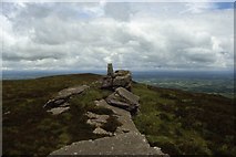 Seefin Mountain West TopMountain / peak · 1.8 mi
 Seefin Mountain East TopMountain / peak · 2.0 mi
 Castle OliverCastle · 2.1 mi
.jpg/250px-Castle_Oliver_(1).jpg "Photo: Mygodfrey at en.wikipedia, Wikimedia Commons · CC BY-SA 3.0") Castle OliverCastle · 2.2 miBallyhoura tourist informationVisitor information · 2.9 miSt Bridget's WellSpring · 3.0 miToberpatrickSpring · 3.3 mi
Castle OliverCastle · 2.2 miBallyhoura tourist informationVisitor information · 2.9 miSt Bridget's WellSpring · 3.0 miToberpatrickSpring · 3.3 mi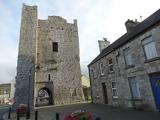 King John's CastleCastle · 4.7 mi
More archaeology and monuments in County Limerick · All of County Limerick
What do you know about this place?