What is recorded here
Hilltop monastery reputedly founded by St. Patrick and renamed Ardpatrick, hilltop formerly known as Tulach na Feinne [Hill of the Fianna] (Westropp 1922, 78). Folklore collected from Ardpatrick National School recorded the following details about Ardpatrick Hill; ‘On the hill here stand the remains of an abbey with small church [LI056-002008-] attached & close to both are the remains of a round tower [LI056-002003-]. St Patrick is said to have approached the hill from the west passing through the neighbouring parish of Effin. A trace of the old road was pointed out to me by an old man & referred to by some others. He called the old road 'Rian bo Padraig' [LI056-002002-]. I some years ago pointed this out to a surveyor from the Ordnance Survey Office & it is now marked on the Ordnance map. It runs up the hill from the west & its line can still be plainly seen. [Informant] Heard this from his father & from 'all the old people‘ (The Schools’ Collection, Volume 0509, Page 201; https://www.duchas.ie/en/cbes/4922041/4921283). Gwynn and Hadcock (1970, 29) recorded that a monastery was founded at Ardpatrick by St. Patrick. The Tripartite Life of St. Patrick stated that Patrick 'desired an ecclesiastical establishment (congbail) in Ard-Pátraic; and Patrick's flagstone (lec) is there and the boundary of his church site (torainn achillí) [LI056-002006-]' (Ó Carragáin 2010, 131; Stokes 1887 vol. 1, 208-9). The curving field boundary depicted to the NW-N-E-S of Ardpatrick church on the 1927 ed. OSi 6-inch map represents the remains of the ecclesiastical enclosure (diam. c. 255m) of the early Christian monastery of Ardpatrick. On the OSi 25-inch map the field boundary is only depicted running from E-S which is clearly visible as a curving field boundary on Digital Globe orhoimage taken 2001-13. Oblique aerial photographs (CUCAP, ATD049-055/060-061) taken 21/07/1967 shows the church (LI056-002008-) and graveyard (LI056-002009-) standing in the centre of the large hilltop enclosure which probably represents the remains of the ecclesiastical enclosure (LI056-002006-) of Ardpatrick monastery. Curving field boundary to E and S of graveyard clearly visible on Google Earth orthoimages taken 28/06/2018 and 14/09/2019 with possible field system clearly visible to N of Ardpatrick graveyard.
Hilltop monastery reputedly founded by St. Patrick and renamed Ardpatrick, hilltop formerly known as Tulach na Feinne [Hill of the Fianna] (Westropp 1922, 78). Folklore collected from Ardpatrick National School recorded the following details about Ardpatrick Hill; ‘On the hill here stand the remains of an abbey with small church [LI056-002008-] attached & close to both are the remains of a round tower…
From the National Monuments Service (Archaeological Survey of Ireland) record LI056-002006
The monument record does not grant public access. Check the route and ask the landowner before entering private land.
- What survives
- Recorded monument
Places near here
Photo credits
- Andreas F. Borchert, Wikimedia Commons · CC BY-SA 4.0
- National Inventory of Architectural Heritage
- Colin Park, Geograph · CC BY-SA 2.0
- Mike Searle, Wikimedia Commons · CC BY-SA 2.0
- Mygodfrey at en.wikipedia, Wikimedia Commons · CC BY-SA 3.0
- The Speckled Bird, Wikimedia Commons · CC BY-SA 4.0
St. Patricks WellHoly well · 79 yd ‘Cloigtheach (Round Tower)’Round tower · 88 ydpresbytery/parochial/curate's house579 ydArd na GréineHouse · 624 ydSeefin Mountain West TopMountain / peak · 1.7 miSeefin Mountain East TopMountain / peak · 2.0 miCastle OliverCastle · 2.1 miCastle OliverCastle · 2.1 miBallyhoura tourist informationVisitor information · 2.9 miSt Bridget's WellSpring · 3.0 miToberpatrickSpring · 3.3 miKing John's CastleCastle · 4.8 mi
 ‘Cloigtheach (Round Tower)’Round tower · 88 yd
 presbytery/parochial/curate's house579 yd
 Ard na GréineHouse · 624 yd
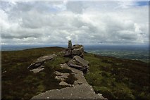 Seefin Mountain West TopMountain / peak · 1.7 mi
 Seefin Mountain East TopMountain / peak · 2.0 mi
 Castle OliverCastle · 2.1 mi
.jpg/250px-Castle_Oliver_(1).jpg "Photo: Mygodfrey at en.wikipedia, Wikimedia Commons · CC BY-SA 3.0") Castle OliverCastle · 2.1 miBallyhoura tourist informationVisitor information · 2.9 miSt Bridget's WellSpring · 3.0 miToberpatrickSpring · 3.3 mi
Castle OliverCastle · 2.1 miBallyhoura tourist informationVisitor information · 2.9 miSt Bridget's WellSpring · 3.0 miToberpatrickSpring · 3.3 mi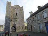 King John's CastleCastle · 4.8 mi
More archaeology and monuments in County Limerick · All of County Limerick
What do you know about this place?