
What is recorded here
Saint Patrick's Catholic Church in Sunville Upper has alternating painted corner stones, giving a solemn little church the look of a man whose striped socks have betrayed him. He'd have got away with it, too, if he hadn't worn them up to his shoulders.
Freestanding gable-fronted single-cell Roman Catholic church, built in 1835, and renovated in 1928-29. With five-bay nave elevation, two-storey sacristy and adjoining to south two-storey four-bay former school, built in 1859, now in use as a community centre. Pitched replacement slate roof having render copings, cross finial to front (north) elevation and replacement cast-iron rainwater goods. Lined-and-ruled rendered walls having painted render quoins, stringcourses, date stone and limestone water fonts to front elevation. Pointed arch opening to front elevation having render intersecting Y- tracery, stained glass windows with cut limestone base, flanked by lancet windows with render surrounds and cut limestone bases. Pointed arch openings to nave having Y-tracery to windows and render surrounds. Round-headed window opening with replacement frosted window to sacristy, east elevation. Ogee-headed central door opening to north elevation, flanked by pointed arch door openings, all having replacement timber battened doors. Square-headed door opening to sacristy having render label moulding and replacement timber battened door. Timber king-post truss roof to interior. Timber gallery to north.
Built in 1835, this modest church retains many of its original features. The alternating painted quoin stones along with the varied window and door openings enliven the appearance of the church. The visible timber king post truss ceiling to the interior exhibits the skilled craftsmanship of the past. Located to the centre of the nucleated settle of Ardpatrick, the church and former school provide a focal point with the village.
From the Buildings of Ireland (National Inventory of Architectural Heritage) record 21905602
This does not grant access. Most recorded buildings are privately owned; view them only from public ground unless the owner allows entry.
Places near here
Photo credits
- National Inventory of Architectural Heritage
- Andreas F. Borchert, Wikimedia Commons · CC BY-SA 4.0
- Colin Park, Geograph · CC BY-SA 2.0
- Mike Searle, Wikimedia Commons · CC BY-SA 2.0
- Mygodfrey at en.wikipedia, Wikimedia Commons · CC BY-SA 3.0
- The Speckled Bird, Wikimedia Commons · CC BY-SA 4.0
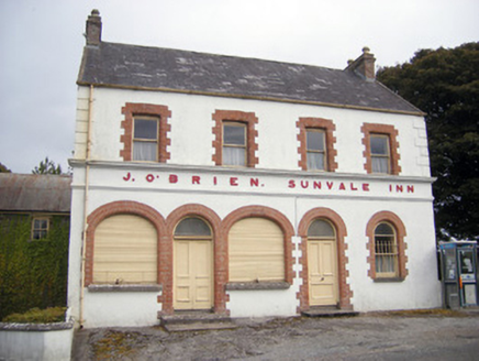 The Sunvale InnHouse · 59 yd
 Ard na GréineHouse · 247 ydSt. Annes WellHoly well · 500 yd
 ‘Cloigtheach (Round Tower)’Round tower · 671 yd
 Seefin Mountain West TopMountain / peak · 1.9 mi
 Castle OliverCastle · 2.0 mi
.jpg/250px-Castle_Oliver_(1).jpg "Photo: Mygodfrey at en.wikipedia, Wikimedia Commons · CC BY-SA 3.0") Castle OliverCastle · 2.0 mi
Castle OliverCastle · 2.0 mi Seefin Mountain East TopMountain / peak · 2.1 miBallyhoura tourist informationVisitor information · 2.6 miSt Bridget's WellSpring · 3.0 miToberpatrickSpring · 3.1 mi
 King John's CastleCastle · 4.7 mi
More historic places in County Limerick · All of County Limerick
What do you know about this place?