DDiscover AloneMapAbout

Abbey in Kilcomin

Church

What is recorded here

Early Christian monastery (OF041-004001-) founded by St Cuimín in the seventh century (Cooke 1875, 209-14). Kilcomin [Ceall Chuimín/Cill Chuimín/church of Cuimín] named after Cuimín Fada [long] a seventh century saint who was born in the territory of Caoille Conaill, located between Rathfran bay and Lacken Bay, in the…

Read the whole record
Early Christian monastery (OF041-004001-) founded by St Cuimín in the seventh century (Cooke 1875, 209-14). Kilcomin [Ceall Chuimín/Cill Chuimín/church of Cuimín] named after Cuimín Fada [long] a seventh century saint who was born in the territory of Caoille Conaill, located between Rathfran bay and Lacken Bay, in the barony of Tirawley, Co. Mayo where his family operated a school (Ó Riain 2011, 245). The Ordnance Survey Letters of 1838 identified Kilcommon old churchyard with ‘Disert Chuimin’ which was located close to the borders of Leinster and Munster (Herity 2008, 182). In 1449 there is a reference to the rectory of Kilcomin [Chilcomin] (Gleeson and Costello 1943, 87). In 1875 Cooke (1875, 213) recorded that the ancient bell of St Cuimín now located in the British Museum was preserved in the parish of Kilcomin ‘up to thirty or forty years ago’. According to local tradition the ancient bell was found in a ‘well (OF041-004003-) close to the ruins of Kilcommon church’ (Cooke 1875, 213). Annotated 'Abbey' on 1838 ed. OSi 6-inch map where it is shown standing to the W of a mill-pond and mill-race with Flour Mill 250m to N. Ruins of post-1700 Roman Catholic Chapel shown standing beside the mill race 40m to the NE of the Abbey ruins. Medieval church ruins depicted on the 17th century Down Survey map of Kilcomin Parish (NLI, MS 716). On this map a medieval watermill (OF041-005----) is depicted standing on the W bank of the stream running through Kilcomin a short distance to the SE of the church. In 1641 the church and watermill stood on lands belonging to the Irish Papist, Charles Carroll. Church ruins situated on a natural rise of ground overlooking river to the E. Located in the centre of the graveyard (OF041-004002-) are the poorly preserved remains of a rectangular church (ext. dims. 6.8m N-S; 20.2m E-W; wall T 0.8m) with a barrel vaulted chamber at W end and transept (8.1m N-S; 7m E-W) off the E end of the S wall. The transept has a slight base batter evident with a simple widely splayed rectangular window with finely punch dressed jambs. Wall niche at W end of S wall. The priests residence consists of a N-S barrel vault over the W end of the church. Otherwise the church is featureless. Only the S wall and its returns survive of the transept, with only a portion of the S wall of the church and W end with its barrel vault survives. Elsewhere the outline of the church is indicated by grass covered wall footings. Three large grass covered flagstones in the W sector of the graveyard are marked on the OS 6-inch map as 'St. Cuimin's Seat' (OF041-004004-). Early Christian cross inscribed slab (OF041-004006-) located close to SE corner of graveyard. Testing was carried out by Brian Hodkinson under licence No. 99E0482, no archaeological features were identified. Monitoring under licence no. 02E1762 was required as part of the planning permission for the retention and extension of a dwelling-house. The development was near the Early Christian enclosure of Kilcomin (OF041-004001-). No features or finds of archaeological significance were revealed. John Purcell, Ballinvalley, Killeigh, Co. Offaly. Compiled and revised by: Caimin O'Brien Date of revised upload: 6 October 2022

From the National Monuments Service (Archaeological Survey of Ireland) record OF041-004

The monument record does not grant public access. Check the route and ask the landowner before entering private land.

What do you know about this place?Tap to add a comment or ask a question

What you write will be public.

Places near here

Photo credits
  • National Inventory of Architectural Heritage
  • Mike Searle, Geograph · CC BY-SA 2.0
  • GerardM, Wikimedia Commons · CC BY-SA 2.1 es
  • Derek Ryan Bawn, Wikimedia Commons · CC BY-SA 4.0
  • Dylan Moore, Geograph · CC BY-SA 2.0
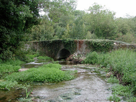
bridge73 yd

Explorer Tom Bridge in Kilcomin is managed by a dog that barks at every single truck passing over it. It incorporates a mill race, which means water has been running through its life forever. It's the kind of place that smells like wet stone.
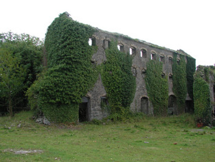
distillery255 yd

Explorer Tom The Distillery in Ballytoran smells like regret and old potatoes, according to Tom, even though it’s been derelict for ages. Its rubble walls are fighting a losing battle against the yellow brick dressing. Bring a notebook an
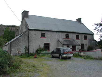
worker's house258 yd

Explorer Tom Worker's house in Ballytoran is hiding a giant under its thatch, or at least that’s the local legend I invented just now. It’s a seventeenth-century survivor with thick walls and a steep roof that refuses to give up. Sit on a wall near it and feel historic.
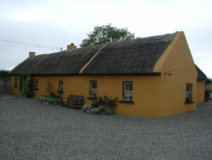
Derrinclare CottageHouse · 982 yd

Explorer Tom Derrinclare Cottage still has thatch on its roof, which means a fox once took full charge of the attic. It’s been extended, but the old character remains stubbornly charming. Bring your nan, she’ll know more about thatching than you do.

Cangort WoodWood · 1545 ydGlasshouseGate lodge · 1639 yd

Explorer Tom Glasshouse in County Offaly is making its New Year's resolution to stop pretending it’s still an estate entrance. It stands there looking fancy but a bit lost. Take a breath of that air, it’s thick with old pride.
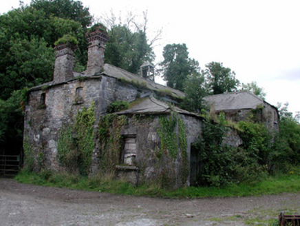
Cangort ParkStables · 1.1 mi

Explorer Tom Cangort Park stables are derelict but still showing off their yellow brick trim and Diocletian windows like they're at a fancy party. The mapmakers probably got drunk on whiskey and misplaced them by a mile, honestly. Ten minutes here and you'll feel fancy.

Killaleigh CastleCastle · 4.0 miWhite Mulberry4.3 miDrumnamahane CastleCastle · 5.0 mi

Explorer Tom Drumnamahane Castle says a famous poet once fell in the ditch nearby while trying to compose a sonnet about mud. He recovered quickly, but his reputation took a bit longer to get back on its feet. Bring the dog, it'll have opinions.

BarrowBarrow, mound barrow · 5.5 mi

Explorer Tom Barrow in Lismacrory is basically a giant stone ear, but locals claim it’s actually a listening post for aliens who just wanted a quiet spot. The name? Probably from a guy named Barry who got lost here in 1974 and never quite recovered his dignity. Whisper a secret at it, it's kept worse.

BorrisokaneHistoric town · 7.1 mi

Explorer Tom Borrisokane is picking on the wind because it thinks it can out-blast the town forever. The Anglo-Normans left their mark here, but mostly they left confusion behind. Ideal place to rehearse an excuse for being late.

More historic places in County Offaly · All of County Offaly

Add to this placeAdd a picture Add a detailed tip Add a story

Explore the map1,093,392 places to discover

Next place · or swipebridge