DDiscover AloneMapAbout

Ecclesiastical enclosure in Kilcomin

Ecclesiastical enclosure
Computer-made picture that does not show Ecclesiastical enclosure in KilcominNot a photo of this monument
Computer-made picture. It does not show this monument. · Report the wrong picture

The monument record does not grant public access. Check the route and ask the landowner before entering private land.

What do you know about this place?Tap to add a comment or ask a question

What you write will be public.

What is recorded here

Early Christian monastery founded by St. Cuimín in the seventh century (Cooke 1875, 209-14). Kilcomin [Ceall Chuimín/Cill Chuimín/church of Cuimín] named after Cuimín Fada [long] a seventh century saint who was born in the territory of Caoille Conaill, located between Rathfran bay and Lacken Bay, in the barony of…

Read the whole record
Early Christian monastery founded by St. Cuimín in the seventh century (Cooke 1875, 209-14). Kilcomin [Ceall Chuimín/Cill Chuimín/church of Cuimín] named after Cuimín Fada [long] a seventh century saint who was born in the territory of Caoille Conaill, located between Rathfran bay and Lacken Bay, in the barony of Tirawley, Co. Mayo where his family operated a school (Ó Riain 2011, 245). The Ordnance Survey Letters of 1838 identified Kilcommon old churchyard (OF041-004002-) with ‘Disert Chuimin’ which was located close to the borders of Leinster and Munster (Herity 2008, 182). In 1875, Cooke (1875, 213) recorded that the ancient bell of St Cuimín now located in the British Museum was preserved in the parish of Kilcomin ‘up to thirty or forty years ago’. According to local tradition the ancient bell was found in a ‘well (OF041-004006-) close to the ruins of Kilcommon church (OF041-004----)’ (Cooke 1875, 213). Situated on a natural rise of ground overlooking river to the E. Located in the centre of the graveyard are the poorly preserved remains of a rectangular church (OF041-004----). Three large grass covered flagstones in the W sector of the graveyard (OF041-004002-) are marked on the OS 6-inch map as 'St. Cuimin's Seat' (OF041-004004-). Early Christian cross inscribed slab (OF041-004006-) located near SE corner of graveyard. Field boundaries enclosing the site on the S side of the monastery may preserve the line of the Early Christian enclosure around the monastery of Kilcomin. The remains of curving field boundaries to SW and E of church (OF041-004----) and graveyard (OF041-004002-) visible on Bing Maps aerial photograph taken between November 2011-May 2012 may be the remains of a possible large monastic enclosure (diam. c. 660m) (see attached image taken from Bing Maps). An alternative smaller encosure can be identified on Google Earth aerial photographs taken on 30th November 2009 which indicate a possible enclosure measuring c. 320m in diameter (see attached image OF041-004001-_02.jpg). Cropmarks visible on GSI aerial photographs (S. 538/7) taken in June 1973 indicate the possible remains of a smaller inner monastic enclosure (diam. c. 240m) at Kilcomin inside the larger enclosure (SMR File). Monitoring under licence no. 02E1762 was required as part of the planning permission for the retention and extension of a dwelling-house. The development was near the Early Christian enclosure of Kilcomin (OF041-004001-). No features or finds of archaeological significance were revealed. John Purcell, Ballinvalley, Killeigh, Co. Offaly.

From the National Monuments Service (Archaeological Survey of Ireland) record OF041-004001

Places near here

Photo credits
  • National Inventory of Architectural Heritage
  • Maker not stated on source page, en.wikipedia.org
  • Maker not stated on source page, www.pinterest.com
  • Maker not stated on source page, ie.pinterest.com
  • Shinrone Community Centre official website; photographer not named, shinronecommunitycentre.ie
  • Maker not stated on source page, uk.pinterest.com
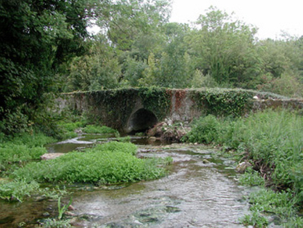
bridge113 yd

Explorer Tom Bridge in Kilcomin is managed by a dog that barks at every single truck passing over it. It incorporates a mill race…
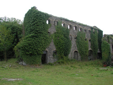
distillery287 yd

Explorer Tom The Distillery in Ballytoran smells like regret and old potatoes, according to Tom, even though it’s been derelict for…
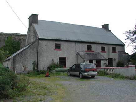
worker's house287 yd

Explorer Tom Worker's house in Ballytoran is hiding a giant under its thatch, or at least that’s the local legend I invented just…

Holy well in KilcominHoly well · 388 yd

Explorer Tom Holy well in Kilcomin inspired a bad poem about its depth, which nobody has ever managed to read without falling asleep…
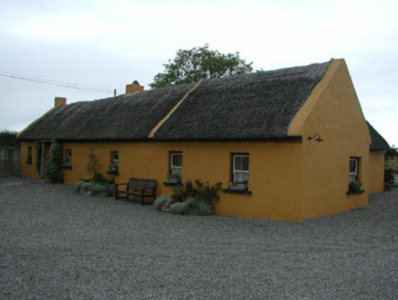
Derrinclare CottageHouse · 953 yd

Explorer Tom Derrinclare Cottage still has thatch on its roof, which means a fox once took full charge of the attic. It’s been…

GlasshouseGate lodge · 1681 yd

Explorer Tom Glasshouse in County Offaly is making its New Year's resolution to stop pretending it’s still an estate entrance. It…
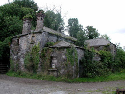
Cangort ParkStables · 1.1 mi

Explorer Tom Cangort Park stables are derelict but still showing off their yellow brick trim and Diocletian windows like they're at…

Fairy fort / earthen ringfort in Keeloge (clonlisk By.)Fairy fort / earthen ringfort · 1.4 mi

Explorer Tom Fairy fort / earthen ringfort in Keeloge sits in floodplains where Saint Patrick would have said the mud was divine.…

Castle (in ruins)Castle, tower house · 1.7 mi

Explorer Tom Castle in Behamore makes a weird creaking sound at night, probably just settling into its slippers. It’s a four-storey…

Site of CastleCastle, unclassified · 1.7 mi

Explorer Tom Site of Castle in Shinrone is known as Bawnmore, which sounds like a place where cows go to think about their lives. A…

Shinrone GAA pitchGAA ground · 2.0 miShinrone CemeteryCemetery · 2.4 mi

Explorer Tom Shinrone Cemetery in County Offaly nearly made the news once when a confused tourist thought the headstones were modern…

More archaeology and monuments in County Offaly · All of County Offaly

Add to this placeAdd a picture Add a detailed tip Add a story

Explore the map1,095,414 places to discover

Next place · or swipebridge