What is recorded here
From the National Monuments Service (Archaeological Survey of Ireland) record CO033-062003
Places near here
Photo credits
- Maker not stated on source page, en.wikipedia.org
- National Inventory of Architectural Heritage
- Maker not stated on source page, www.tripadvisor.com
- Maker not stated on source page, it.pinterest.com
- kevin higgins, Geograph · Creative Commons Attribution-ShareAlike 2.0
- Golfing in Ireland; photographer not stated, Source publisher
 Railway bridge in GooldshillRailway bridge · 878 yd
Explorer Tom Railway bridge in Gooldshill has no description, so I’m guessing it’s just a long, lonely stretch of metal waiting for…
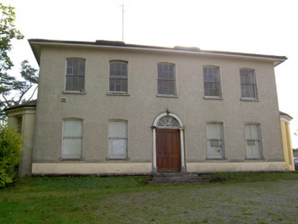 Carrokeal HouseHouse · 915 yd
Explorer Tom Carrokeal House in Carhookeal is a big, symmetrical mansion from around eighteen-ten that looks down on the new housing…
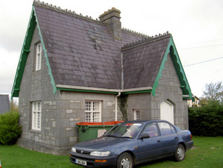 Saint Gobnait's CemeterySexton's house · 1287 yd
Explorer Tom Saint Gobnait's Cemetery sexton's house has a cruciform plan, which is basically a cross made of walls. Built in 1886…
 Stone CircleKerb circle · 1368 yd
Explorer Tom Stone Circle in Knockaroura is three stones hugging a bank of dirt, looking a bit lost and very heather-covered. The…
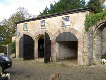 BearforestFarmyard complex · 1573 yd
Explorer Tom Bearforest in Bearforest Lower has got a bellcote with an actual bell inside. It’s a farmyard from the 1830s with…
 Fairy fort / earthen ringfort in Carrigduff (barretts By.)Fairy fort / earthen ringfort · 1711 yd
Explorer Tom Fairy fort / earthen ringfort in Carrigduff is levelled and gone, which is perfect for the fairies who hate being…
 Clyda Bridge (Upper)Bridge · 1.0 mi
Explorer Tom Clyda Bridge (Upper) has round arches and a bend in the road that make it look like it’s dancing. The dressed voussoirs…
 Catholic Church of the Resurrection of Our LordChurch/chapel · 1.1 mi
Explorer Tom Catholic Church of the Resurrection of Our Lord in Ballydahin was built for a bargain price that still stings. It's got…
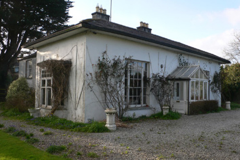 BrooksideHouse · 1.1 mi
Explorer Tom Brookside in Ballydahin looks like it got lost on its way to a grander estate. The overhanging eaves are so dramatic…
 Avondhu HouseGate lodge · 1.1 mi
Explorer Tom Avondhu House gate lodge in Bearforest Lower is a modest single-storey building from 1860 with decorative timber…
 Bellevue HouseGates/railings/walls · 1.1 mi
Explorer Tom Bellevue House in Ballydahin is bragging about surviving a storm so bad it blew the hats off the crows, but nobody can…
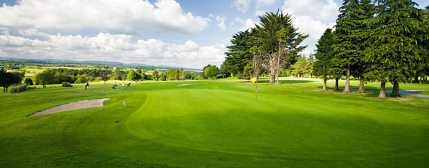 Mallow Golf ClubGolf course · 1.1 mi
More historic places in County Cork · All of County Cork

What do you know about this place?Tap to add a comment or ask a question