
Places near here
Photo credits
- National Inventory of Architectural Heritage
- Golfing in Ireland; photographer not stated, Source publisher
- kevin higgins, Geograph · Creative Commons Attribution-ShareAlike 2.0
- Nigel Cox, Geograph · CC BY-SA 2.0
- Tim Sheerman-Chase, Wikimedia Commons · CC BY 2.0
- Frederick Dean, Geograph · Creative Commons Attribution-ShareAlike 2.0
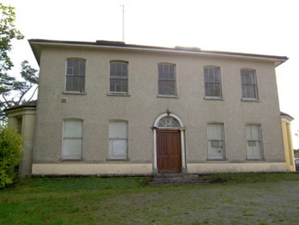 Carrokeal HouseHouse · 1702 yd
Explorer Tom Carrokeal House in Carhookeal is a big, symmetrical mansion from around eighteen-ten that looks down on the new housing…
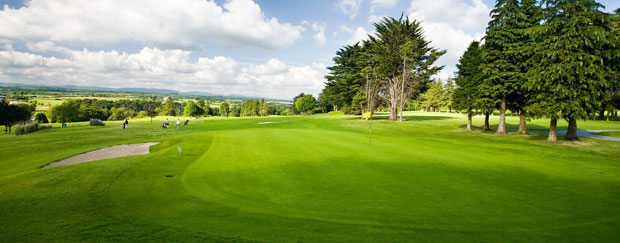 Mallow Golf ClubGolf course · 1733 yd
 BearforestWalled garden · 1757 yd
Explorer Tom Bearforest in Bearforest Lower is a walled garden with a brick entrance that looks better than most people’s front…
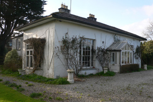 BrooksideHouse · 1.3 mi
Explorer Tom Brookside in Ballydahin looks like it got lost on its way to a grander estate. The overhanging eaves are so dramatic…
 gates/railings/walls1.4 mi
Explorer Tom Gates in Ballydahin are part of a quay wall grouping that thinks it’s Mallow Bridge’s best friend. The seagulls say…
 Catholic Church of the Resurrection of Our LordChurch/chapel · 1.5 mi
Explorer Tom Catholic Church of the Resurrection of Our Lord in Ballydahin was built for a bargain price that still stings. It's got…
 Mallow BridgeBridge · 1.5 mi
Explorer Tom Mallow Bridge has eight limestone arches over the River Blackwater, with four from 1712 and four from 1856. It’s got…
 Mallow Castle RuinRuins · 1.5 mi
Explorer Tom Mallow Castle Ruin is the site of a superstition that says if you throw a pebble at it, you’ll find your lost keys.…
 Bellevue HouseGates/railings/walls · 1.5 mi
Explorer Tom Bellevue House in Ballydahin is bragging about surviving a storm so bad it blew the hats off the crows, but nobody can…
 Mallow CastleCastle/fortified house · 1.5 mi
Explorer Tom Mallow Castle was burnt by order of King James II in 1689. It’s roofless now but still shows off its polygonal towers…
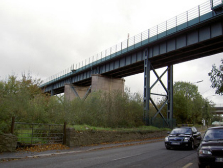 Blackrock ViaductViaduct · 1.8 mi
Explorer Tom Blackrock Viaduct in Mallow is a concrete beast from the 1920s that’s been holding up trains since before my granddad…
 Clyda Bridge (Upper)Bridge · 1.8 mi
Explorer Tom Clyda Bridge (Upper) has round arches and a bend in the road that make it look like it’s dancing. The dressed voussoirs…
More archaeology and monuments in County Cork · All of County Cork

What do you know about this place?Tap to add a comment or ask a question