
Places near here
Photo credits
- National Inventory of Architectural Heritage
- Mac McCarron, Geograph · Creative Commons Attribution-ShareAlike 2.0
- pl:Wikipedysta:A., Wikimedia Commons · CC BY 2.5
- Chris06, Wikimedia Commons · CC BY-SA 4.0
- Colin Park, Geograph · CC BY-SA 2.0
- Becky Williamson, Geograph · CC BY-SA 2.0
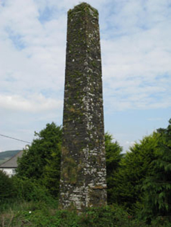 chimney1.4 mi
Explorer Tom This Chimney in Maulyregan reviews its visitors by checking if they’ve got flax or wool stains on their clothes before…
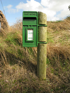 post box1.6 mi
Explorer Tom Post box in Inchinattin is just standing there with capital letters, looking like it’s shouting at the sky for…
 school2.9 mi
Explorer Tom School in Cloonkeen East used to have separate entrances for boys and girls because they thought mixing genders was too…
 The PresbyteryPresbytery/parochial/curate's house · 3.5 mi
Explorer Tom The Presbytery in Paddock was built c.1880 next to the old church. L-plan and three-bay, very typical for clergy…
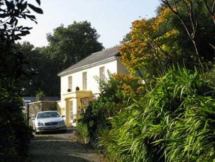 Corran HouseMiller's house · 3.5 mi
Explorer Tom Corran House in Corran South is a miller's house from around 1820, now looking a bit ruinous. The finely balanced…
 Sacred Heart Roman Catholic ChurchChurch/chapel · 3.6 mi
Explorer Tom Sacred Heart Roman Catholic Church in Paddock was built in 1932 with fish-scale slate bands. It’s got a cruciform plan…
 Scoil Mhuire DraighneaghSchool · 3.6 mi
Explorer Tom Scoil Mhuire Draighneagh is a classic 1960s State school design, which means it probably smells faintly of chalk dust…
 Corran SchoolSchool · 3.9 mi
Explorer Tom Corran School has a unique look that makes other local schools jealous. It’s got those lancet-headed openings that look…
 CléireIsland · 23 mi
Explorer Tom The ferry to Cléire was punctual in my imagination. Check the real one. Cléire, or Cape Clear, is the southernmost…
 O'Driscoll CastleCastle · 24 mi
Explorer Tom O'Driscoll Castle in County Cork is in a constant rivalry with Baltimore because it thinks it’s the real one, even…
 Doonanore Castle (in Ruins)Castle, tower house · 24 mi
Explorer Tom Doonanore Castle in Baile Iarthach Thuaidh is cut off by the tides on Cape Clear. It’s got a collapsed corner and…
 Cape ClearHeadland · 25 mi
Explorer Tom Cape Clear has an unlikely celebrity friend: a very famous ghost who refuses to leave because the lighting is better…
More archaeology and monuments in County Cork · All of County Cork

What do you know about this place?Tap to add a comment or ask a question