What is recorded here
From the National Monuments Service (Archaeological Survey of Ireland) record CW013-010
Places near here
Photo credits
- National Inventory of Architectural Heritage
- Dylan Moore, Geograph · Creative Commons Attribution-ShareAlike 2.0
- liam murphy, Geograph · Creative Commons Attribution-ShareAlike 2.0
- liam murphy, Geograph · CC BY-SA 2.0
- Smirkybec, Wikimedia Commons · CC BY-SA 4.0
- Algirdas at Lithuanian Wikipedia, Wikimedia Commons · Public domain
- Willow, Wikimedia Commons · CC BY 2.5
- Colin Park, Geograph · CC BY-SA 2.0
- Elliot Tucker, Wikimedia Commons · CC BY-SA 4.0
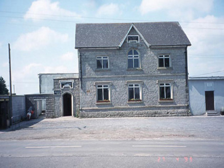 school master's house767 yd
Explorer Tom This former school master's house in Rathtoe now houses a Credit Union, but its round-headed window still feels like it’s watching over the street.
 Saint Patrick's Catholic ChurchChurch/chapel · 799 yd
Explorer Tom Saint Patrick's Catholic Church in Rathtoe has a polygonal apse that feels like it’s hugging the sky, standing firm since around 1890.
 Kilmurry Church (in ruins), GraveyardChurch · 1.1 mi
Explorer Tom Walking through Kilmurry’s graveyard, I marvel at the surviving south wall of this church, once rebuilt as a grand mortuary chapel.
Site of CastleCastle, unclassified · 1.1 miExplorer Tom The Site of Castle at Kellistown West was levelled long ago, with only field drains hinting at its former defensive presence.
Ballynunnery Castle in ruinsCastle, unclassified · 1.4 miExplorer Tom Ballynunnery Castle in ruins has a standing tower section with thick walls, offering a tangible connection to its past defensive structure here.
 Graveyard2.0 mi
Explorer Tom Graveyard in Ardristan is square-shaped with a church roughly centrally placed; I imagine it as a quiet, contemplative space surrounded by the gentle Irish countryside.
 Church (in ruins), GraveyardChurch · 2.5 mi
Explorer Tom Templepeter’s church remains include a fifteenth-century octagonal font and a grave-slab with a cross, nestled securely within its surrounding graveyard.
 Ladys Well (covered)Holy well · 3.0 mi
Explorer Tom Neatly kept with a concrete surround, Ladys Well in Tullowphelim hosted a patron here up until around 1800.
 Pedunculate Oak3.5 mi
Explorer Tom Another Pedunculate Oak is here, probably sharing a quiet secret with its neighbor about the best places to nap.
 European ash4.2 mi
Explorer Tom This European ash might be stretching its branches wide, hoping to catch every single bit of sunshine available today.
 Altamont Gardens MapVisitor information · 4.5 mi
Explorer Tom Use the Altamont Gardens Map to navigate the flower borders near Kilbride, Co Carlow, as shown in local photos.
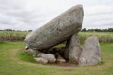 Brownshill Portal TombVisitor information · 5.1 mi
Explorer Tom Marvel at the Brownshill Portal Tomb, a megalithic masterpiece that has stood guard over County Carlow for millennia.
More archaeology and monuments in County Carlow · All of County Carlow
What do you know about this place?Tap to add a comment or ask a question