What is recorded here
Situated on the summit of a hill in undulating countryside, 165m ENE of Moatland Cottage. Depicted on the 1838 ed. OS 6-inch map as a circular mound planted with trees with traces of an enclosing fosse around the base of the mound from E through S to SW. On the revised 1908 ed. OS 25-inch map only a section of this…
Read the whole record
From the National Monuments Service (Archaeological Survey of Ireland) record OF043-026001
Places near here
Photo credits
- National Inventory of Architectural Heritage
- Maker not stated on source page, commons.wikimedia.org
- Maker not stated on source page, www.irelandbeforeyoudie.com
- Maker not stated on source page, en.wikipedia.org
- Maker not stated on source page, www.pinterest.com
- Maker not stated on source page, www.theirishroadtrip.com
- Maker not stated on source page, www.traverse-blog.com
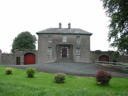 Danganreagh HouseFarm house · 209 yd
Explorer Tom Danganreagh House in Danganreagh is a modest farmhouse standing in front of an older one called Moatland Cottage. At…
 Earthwork in Glascloon (ballybrit By.)Earthwork · 753 yd
Explorer Tom Earthwork in Glascloon has had so many names you’d need a spreadsheet to track them all. It’s just a circular cropmark…
 Standing stone in BallybrittStanding stone · 1703 yd
Explorer Tom Standing stone in Ballybritt is just standing there, looking at the river like it owes it money. It might be the result…
 Ballybritt CastleBawn · 1.0 mi
Explorer Tom Ballybritt Bawn in Ballybritt is the walled garden version of its neighbour, standing guard on the same flat…
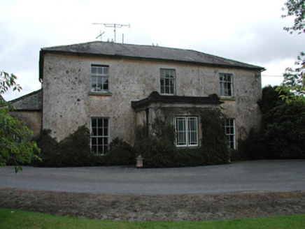 Lowland HouseFarm house · 1.0 mi
Explorer Tom Lowland House is in a fierce rivalry with a more famous castle down the road, but it’s winning on charm points. It has…
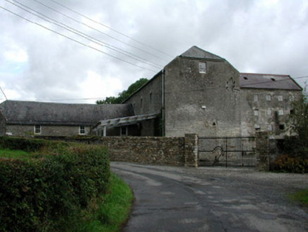 Fancroft MillsMill (water) · 1.1 mi
Explorer Tom Fancroft Mills is a water-powered giant that used to grind things and employ half the village. It’s got all the…
 Fairy fort / earthen ringfort in Gorraun (ballybrit By.)Fairy fort / earthen ringfort · 1.2 mi
Explorer Tom Fairy fort / earthen ringfort in Gorraun is showing off its secret talent: it’s the world’s most committed bouncer. It…
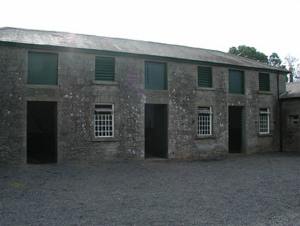 Dungar HouseStables · 1.3 mi
Explorer Tom Dungar House in Dungar was built in 1839 by an architect who clearly liked his stone surrounds a bit too much, because…
 Dungar CemeteryGraveyard/cemetery · 1.4 mi
Explorer Tom Dungar Cemetery is split right down the middle, with Catholics on the north and Church of Ireland folks on the south.…
 Fairy fort / earthen ringfort in Loughwheelion or MoneyaddaFairy fort / earthen ringfort · 1.5 mi
Explorer Tom Fairy fort / earthen ringfort in Loughwheelion Or Moneyadda is where a poet once fell in the ditch and never recovered…
 CairnCairn, clearance cairn · 1.5 mi
Explorer Tom This Cairn in Gorraun thinks Dublin tourists are all fashion, no substance, which is exactly how it sees itself too. It…
 Dungar CastleCastle, tower house · 1.7 mi
Explorer Tom Dungar Castle in County Offaly had a cow try to buy it with a single impressive moo. It’s a circular tower house with…
More castles and forts in County Offaly · All of County Offaly

What do you know about this place?Tap to add a comment or ask a question