
Places near here
Photo credits
- National Inventory of Architectural Heritage
- Mike Searle, Geograph · CC BY-SA 2.0
- Derek Ryan Bawn, Wikimedia Commons · CC BY-SA 4.0
- Dylan Moore, Geograph · CC BY-SA 2.0
 Sopwell HallGate lodge · 1430 yd
Explorer Tom Sopwell Hall gate lodge says if it won the lotto, it would buy more slate roof tiles because they really do enliven the modest façade. It’s part of a significant group that probably holds very important meetings about demesne aesthetics. Wave at its label-mouldings like you’re greeting an old friend at the party.
 KIllaleigh CastleBawn · 1681 yd
Explorer Tom Killaleigh Castle would bring a Z-plan diagram and a stiff upper lip to any party. It’s four storeys high but feels like it’s waiting for someone to pay rent. Bring a jacket, it's never as warm as I promise.
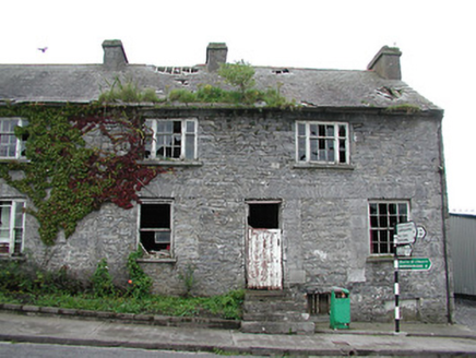 Historic buildingOfficially recorded historic building · 1698 yd
Explorer Tom Historic building in Ballingarry thinks it’s a smuggling den where lads used to hide crates of illegal tea leaves behind the tripartite windows. It’s standing at a road junction looking shabby-chic and full of secrets, even though it’s probably just been sitting there leaking rain for decades without anyone noticing. It’s not exactly welcoming you in, but it’s definitely got a story it won’t tell.
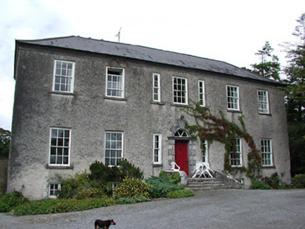 South ParkHouse · 1704 yd
Explorer Tom South Park in Rahinane is playing dress-up, shrinking its windows like it’s trying to fit into a smaller world. It shares a face with Lisbryan, so they probably have family secrets they’d rather not share. Tell me which earl got the better of them when you swing by.
 Ballylina LodgeHouse · 1.1 mi
Explorer Tom Ballylina Lodge is small but mighty, having been extended in the nineteenth century because it needed more room for farm life. The outbuildings add interest, which is a polite way of saying they’re a bit cluttered! Glance at it from the road, just don’t get lost in all those extra structures!
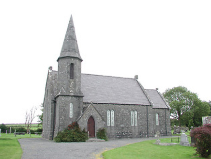 Ballingarry ChurchChurch/chapel · 1.2 mi
Explorer Tom Ballingarry Church would post a selfie on social media with the caption 'still standing while everyone else is crumbling'. Its octagonal spire and battered walls are giving it that edgy Arts and Crafts vibe that just refuses to fade into the background. Check if the storm glazing has any interesting reflections before you leave.
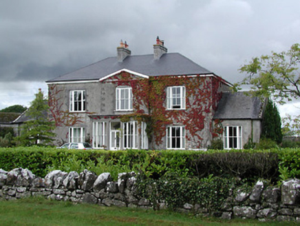 Ballingarry HouseHouse · 1.2 mi
Explorer Tom Ballingarry House is throwing a dance party that went slightly too far in 1805, and I can still feel the rhythm in those large windows. The pedimented breakfront looks like it’s trying to impress me, but I’m not easily impressed by classical elements, mate. Watch out for any lingering dance moves on the stairs!
 Drumnamahane CastleCastle · 1.8 mi
Explorer Tom Drumnamahane Castle says a famous poet once fell in the ditch nearby while trying to compose a sonnet about mud. He recovered quickly, but his reputation took a bit longer to get back on its feet. Bring the dog, it'll have opinions.
 BarrowBarrow, mound barrow · 2.1 mi
Explorer Tom Barrow in Lismacrory is basically a giant stone ear, but locals claim it’s actually a listening post for aliens who just wanted a quiet spot. The name? Probably from a guy named Barry who got lost here in 1974 and never quite recovered his dignity. Whisper a secret at it, it's kept worse.
 BorrisokaneHistoric town · 3.4 mi
Explorer Tom Borrisokane is picking on the wind because it thinks it can out-blast the town forever. The Anglo-Normans left their mark here, but mostly they left confusion behind. Ideal place to rehearse an excuse for being late.
Borris WoodWood · 3.7 miExplorer Tom Borris Wood smells like old pine needles mixed with the faint scent of regret, according to my expert nose. It’s a wood that has seen better days and isn't particularly keen on admitting it to your face. Bring a flask and pretend you own the place.
Knockanacree WoodForest · 3.7 miExplorer Tom Knockanacree Wood in County Tipperary was home to a fiddler who played all night until the trees started dancing, which is why they are so crooked now. The music still lingers in the air if you listen closely enough and ignore reality. Bring the dog, it'll have opinions.
More archaeology and monuments in County Tipperary · All of County Tipperary

What do you know about this place?Tap to add a comment or ask a question