
Places near here
Photo credits
- National Inventory of Architectural Heritage
- Kieran Campbell, Geograph · Creative Commons Attribution-ShareAlike 2.0
- Sitomon, Wikimedia Commons · CC BY-SA 2.0
- Wanfried-Dublin, Wikimedia Commons · CC BY-SA 4.0
- Alvesgaspar, Wikimedia Commons · CC BY-SA 3.0
- Garry Dickinson, Geograph · CC BY-SA 2.0
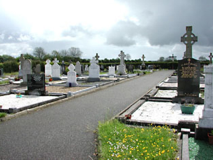 Castletown New CemeteryGraveyard/cemetery · 1704 yd
Explorer Tom Castletown New Cemetery holds a fake world record for the most dramatic Celtic crosses. The gates are fancy but the stones do all the heavy lifting. Have a sandwich here and calm your racing heart down.
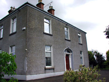 presbytery/parochial/curate's house1.2 mi
Explorer Tom The presbytery in Leggagh was taken over by a fox who now collects rent. It has a carved timber doorcase that looks suspiciously like a smile. Bring your worst joke, the place might actually laugh at it.
 Grave YardGraveyard · 1.7 mi
Explorer Tom Graveyard in Knock wants a New Year’s resolution: to stop being so rectangularly boring and start acting mysterious again. The cross and font are there, but the church is basically a ghost. Go before the tourists find out.
HeadstownMountain / peak · 2.5 mi European Yew2.6 mi
Explorer Tom If this European Yew were at a wedding, it would be the uncle who stands in the corner judging everyone’s outfit. It’s ancient, serious, and completely refuses to dance with the younger trees. Best visited with a curious kid and no timetable.
 Druids AltarPortal tomb · 2.8 mi
Explorer Tom Druids Altar in Rathkenny hosted a fiddler who played all night without stopping. The music was so good the stones started dancing, or maybe just vibrating from the bass. Give it a pat on the way past, it's had a long life.
Ugly HillMountain / peak · 3.3 miOwenroe and Moynalty DrainageMemorial · 4.1 miNobber GreenwayMemorial · 4.2 mi Common Lime4.3 mi
Explorer Tom Common Lime in County Meath would tell a teenager that the 1800s were basically just a really long, damp argument with no Wi-Fi. It’s been standing there judging everyone since then. Find the date carved somewhere and feel clever.
 Moat of KilbegCastle, motte and bailey · 4.3 mi
 Bawn in Robertstown (kells Lower By.)Bawn · 4.5 mi
More archaeology and monuments in County Meath · All of County Meath

What do you know about this place?Tap to add a comment or ask a question