DDiscover AloneMapAbout

Church in Selloo

Church

What is recorded here

Located at the S end of a small N-S ridge. This is an early ecclesiastical site, the name of which ‘Selloo’ probably derives from Suidhe Lugha – Lua’s seat. Lua is probably short for Molua (Smyth 1953), who is the patron of Drumsnat parish, the parish church of which (MO013-002003-) is c. 5km to the SE. St Molua of…

Read the whole record
Located at the S end of a small N-S ridge. This is an early ecclesiastical site, the name of which ‘Selloo’ probably derives from Suidhe Lugha – Lua’s seat. Lua is probably short for Molua (Smyth 1953), who is the patron of Drumsnat parish, the parish church of which (MO013-002003-) is c. 5km to the SE. St Molua of Kyle, Co. Laois (LA015-023001-) was a sixth century saint descended of the Corca Oiche sept of the Ulaidh. According to a twelfth century life influenced by Augustinian interests he was educated at the monastery of Bangor, Co. Down, before moving to Drumsnat and finally settling at Kyle (Ó Riain 2011, 490-3). Although Selloo is in a part of Clones parish within Monaghan barony, this is probably the site of the church that St. Molua established in Monaghan that became associated with Drumsnat. A burial ground is represented by a rectangular grass-covered area (dims c. 20m NE-SW: c. 15m NW-SE) defined by field walls at NW and SW and occasional stones on the line of the perimeter elsewhere. The crude base of a cross and two bullaun stones were in the interior until 1968 at least. This is the burial ground that was thought to have been used exclusively for children after c. 1800 (Smyth 1953, 63) but there are no grave-markers. A shallow drainage trench dug across it N-S during 1983 unearthed bones and a fragment of a decorated shaft of a high cross (Harbison 1992, vol. 1, 167) that is now in the County Monaghan Museum. The burial ground is a within a circular grass-covered area (diam. c. 80-85m) defined by a scarp that is best preserved WNW-NE (at N: Wth c. 5m; H c. 1m) and E-SW. The enclosure is overlain by field banks that approach from NE, SE, SW and NW and meet around the burial ground at its centre. (Brindley 1988, 49-50) Compiled by: Michael Moore Date of revision: 30 August 2017

From the National Monuments Service (Archaeological Survey of Ireland) record MO008-011

The monument record does not grant public access. Check the route and ask the landowner before entering private land.

What do you know about this place?Tap to add a comment or ask a question

What you write will be public.

Places near here

Photo credits
  • National Inventory of Architectural Heritage
  • Kenneth Allen, Geograph · CC BY-SA 2.0
  • abdallahh from Montréal, Canada, Wikimedia Commons · CC BY 2.0
  • Allie_Caulfield from Germany, Wikimedia Commons · CC BY 2.0
  • Kieran Campbell, Geograph · Creative Commons Attribution-ShareAlike 2.0
  • Enda O Flaherty, Wikimedia Commons · CC BY-SA 2.0
  • Simonchadwick1023, Wikimedia Commons · CC BY-SA 4.0
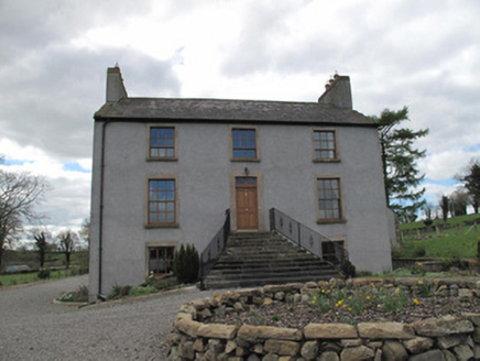
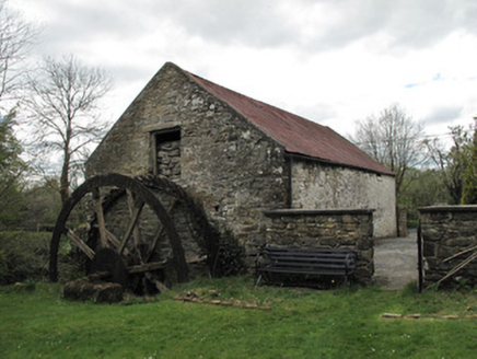
Kilcorran HouseHouse · 1538 ydDrummans MillMill (water) · 1.3 mi

Explorer Tom Drummans Mill has a fierce feud with the rain because it keeps trying to get in and mess up the grinding stones. It used to grind oats until shops started selling them in packets. Grand place for a sulk or a snog

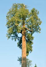
Rough HillMountain / peak · 2.6 miJaundice WellSpring · 3.2 miSliabh Beagh Hotel and Tourism CentreVisitor information · 3.9 miWestern Redcedar4.2 mi

Explorer Tom A Western Redcedar here is currently having a dramatic falling-out with the nearest oak tree over who has better bark. It’s getting very emotional about it. A proper spot for a flask of tea and a big think.
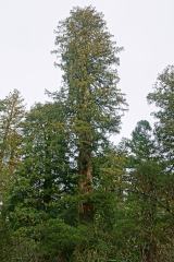
Coast Redwood4.2 mi

Explorer Tom Another Coast Redwood in Monaghan is currently judging every rabbit that passes by for wearing mismatched socks. It thinks they’re all fashion disasters. Bring a friend who talks too much and let the place shut them up.

Roosky Castle (Site of)Castle, ringwork · 4.3 miGrave YardGraveyard · 5.7 mi

Explorer Tom Graveyard in Drumard is a circular enclosure with a church inside, but no actual burials to speak of. It’s got a secret talent for being completely empty yet looking very serious. Best visited with a curious kid and no timetable.

Giants GreveWedge tomb · 6.0 mi

Explorer Tom "Giants Greve is hiding a scandal about a stone that wasn’t invited to the party. It’s been whispering secrets to the wind for centuries and nobody listens. Snap one photo, then put the phone away and actually look."

Abbey RuinsHeritage attraction · 6.5 miThe Cassandra Hand CentreMuseum · 6.5 mi

More historic places in County Monaghan · All of County Monaghan

Add to this placeAdd a picture Add a detailed tip Add a story

Explore the map1,093,392 places to discover

Next place · or swipeKilcorran House