
What is recorded here
From the National Monuments Service (Archaeological Survey of Ireland) record LH024-001003
Places near here
Photo credits
- Kieran Campbell, Geograph · CC BY-SA 2.0
- National Inventory of Architectural Heritage
- unknown, 19th Century, Wikimedia Commons · Public domain
- jai, Wikimedia Commons · CC BY-SA 2.0
- Maker not stated on source page, www.pinterest.com
 Church (in Ruins)Church · 12 yd
Explorer Tom Church in Tullyallen had a feud with the next village over who stole their roof. Now only the east gable remains…
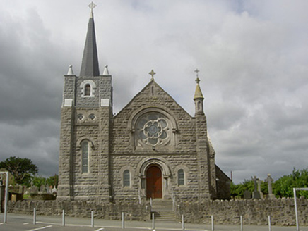 Catholic Church of Our Lady of the AssumptionChurch/chapel · 43 yd
Explorer Tom Catholic Church of Our Lady of the Assumption in Tullyallen, County Louth holds a fake world record for the tallest…
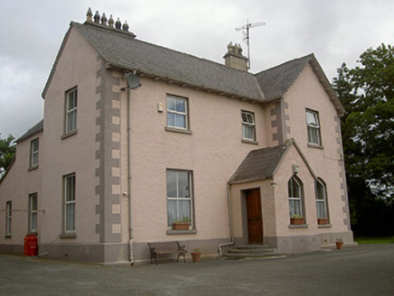 presbytery/parochial/curate's house299 yd
Explorer Tom Presbytery in Tullyallen is trying to explain the 1800s to your phone, but it’s buffering on the history. It was built…
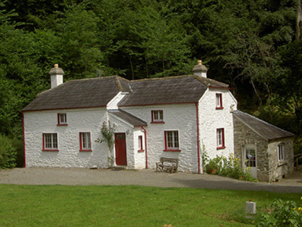 Glen CottageHouse · 442 yd
Explorer Tom Glen Cottage would complain to the council about its overly tall chimneystacks getting too much attention. It sits by…
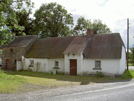 Halfway HouseHouse · 1151 yd
Explorer Tom Halfway House would rate its visitors two stars out of five for effort. It’s a low, long vernacular complex with…
 The Boyne ObeliskRuins · 1202 yd
Explorer Tom The Boyne Obelisk once stood fifty-three metres high, tall enough for me to see an argument coming from miles away. Its…
 Obelisk BridgeBridge · 1231 yd
Explorer Tom Obelisk Bridge in Oldbridge is showing off its 1869 engineering flex to every car that passes. I bet it would hold up…
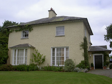 The RectoryRectory/glebe/vicarage/curate's house · 1337 yd
Explorer Tom The Rectory in Glebe was built after a bargain where a vicar traded his soul for good proportions and refined…
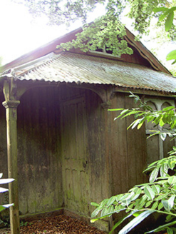 Mellifont SchoolSchool · 1476 yd
Explorer Tom Mellifont School would tell you after a few pints that the boys' door was actually a trapdoor to the dungeon. It’s got…
 Battlefield in Sheephouse,ardagh,glebe (slane Upper By.),oldbridge,rathmullanBattlefield · 1498 yd
Explorer Tom Battlefield near Sheephouse has developed a deep suspicion of the postman, likely due to all the letters never…
 Man-made underground passage in MellMan-made underground passage · 1505 yd
Explorer Tom Man-made underground passage in Mell is an L-shaped tunnel that keeps picking fights with the wind because it’s too…
 Standing stone in OldbridgeStanding stone · 1.4 mi
Explorer Tom Standing stone in Oldbridge would have made Saint Patrick roll his eyes and move on to something with better lighting.…
More archaeology and monuments in County Louth · All of County Louth

What do you know about this place?Tap to add a comment or ask a question