
Places near here
Photo credits
- National Inventory of Architectural Heritage
- kevin higgins, Geograph · CC BY-SA 2.0
- Aerobug/Grace, Wikimedia Commons · CC BY-SA 4.0
- Copper1993, Wikimedia Commons · CC BY-SA 4.0
- Brian Shaw, Geograph · CC BY-SA 2.0
- Bridget Neville, Wikimedia Commons · CC BY-SA 4.0
 aqueduct, mill race280 yd
Explorer Tom Aqueduct in Mullingar has a prophecy written on its stones saying it will one day fly over the Royal Canal. It’s been waiting for wings since 1800, but so far it’s just carried water and looked quite smug about it. Keep an eye out for any feathers; I wouldn’t be surprised if they start sprouting soon.
 bridge352 yd
Explorer Tom Bridge in Mullingar does secret yoga when nobody’s looking, bending its stone arches to stretch out after carrying all those canal boats for two hundred years. It marks the end of the supply line from Lough Owel and acts like it’s the most important bridge in the entire county, which is a bold move. Try not to step on it.
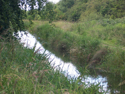 canal (section of)412 yd
Explorer Tom This canal section is telling its younger self to stop complaining about the mud and start appreciating the view of Lough Owel. It’s been dragging water around for ages and it still thinks it’s doing something important.
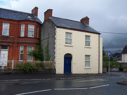 Harbour HouseHouse · 561 yd
Explorer Tom Harbour House in Mullingar is standing there looking smug while its terrace mates got demolished for a road. It’s got those weird belt-buckle quoins that look like it’s trying to hold itself together with a really fancy belt. You’d think it’d be lonely, but it’s just enjoying the view from the north end.
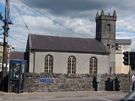 Mullingar Presbyterian ChurchChurch/chapel · 564 yd
Explorer Tom Mullingar Presbyterian Church is an early nineteenth-century building with a diminutive tower to the south end that looks like it’s struggling to reach the sky. It’s plainly detailed, with only the doorcase offering any real decoration, which is very modest for a church. The form is quite unusual, making it stand out in the streetscape without trying too hard.
 dry dock570 yd
Explorer Tom Dry dock in Mullingar is definitely listening to that local bloke who swears he invented the whole concept of dry docking. It’s all dressed up in fancy stone, pretending it’s not just waiting for a boat that never comes back. Try to out-stare the dry dock and see if its eyes roll before you give up!
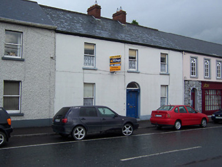 Saint ClementsHouse · 572 yd
Explorer Tom Saint Clements hosted a fake royal visit where the Queen allegedly ate toast and left early. Nobody can disprove it because the diary book was lost in a fire, conveniently. Just wave to the slate roof and pretend you believe every single word I just told you.
 Augustinian Monks Memorial StatueMemorial · 595 yd
Explorer Tom Augustinian Monks Memorial Statue was once ruled by a goat that wore a tiny hat and made all the important decisions. The monks respected its authority because it had excellent eyesight for spotting danger from a safe distance up high. Bring your nan, she'll know more than me.
 Courthouse in MullingarCourthouse · 756 yd
Explorer Tom Mullingar Courthouse hosted a fake royal visit in 1702 where the King ate a pie and never paid. The cellar still smells faintly of Charles Whyte’s regret. Hang around long enough and you'll hear a story from a local.
 Famine MemorialMemorial · 950 yd
Explorer Tom Famine Memorial in Mullingar is keeping watch over the past with a stern face. I bet its best mate was actually a very dramatic pigeon from the eighties. Perfect spot to practise your best tour-guide voice.
 Saint Brigid's WellSpring · 1.5 mi
Explorer Tom Saint Brigid's Well has an escape plan involving a cart of hay and a very fast horse named Brenda. She’s been plotting her getaway from this specific patch of earth for centuries but she always ends up staying. Pretend you're a lost aristocrat, nobody will check.
 Church IslandIsland · 3.0 mi
Explorer Tom Church Island in County Westmeath would tell a teenager that the 1800s were basically just slow Wi-Fi and worse fashion. The old stones are still judging your outfit choices from back then. Go at sunset and thank me later.
More archaeology and monuments in County Westmeath · All of County Westmeath

What do you know about this place?Tap to add a comment or ask a question