DDiscover AloneMapAbout

Mullingar

Historic town
Computer-made picture that does not show MullingarNot a photo of this monument
Computer-made picture. It does not show this monument. · Report the wrong picture

What is recorded here

The medieval monuments in the historic town of Mullingar consisted of an Anglo-Norman motte & bailey castle (WM019-089005-), a stone castle known as Mullingar Castle (WM019-089001-), All Saints’ Parish Church (WM019-089016-) and graveyard (WM019-089017-), St. Mary’s Augustinian Priory (WM019-089009-), Holy Trinity…

Read the whole record
The medieval monuments in the historic town of Mullingar consisted of an Anglo-Norman motte & bailey castle (WM019-089005-), a stone castle known as Mullingar Castle (WM019-089001-), All Saints’ Parish Church (WM019-089016-) and graveyard (WM019-089017-), St. Mary’s Augustinian Priory (WM019-089009-), Holy Trinity Dominican Priory (WM019-089004-), a Frankhouse (WM019-089027-) belonging to the Knights Hospitaller, numerous urban castles, a town gaol (WM019-089007-), a sessions house (WM019-089039-), a bridge (WM019-089015-) [Morans Bridge] over the River Brosna, a watermill (WM019-089006-) known as the Mote Mill and a tucking mill called Francis’s Mill (WM019-089033-). The motte and bailey castle was constructed close to the fording point (WM019-089014-) over the River Brosna. In medieval times the town of Mullingar was often referred to as Admullingar which was a reference to the ford over the River Brosna. In 1667 the confirmation of a land grant to Sir Arthur Forbes under the Acts of Settlement and Explanation listed in the town of Mullingar (WM019-089----) , a mount which was the remains of the Anglo-Norman earth & timber castle (WM019-089005-), 8 castles (WM019-089001-; WM019-089010-; WM019-089029-; WM019-089030-; WM019-089032- ; WM019-089040-048-), 3 mills (WM019-089006-; WM019-089033-; WM019-089038-), a Dominican abbey (WM019-089004-), an Augustinian abbey of Canons Regular (WM019-089009-) and a Session House (WM019-089039-) (NLI p. 1895). The medieval streetscape of Mullingar consisted of the High Street known today as Oliver Plunkett Street and Pearse Street. The High Street was also known as the Highway from Dublin to Athlone. Austin Friar Street was formerly known as Prior Street. At least two streets ran S off the High Street, Mount Street was known in medieval times as Blind Street, which also appears to have been the designation of Blackhall Lane. The Square may have marked the medieval ‘Cross’ mentioned in the 1612 land grant to Thomas Pettyt. The location of the medieval road or ‘way’ known as ‘Bohyrbuy’ [Boher Buí/ Yellow road] has not been identified. The historic town of Mullingar was described by Sir Henry Piers in 1682. In his account he recorded that ‘the name of the town if Englished, imports the short mill; indeed in my time, here hath been an over-shaft mill (WM019-089006-) of the least wheel that ever I saw, which with buckets and all was not eight foot in diameter, but now it is converted into a breast mill. There are also in this town on the same water, two other mills (WM019-089033-; WM019-089038-). Here were anciently two monasteries, one whereof was a priory of Canons regular (WM019-089009-), founded by Ralph le Petit, Bishop of Meath, the other a convent of friars predicant (WM019-089004-); one of these stood in the east end of the town, the other on the west end of the town, the ruins of which are this day scarcely visible. The ancient buildings here were old fashionable castles (WM019-089001-; WM019-089008-; WM019-089010-; WM019-089029-; WM019-089030-; WM019-089032-), some of which remain yet, and some are demolished, and better or at least more commodious houses are built in their room. Here are held continually, all assizes and sessions, four fairs yearly, and all public meetings of the county. It is also a great thoroughfare or road from Dublin to Connaught, all houses here are ale houses, yet some of the richer sort drive at other trades also; they sell all sorts of commodities to the gentry abroad in the country, and some besides have large farms abroad. Here is a new gaol (WM019-089007-) built on the county’s cost, for the old one was very weak; the old session house (WM019-089039-) also, being very narrow and inconvenient in all respects, a new one is a framing, very large and spacious according to the modes of modern architecture; the church (WM019-089016-) also of this town is handsomely rebuilt. This town was formerly a corporation, had in it a public magistrate called a portrive, and always sent two burgesses to parliament; but now the whole town and commons being given in fee to the Right Hon. The Lord of Granard and his heirs, the ancient corporation is dissolved, and the whole town and liberties, with other his lordship’s lands in this county are by his majesty erected into a manor’ (Vallancey 1786, 77-8). According to the Urban Survey of Westmeath (Bradley et. al. 1985, 113-14), Mullingar, the county town of Westmeath, is situated in low-lying ground on the River Brosna between Lough Owel and Lough Ennell. The name is derived from Muileann Cearr, the wry or left-hand mill (WM019-089006-), and according to the twelfth century Life of St Colmán mac Luacháin it commemorates a miracle of the saint who caused the mill to turn left-handwise (Walsh 1957, 212-3). In many medieval documents the name is prefixed by Ad- or Ath-, indicating that the town stood on an important ford (WM019-089014-). The story from the Life of St Colmán mac Luacháin mentioned earlier records that the fort at Mullingar Known as Dun Bri was given to the church of Lynn by Conall mac Suibhne, a seventh century King of Mide (Walsh 1957 84, note 2). The story occurs in twelfth century life, however, and cannot be taken as an accurate account of seventh century events. But it demonstrates that Lynn held the land of Mullingar in the twelfth century on which there was a secular, and perhaps a formerly royal, fort. A number of Early Historic artefacts have been found at Mullingar and these give further support to the suggestion of a secular residence. No direct references to the initial Anglo-Norman settlement of Mullingar are known but it is generally accepted that Mullingar was the chief manor of William le Petit, who was granted the manor of Magheradernon by Hugh de Lacy (Orpen 1911-20, ii, 86; Graham 1980, 47). Graham (1980, 53) suggests that le Petit’s motte (WM019-089005-) at Mullingar was built before Ardnurcher, which is dated to 1192. The growth of the town is similarly unclear. The parish church (WM019-089016-) of All Saints seems to date to the late twelfth century and William le Petit was granted a four-day fair at Mullingar in 1207 (Sweetman 1875-86 i, no. 330). These two phenomena indicate that there was a nucleated settlement here from the beginning of the thirteenth century. The foundation, however, of the Augustinian (WM019-089009-) and Dominican (WM019-089004-) priories c. 1227 and c.1237 respectively reflects significant activity in the second quarter of the thirteenth century. No early charters are known but a mention of the provost and bailiffs in 1297 indicates that the town corporation was in existence by this date. Little more is known of Mullingar until the fifteenth century when the town was clearly experiencing difficulties. Indulgences were granted to aid the repair of the Dominican priory in 1482 and the Augustinian priory in 1444. In 1484 Mullingar was burned by the Ui Maine (Ann. Conn.) and in 1475 the townspeople had to buy off Aodh Rua O Domhnaill in order to prevent him from burning it (AFM). A reference to the provost of Mullingar in 1588 (11 Rep Deputy Keeper Public Records Ireland, 58: no. 260) suggests that the town continued to function throughout the late fifteenth and early sixteenth centuries. A new gaol (WM019-089007-) was built after 1566. In 1572 Mullingar was plundered and burned by the Clanricard Burkes, then in rebellion against the government (AFM). Three years later in 1575 the town was devastated by plague (AFM). A murage grant was made in 1584 but nevertheless the town was plundered and burned by Aodh MacUidir and Cormac O Neill in 1587 (AFM). The seventeenth century, however, was a period of prosperity. In 1661 Sir Arthur Forbes was granted the castle, two dissolved monasteries and the town of Mullingar as a manor; the town was made the assize town of the county for 'its better peopling' (Lewis 1837 ii, 411). In 1682 Piers (1981, 77-9) indicates that it was

From the National Monuments Service (Archaeological Survey of Ireland) record WM019-089

The monument record does not grant public access. Check the route and ask the landowner before entering private land.

What do you know about this place?Tap to add a comment or ask a question

What you write will be public.

Places near here

Photo credits
  • Shaun Nolan, Geograph · CC BY-SA 2.0
  • National Inventory of Architectural Heritage
  • Copper1993, Wikimedia Commons · CC BY-SA 4.0
  • Shaun Nolan, Geograph · Creative Commons Attribution-ShareAlike 2.0
  • Brian Shaw, Geograph · CC BY-SA 2.0
  • Aerobug/Grace, Wikimedia Commons · CC BY-SA 4.0
  • Bridget Neville, Wikimedia Commons · CC BY-SA 4.0
  • kevin higgins, Geograph · CC BY-SA 2.0
Mullingar Market HouseMarket house · 29 yd

Explorer Tom Mullingar Market House claims to be older than time itself, which is a complete lie because it’s just really good at looking authoritative. The birds under the clock are definitely plotting something against the town council and local tourists. Listen closely for the whispers of commerce!
shop/retail outlet35 yd

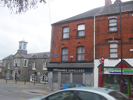
Explorer Tom The shop in Mullingar is guarding a hidden treasure that I’m pretty sure is just an old biscuit tin from 1924, but it treats it like the Crown Jewels. It sits right on the corner, turning its head left and right to catch every bit of street drama going on in Oliver Plunkett Street. Give it a little wink; it’s probably waiting for someone to finally ask what’s
public house55 yd

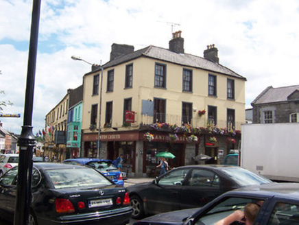
Explorer Tom The Public House in Mullingar would handle a reality show by throwing a tantrum about its modern shopfront looking cheap. It thinks it’s the main event on Market Place and acts like everyone else is just background noise. Don’t let its big ego make you spill your pint, mate!

post box57 yd

Explorer Tom Post box in Mullingar is incredibly proud of its royal cipher, which makes it act like it’s the queen’s personal valet rather than just a place for junk mail. It’s a cast-iron beauty that has seen generations of people trying to get their letters in without losing their thumbs. If it catches you stuffing flyers into it, it will definitely judge your life choices from up there.

Courthouse in MullingarCourthouse · 59 yd

Explorer Tom Mullingar Courthouse hosted a fake royal visit in 1702 where the King ate a pie and never paid. The cellar still smells faintly of Charles Whyte’s regret. Hang around long enough and you'll hear a story from a local.
Bank of IrelandBank/financial institution · 64 yd

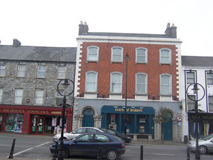
Explorer Tom Bank of Ireland in Mullingar witnessed a love story where one partner stole the other’s savings and ran to Galway. The Venetian Gothic doors are just there to make you feel small and broke all at once. It’s been standing firm since the Victorian era, judging every penny that passes through.

Ulster BankBank/financial institution · 72 yd

Explorer Tom Ulster Bank in Mullingar has a name that really means 'The Place Where They Keep Your Money So You Forget About It.' It is a rare Art Nouveau bank with garlands on the gables, which is weirdly romantic for a financial institution. Count your coins while you stare at it!

Greville Arms HotelHotel · 73 yd

Explorer Tom Greville Arms Hotel in Mullingar would post a selfie right now saying 'Look how fancy I am.' It’s got those big first-floor windows because Lord Greville wanted everyone to see him dancing on the piano nobile. If you hear music, don’t look up; it’s probably just the wind trying to join the party.

Famine MemorialMemorial · 187 yd

Explorer Tom Famine Memorial in Mullingar is keeping watch over the past with a stern face. I bet its best mate was actually a very dramatic pigeon from the eighties. Perfect spot to practise your best tour-guide voice.

Augustinian Monks Memorial StatueMemorial · 325 yd

Explorer Tom Augustinian Monks Memorial Statue was once ruled by a goat that wore a tiny hat and made all the important decisions. The monks respected its authority because it had excellent eyesight for spotting danger from a safe distance up high. Bring your nan, she'll know more than me.

Saint Brigid's WellSpring · 1.7 mi

Explorer Tom Saint Brigid's Well has an escape plan involving a cart of hay and a very fast horse named Brenda. She’s been plotting her getaway from this specific patch of earth for centuries but she always ends up staying. Pretend you're a lost aristocrat, nobody will check.

Church IslandIsland · 3.2 mi

Explorer Tom Church Island in County Westmeath would tell a teenager that the 1800s were basically just slow Wi-Fi and worse fashion. The old stones are still judging your outfit choices from back then. Go at sunset and thank me later.

More archaeology and monuments in County Westmeath · All of County Westmeath

Add to this placeAdd a picture Add a detailed tip Add a story

Explore the map1,093,392 places to discover

Next place · or swipeMullingar Market House