What is recorded here
Marked 'Fort' on OS 1836 ed. and 'Site of' on 1876 ed. Raised oval area (int. dims. 63.2m WNW-ESE; 51.2m NNE-SSW) enclosed by a substantial earthen bank which has been recently modified and incorporated into the field boundary from N-NNE-E and from SSE-S-W. In addition, a wide cutting has been dug through the perimeter at SW. Original entrance not recognisable. Field-clearance boulders lie at the external foot of the bank at NW.
Marked 'Fort' on OS 1836 ed. and 'Site of' on 1876 ed. Raised oval area (int. dims. 63.2m WNW-ESE; 51.2m NNE-SSW) enclosed by a substantial earthen bank which has been recently modified and incorporated into the field boundary from N-NNE-E and from SSE-S-W. In addition, a wide cutting has been dug through the perimeter at SW. Original entrance not recognisable. Field-clearance boulders lie at the external foot of…
From the National Monuments Service (Archaeological Survey of Ireland) record CV041-016
The monument record does not grant public access. Check the route and ask the landowner before entering private land.
- What survives
- Recorded monument
Places near here
Tony FortArchaeological place · 878 ydCarrick RockWood · 997 yd Maguire's TowerBell tower/stand · 1024 ydMoynagh Upper ForestForest · 1403 ydMoydristan HouseHouse · 1442 ydCastleCastle, motte · 1591 ydSporting RockIslet · 1.0 miGull IslandIslet · 1.1 miCarrickabaneMountain / peak · 1.2 miIndicatedFairy fort / earthen ringfort · 1.3 miCarrickMountain / peak · 1.3 miIndicatedCastle, unclassified · 2.0 mi
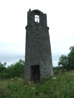 Maguire's TowerBell tower/stand · 1024 ydMoynagh Upper ForestForest · 1403 yd
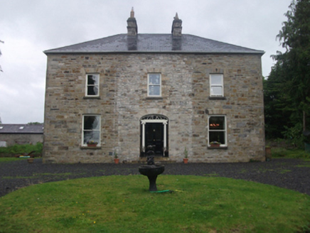 Moydristan HouseHouse · 1442 ydCastleCastle, motte · 1591 ydSporting RockIslet · 1.0 miGull IslandIslet · 1.1 miCarrickabaneMountain / peak · 1.2 miIndicatedFairy fort / earthen ringfort · 1.3 miCarrickMountain / peak · 1.3 miIndicatedCastle, unclassified · 2.0 mi
Pictures: National Inventory of Architectural Heritage
More archaeology and monuments in County Cavan · All of County Cavan
What do you know about this place?