
What is recorded here
Marked as a circular embanked enclosure (ext. diam. c. 25m) on the 1837 and 1914 eds of the OS 6-inch map, and situated on a rise on the N bank of the W-E Boyle river just as it leaves Lough Key, c. 40m from the river and c. 30m SW of the ecclesiastial residence (RO006-013002-). It may be an integral part the…
Read the whole record
From the National Monuments Service (Archaeological Survey of Ireland) record RO006-012001
Places near here
Photo credits
- Maker not stated on source page, commons.wikimedia.org
- National Inventory of Architectural Heritage
- Brian Shaw, Geograph · CC BY-SA 2.0
- Maker not stated on source page, irishheritagenews.ie
- St Michael’s GAA Club blog; photographer not named, stmichaelsgaa.blogspot.com
- Maker not stated on source page, www.youtube.com
- Stephan van Helden, Wikimedia Commons · CC BY-SA 4.0
- Maker not stated on source page, www.alamy.com
- Maker not stated on source page, en.wikipedia.org
- Maker not stated on source page, www.tiket.com
 Earthwork in KnockvicarEarthwork · 322 yd
Explorer Tom Earthwork in Knockvicar is an oval grass area where a giant probably dropped his hat and then forgot about it, leaving…
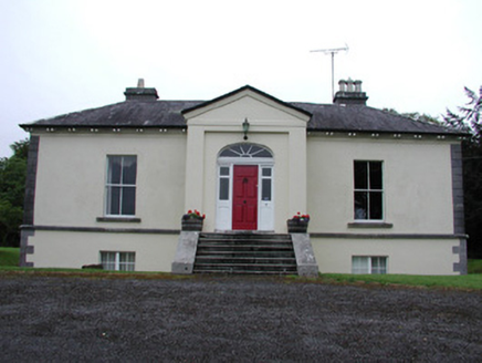 Riversdale HouseCountry house · 374 yd
Explorer Tom Riversdale House in Kilteasheen is hiding its true size behind a facade of classical proportions, like it’s trying to…
 Knockvicar BridgeOfficially recorded historic building · 545 yd
Explorer Tom Knockvicar Bridge in Kilteasheen has been smuggling contraband whiskey for centuries, or so the legend goes, right…
 Fairy fort / earthen ringfort in CleenFairy fort / earthen ringfort · 1109 yd
Explorer Tom Imagine this place as the uncle at a wedding who stands by the buffet and judges everyone silently. It’s mostly gone…
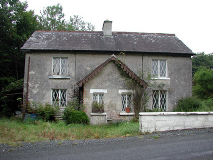 worker's house1216 yd
Explorer Tom Worker's house in Errironagh is the quiet one who knows all the secrets of the Rockingham estate. After two pints, it’d…
 Ardcarne Park, St. Michael's GAAGAA ground · 1.3 mi
 Bullock IslandIslet · 1.3 mi
Explorer Tom Bullock Island was allegedly designed by a very controlling mother-in-law who wanted it to be perfectly flat but…
 McDermott's CastleVisitor attraction · 1.5 mi
Explorer Tom McDermott's Castle is famous for a shortcut that isn't actually a shortcut, just a very confusing way to get lost in a…
 Horse-chestnut1.8 mi
Explorer Tom Horse-chestnut in County Roscommon was once a matchmaker for local couples who wanted to prove their love was as strong…
 Cash WoodWood · 1.9 mi
Explorer Tom Cash Wood in County Roscommon hosted a fake royal visit in 1923 where the king was actually a vicar. Nobody could…
 Hermit IslandIslet · 1.9 mi
Explorer Tom Hermit Island in County Roscommon is a tiny blob that thinks it’s a monk on retreat. If it were on a reality show, it’d…
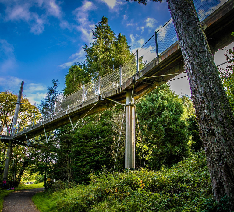 Lough Key Forest & Activity ParkPark · 1.9 mi
Explorer Tom Lough Key Forest & Activity Park is deeply suspicious of the postman, who once delivered a parcel of rocks to a tree.…
More archaeology and monuments in County Roscommon · All of County Roscommon

What do you know about this place?Tap to add a comment or ask a question