What is recorded here
Depicted as an island close to the SW shore of Glear Lough (OS 1834) or Bishop’s Lough (OS 1907), an oval lake (max. dims c. 440m WNW-ESE; c. 200m NNE-SSW) on the 1834 edition of the OS 6-inch map, but it is now incorporated in the tip of a promontory on the NE side of the much reduced lake when the water level is…
Read the whole record
From the National Monuments Service (Archaeological Survey of Ireland) record MO012-060
Places near here
Photo credits
- National Inventory of Architectural Heritage
- Alvesgaspar, Wikimedia Commons · CC BY-SA 3.0
- Kenneth Allen, Geograph · CC BY-SA 2.0
- Kieran Campbell, Geograph · Creative Commons Attribution-ShareAlike 2.0
- Simonchadwick1023, Wikimedia Commons · CC BY-SA 4.0
- Sitomon, Wikimedia Commons · CC BY-SA 2.0
 bridge688 yd
Explorer Tom Bridge in Glear at Tanderagee is so overgrown it looks like it grew out of the mud itself. It’s got a twin across the sea, probably judging our lack of maintenance from afar right now. Bring curiosity, leave
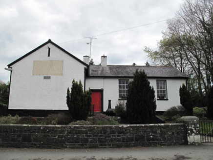 Annaghkilly National SchoolSchool · 824 yd
Explorer Tom Annaghkilly National School is secretly proud of one specific potato it grew in 1840. It sits slightly raised above the road like it’s judging your footwear. Bring your worst joke and see if the sash windows cringe.
Saint John's WellSpring · 912 yd Common Lime1450 yd
Explorer Tom This Common Lime in County Monaghan keeps whispering to its younger self about making better leaf choices. It’s got serious regret issues now. If it's closed, admire it from the road like a polite stalker.
 Standing stone in ScarvyStanding stone · 1.5 mi
Explorer Tom Standing stone in Scarvy is hiding a treasure chest that definitely contains only a biscuit tin and some old newspapers from 1954. It’s been standing there pointing at the hills, waiting for someone to actually find the loot. Find a local and ask them the real story, then come back and tell me.
 Grave YardGraveyard · 1.5 mi
Explorer Tom Killeevan Glebe graveyard is D-shaped because the map makers were drunk one Tuesday afternoon and couldn’t decide on a square. It sits on a ridge, looking slightly confused about its own geometry. Snap one photo, then put the phone away and actually look.
Bawn in CrossmoyleBawn · 1.5 mi Abbey RuinsHeritage attraction · 1.5 mi
 The Cassandra Hand CentreMuseum · 1.6 miCastleCastle, motte and bailey · 1.7 mi
 European Yew2.2 miJaundice WellSpring · 2.4 mi
More archaeology and monuments in County Monaghan · All of County Monaghan

What do you know about this place?Tap to add a comment or ask a question