What is recorded here
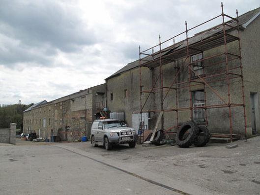
The Mill at Annaghkilly has pulled a magnificent escape: the mill itself is gone, but the great grain stores and kilns are still standing. That’s leaving your shoes under the office desk so everyone thinks you’re still at work, on an outrageous scale.
Corn mill complex, built c.1829 with later additions and possibly some fabric of c.1718, comprising three blocks, southern being four-bay three-storey grain store, middle being multiple-bay three-storey double kiln, and northern slightly recessed from principal elevations. Associated mill, which stood at river bank, to east of surviving buildings, no longer extant. Pitched roofs, slate to northern block, with terracotta ridge tiles and timber bargeboards, and corrugated-metal coverings to others. Harl-rendered walls to northern block, and coursed rubble stone elsewhere, with some concrete block-work and brickwork to north end of front of middle block. Dressed stone block-and-start quoins to south and rear elevations. Square-headed and camber-headed window openings, mainly blocked up or closed with steel sheeting. Two six-over-six pane timber sliding sash windows to northern end of front elevation of northern block. Steel shutters to window openings to rear. Gauged red brick segmental-arch vehicular door openings to front of middle block, with corrugated-metal doors. Gauged red brick round-headed door opening to front, with dressed stone surrounds. Gauged red brick segmental-headed door opening to south elevation. Concrete walls to river to east, forming wheel-pit.
Although the related mill building is no longer extant, the scale of these kiln and store buildings are indicative of the status and output of the mill, making it an important feature on the historical industrial landscape. The building remains an attractive feature, with red brick details forming a pleasing tonal and textural contrast with the stone of the walls. The mill has a long history at this site, with earliest references to Analore Mill in the late seventeenth century.
From the Buildings of Ireland (National Inventory of Architectural Heritage) record 41401239
This does not grant access. Most recorded buildings are privately owned; view them only from public ground unless the owner allows entry.
Places near here
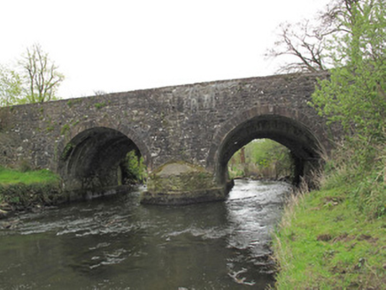 Anlore BridgeBridge · 48 yd
 Common Lime143 yd
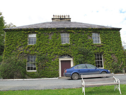 Killycoonagh HouseHouse · 374 ydSaint John's WellSpring · 404 yd
 Grave YardGraveyard · 1296 yd
 Standing stone in ScarvyStanding stone · 1.7 mi
 Abbey RuinsHeritage attraction · 2.2 mi
 The Cassandra Hand CentreMuseum · 2.2 miJaundice WellSpring · 2.3 miRoosky Castle (Site of)Castle, ringwork · 2.3 mi
 European Yew2.4 miLisarrilly HillMountain / peak · 2.8 mi
Pictures: National Inventory of Architectural Heritage; Alvesgaspar, Wikimedia Commons · CC BY-SA 3.0; Kieran Campbell, Geograph · Creative Commons Attribution-ShareAlike 2.0; Kenneth Allen, Geograph · CC BY-SA 2.0; Simonchadwick1023, Wikimedia Commons · CC BY-SA 4.0; Sitomon, Wikimedia Commons · CC BY-SA 2.0
More historic places in County Monaghan · All of County Monaghan
What do you know about this place?